|
|
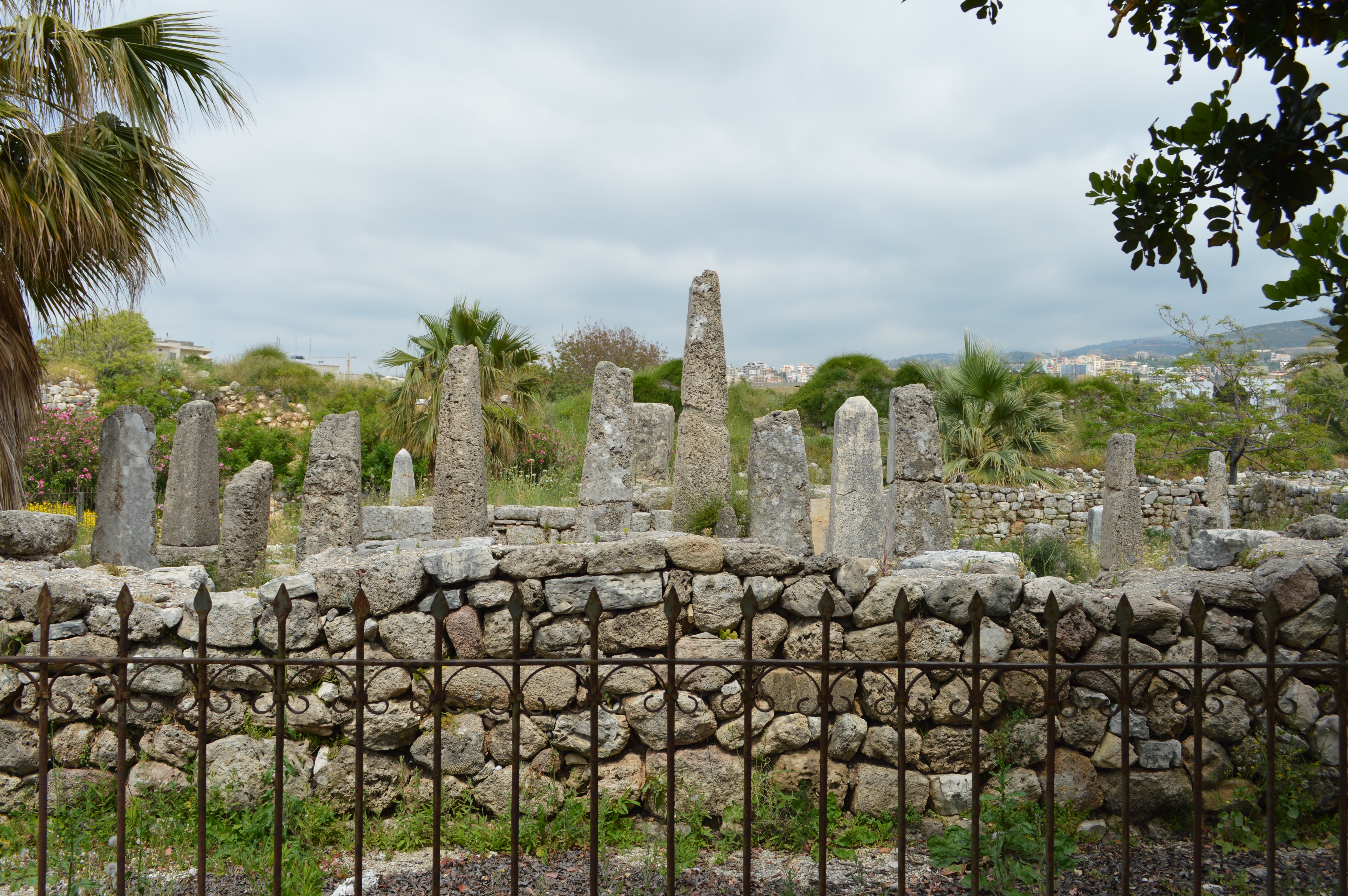
Temple of the Obelisks in Byblos
| Present Site: | Byblos archaeological site, Byblos, Lebanon N 34°07'08.1"(34.118920) E 35°38'50.1"(35.647247) |
| Pharaoh: | Probably made by Phoenician under the influence of the Egyptian civilization |
| Measurement: | 26 obelisks exist which are about 50 cm to 2.5 meters high. |
| Stone: | Unknown |
About The Site:
Byblos is the ancient geographic name in Greek, this is now locally called Jubail which is Arabic language.
| |
|
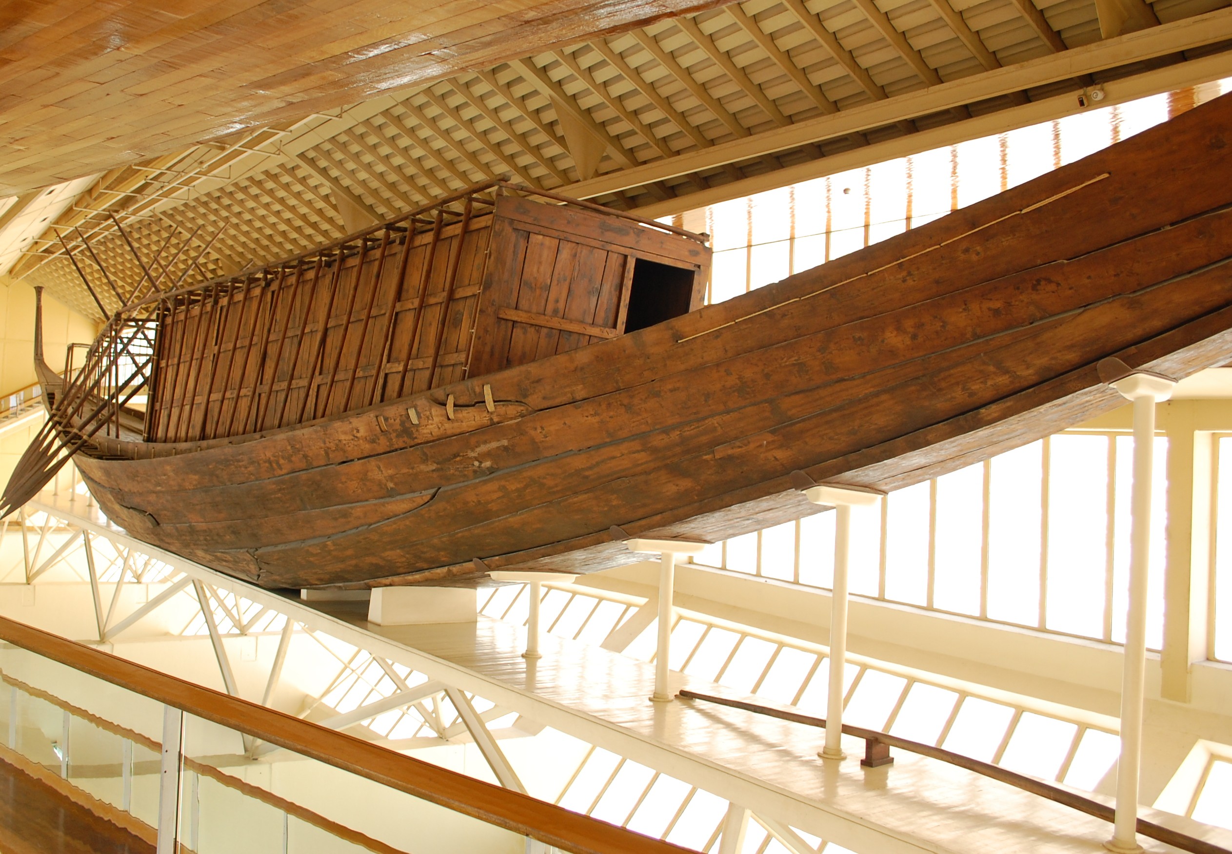
Khufu Ship (Solar Barge)
|
There are five World Heritage Sites in Lebanon. Byblos, one of them, was registered in 1984, is located about about 30 km north of Beirut.
It's known as one of the oldest Phoenician cities, and the embarkation port of Lebanon cedar as well. Lebanon cedar was a valuable resource to ancient Egypt which has poor forest resources, and it was widely used for "Khufu Ship" (also called "Solar Barge"), 42m long, at the side of the Pyramid of Khufu (or the Pyramid of Cheops) in Giza. (See Photo left)
Since the perfume oil indispensable in mummy-making is taken from Lebanon cedar, it was also a valuable exported goods, along with cedar.
Thus Byblos was flourished as the trade center with ancient Egypt. Egyptian officials are also believed to have been stationed here. Under the strong influence of the ancient Egyptian civilization, the relics with inscriptions of Egyptian hieroglyphs are also discovered.
| |
|
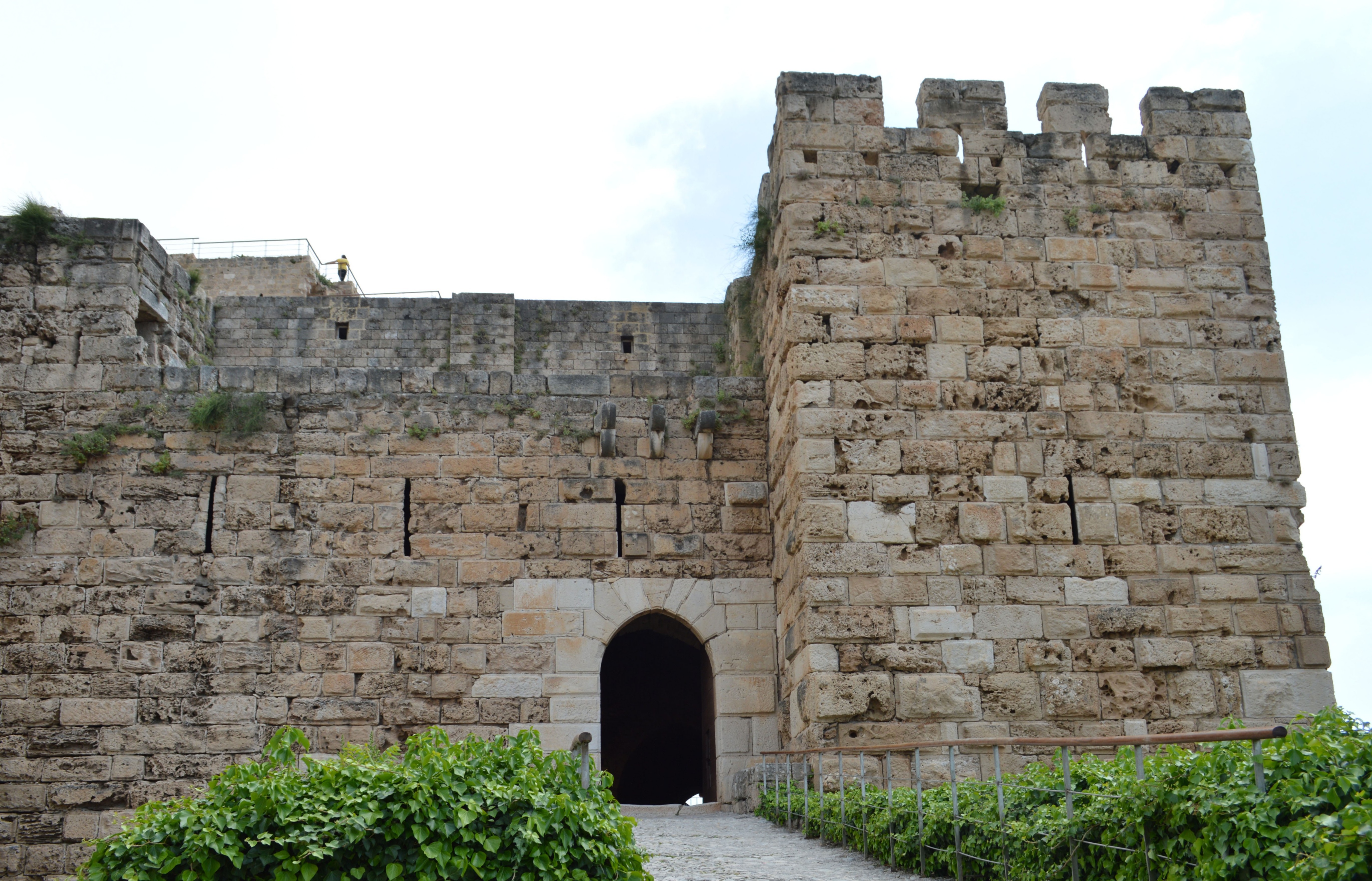
Photo #2 Crusader Citadel
| |

| |
|
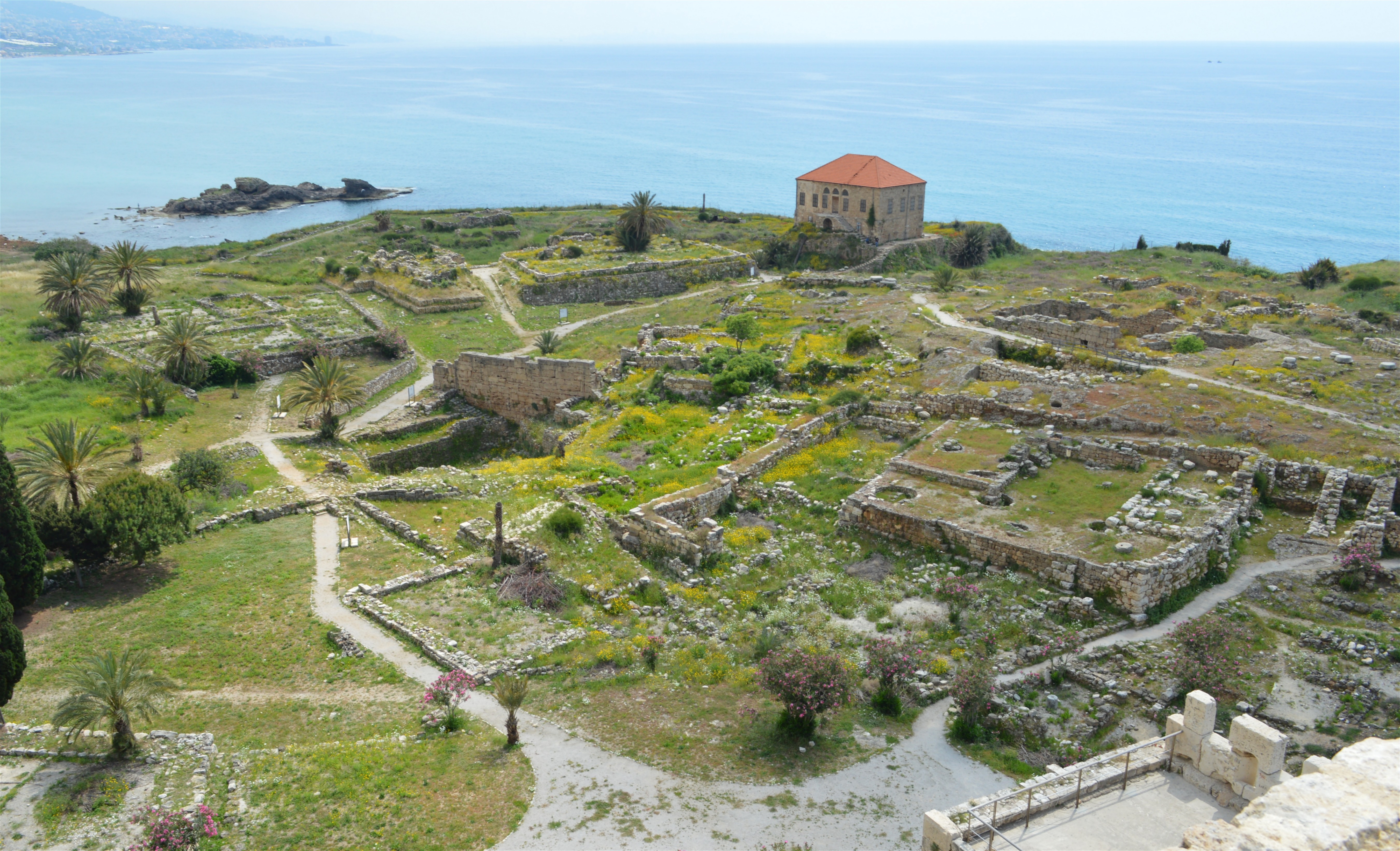
Photo #3 West View from the Crusader Citadel
| |
| |
|
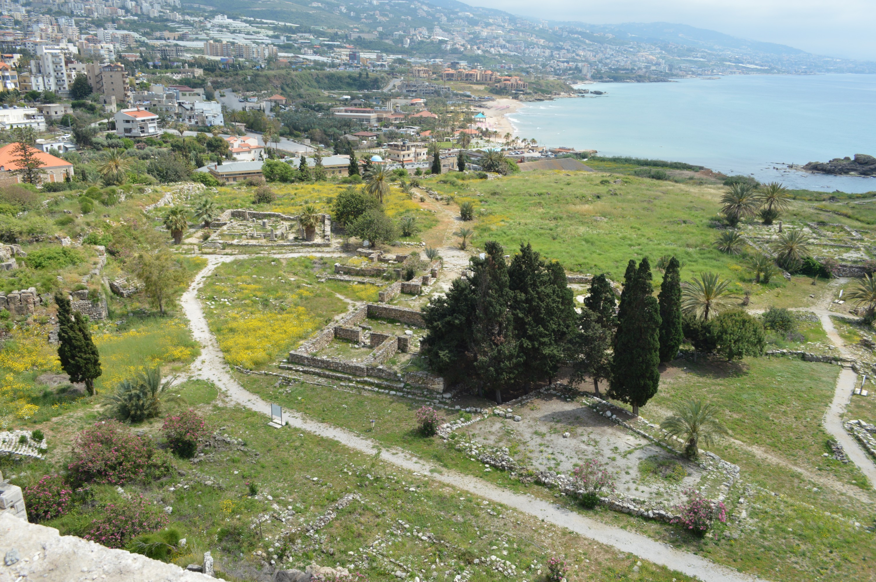
Photo #4 South-west view from the Crusader Citadel
| |
| |
|
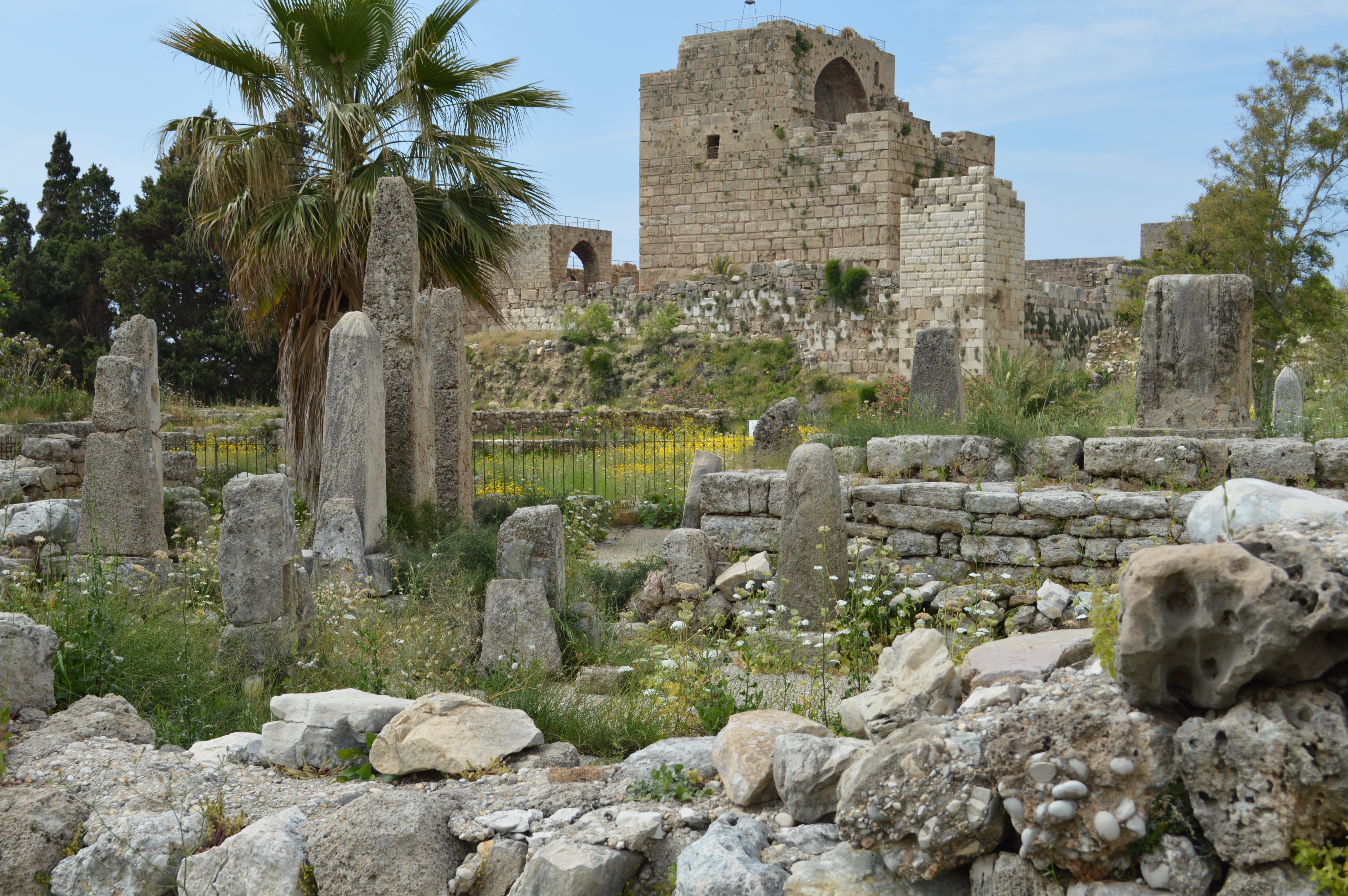
Photo #5 South View from the Crusader Citadel
|
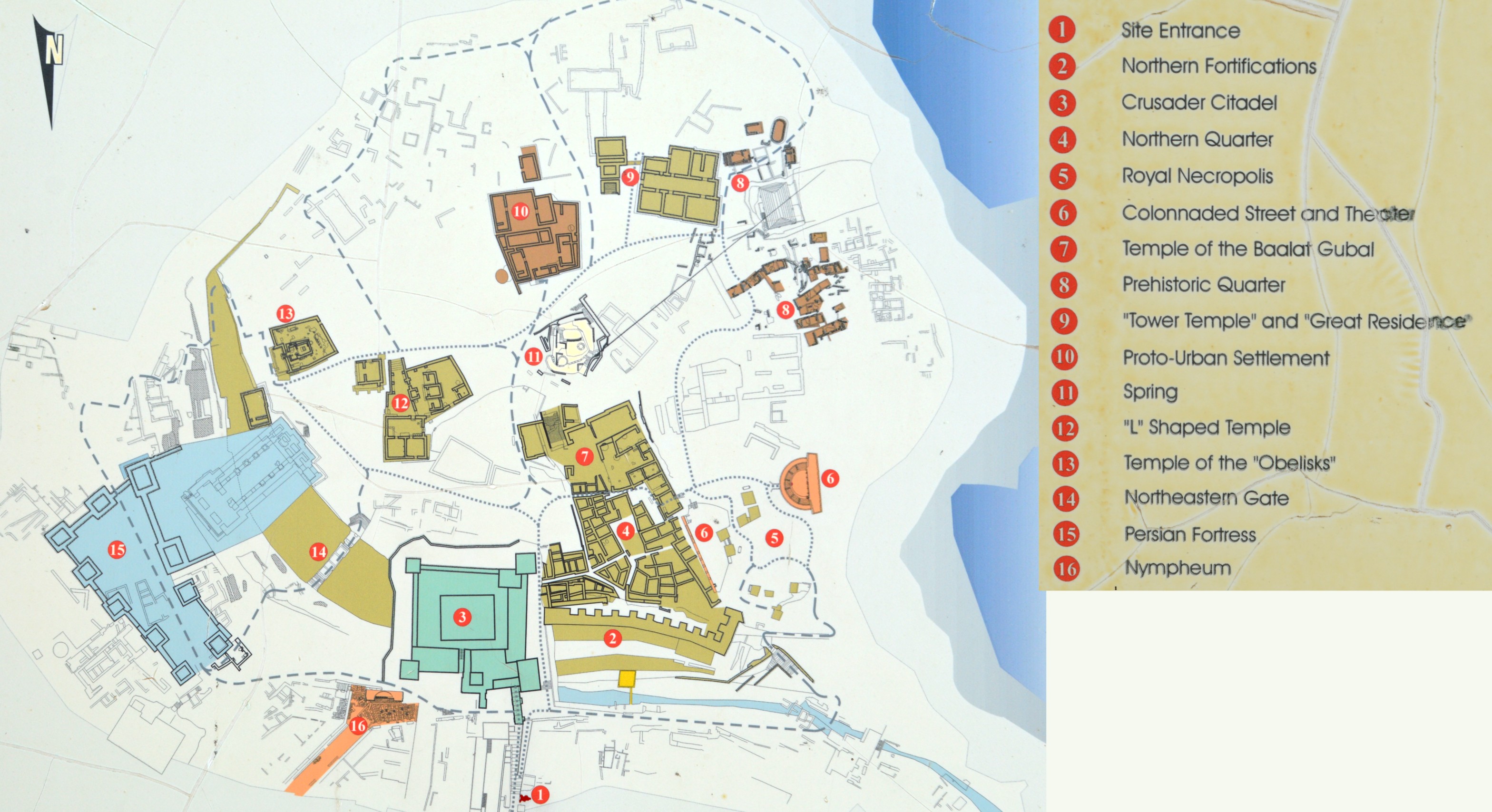
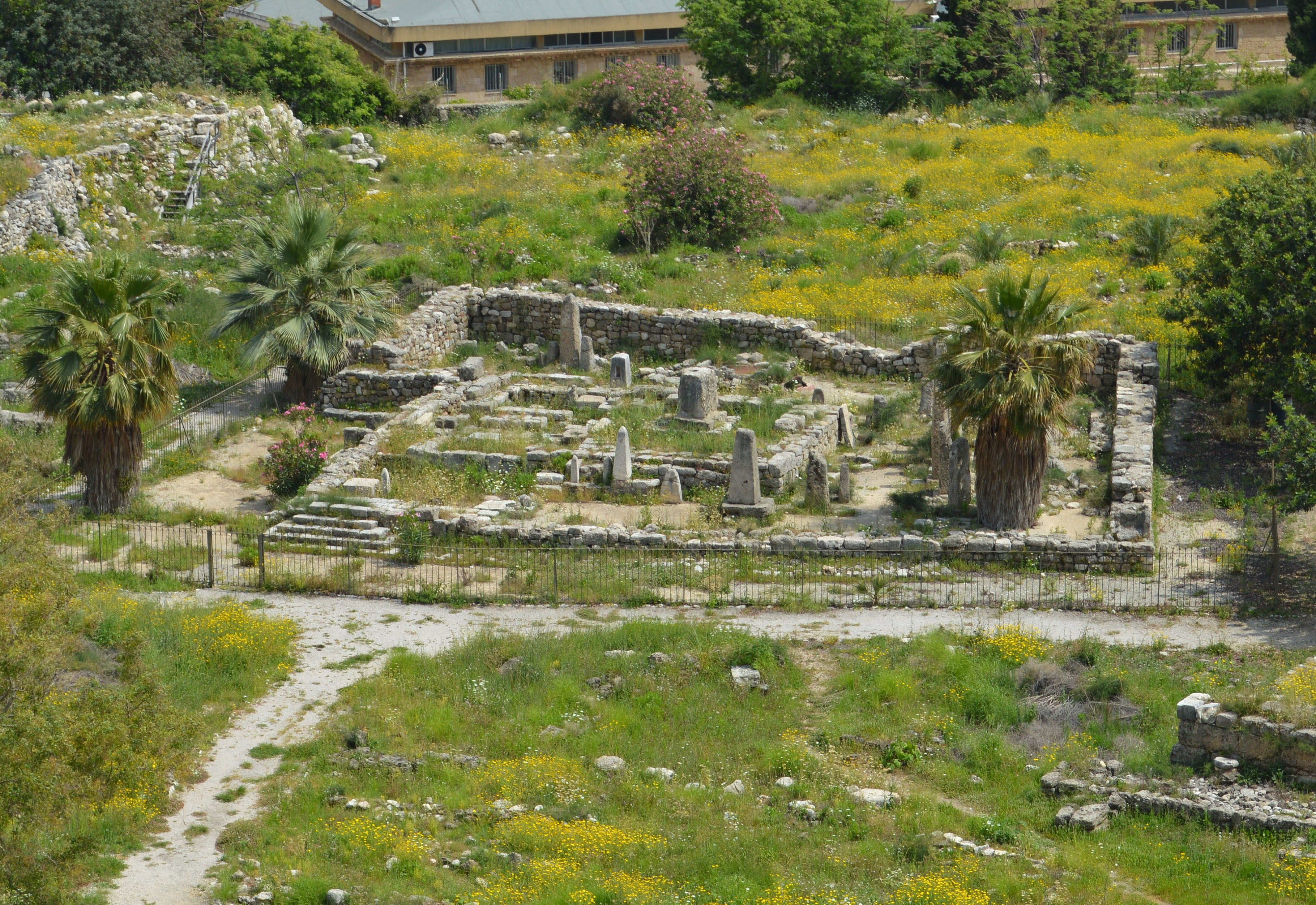
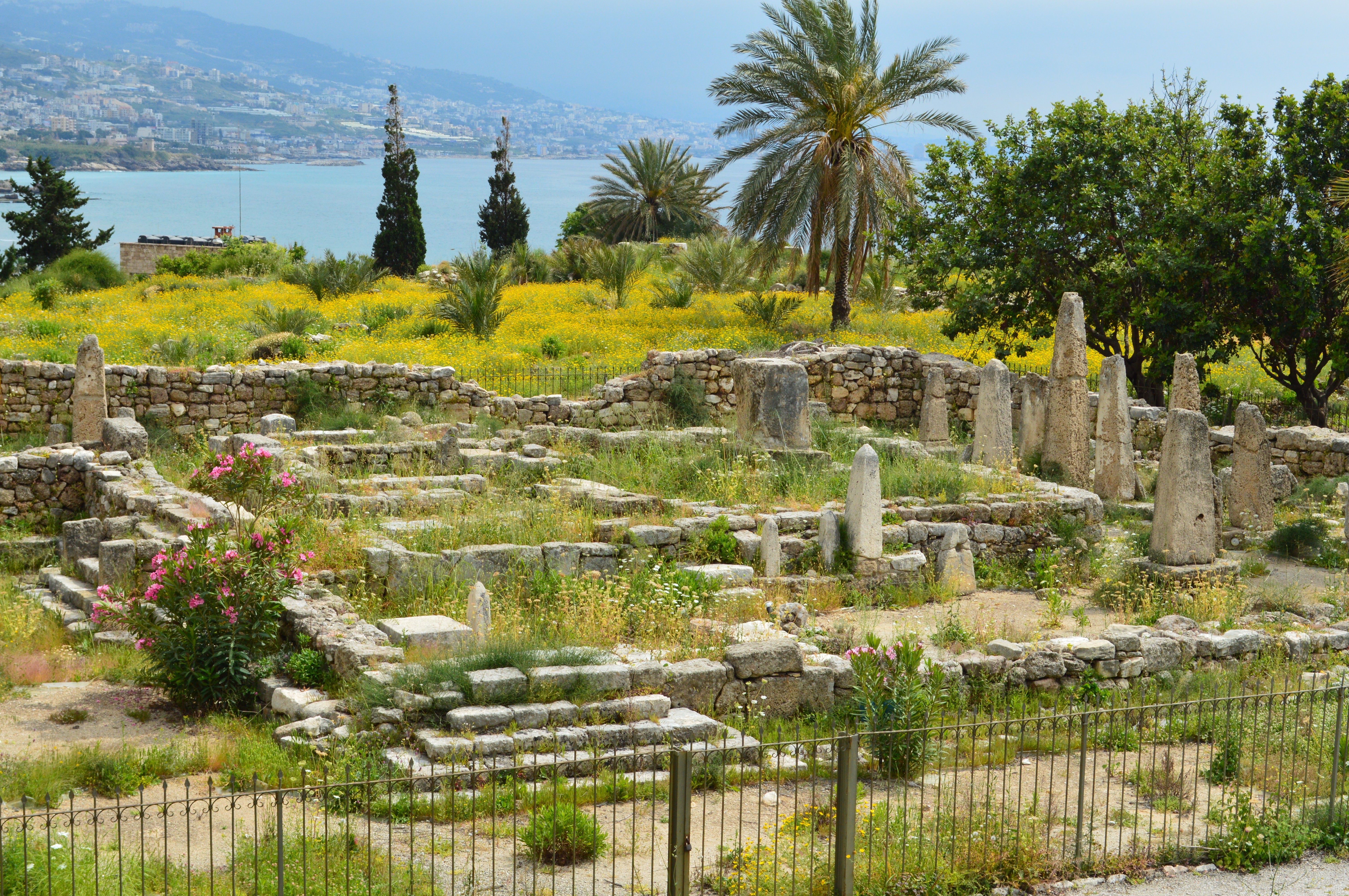
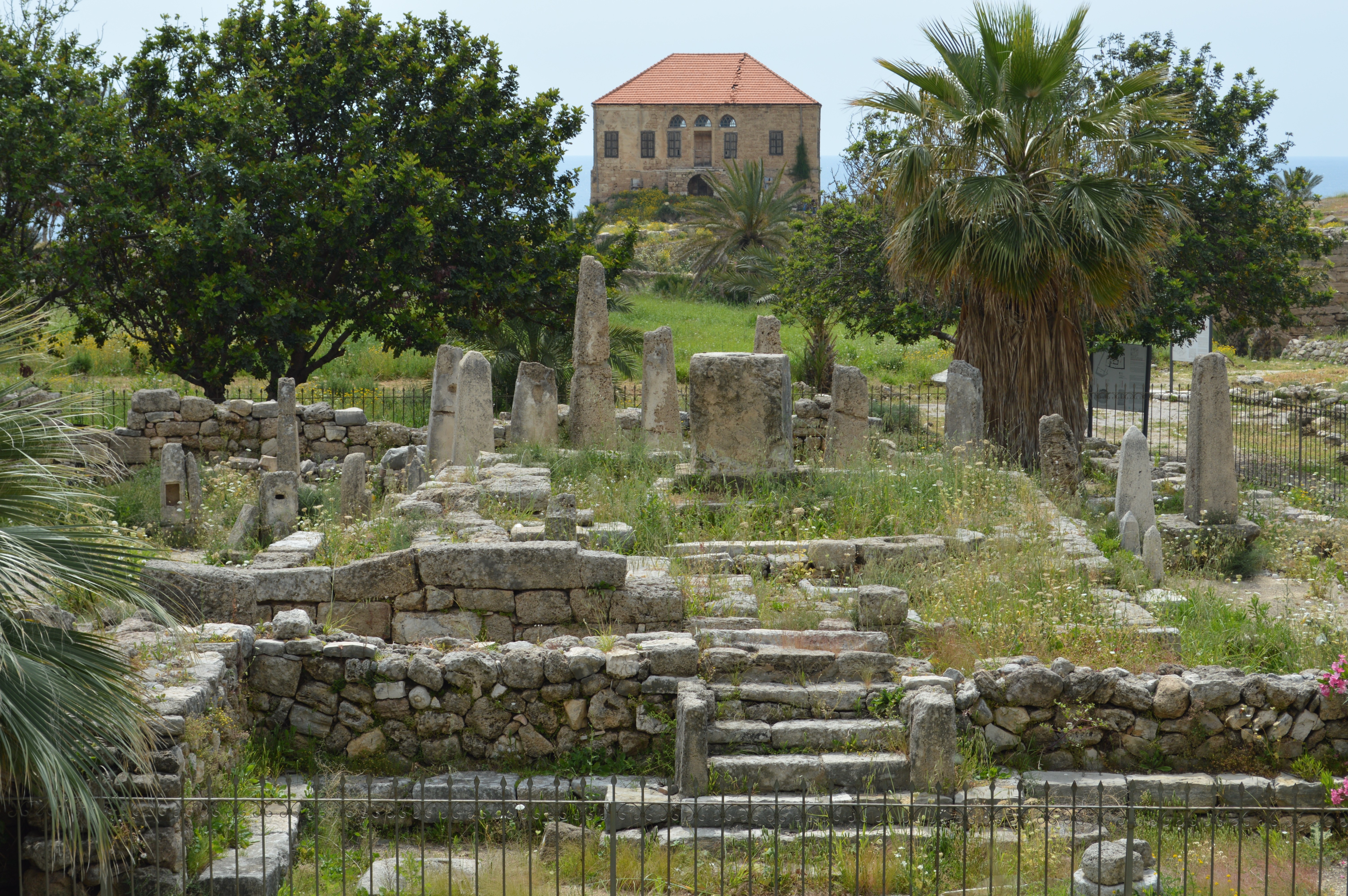
Temple of the Obelisks is a part of the ancient ruins, out of Byblos, near the Mediterranean Sea. (See the map upper right on this page). We can freely enter into the ancient ruins area, but cannot get inside of the Temple because the Temple is surrounded by the fence. When I visited here, the fence was shut by rusty padlock.
The ruins of Byblos is a composite remains from the Bronze Age to the Crusader Period. Please refer to the illustrate map of the ancient ruins of Byblos (see a picture below), which was posted at the entrance. The map, south is up, so please be aware that the map is upside down. Entering through #1 (Entrance), and walk the area that the debris of the cylinder of a large number of stone are scattered remains unearthed. Then we see #3 (Crusader Citadel) (Photo #2), which was built by the Crusade in 12 Century, well reserved. From top of this, we can see a beautiful view of the ancient ruins of Byblos, Mediterranean Sea and the high-class residential area of Byblos. Photo #3 is a west view from the Crusader Citadel, which we can see #2 (Northern Fortifications), and the old pier facing into the Mediterranean Sea. Photo #4 is a south-west view from the Crusader Citadel, which we can see the ruins of #7 (Baalat Gubal Temple). Photo #5 is a south view from the Crusader Citadel, which we can see the ruins of #13 (Temple of the Obelisks) at slightly upper left. This is our destination.
How To Get There:
Byblos (Jubail) is located about 30 km north of Beirut. The National Highway and its neighbouring areas are under the governance of the Lebanese Government Forces, security is relatively good, and there is no region that we feel a dangerous atmosphere.
Even though, it would be better that we use a package tours which are planned by the local travel agencies. Alternatively, we may use a public bus for Tripoli.
About The Obelisk:
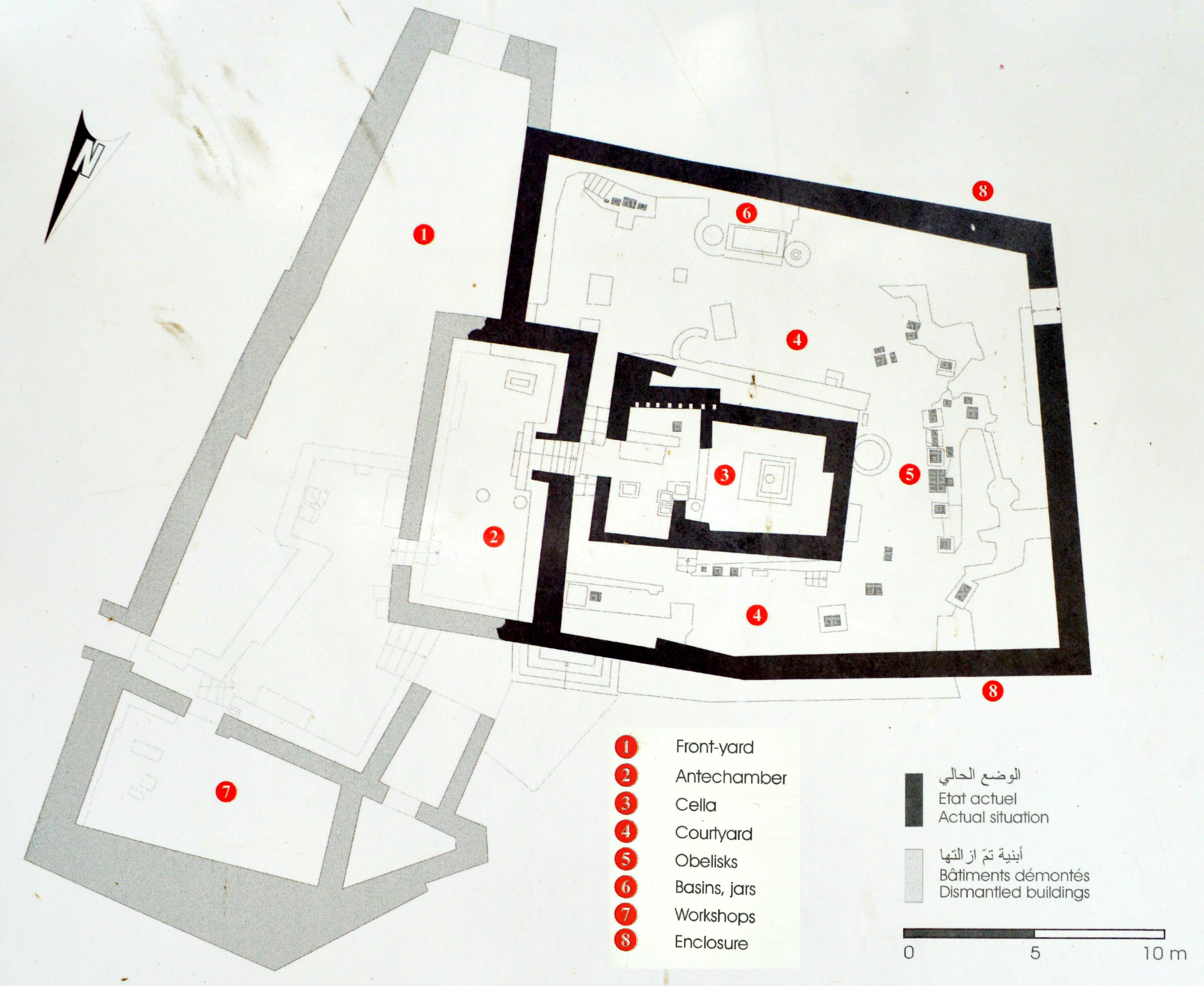
Temple of the Obelisks are the ruins of about 1900 BC through 1600 BC, after Phoenician was released from the control by Amorites. According to the Enlish explanation at the site (see left below for its copy), the Temple was reconstructed over the "L" shaped temple.
|
TEMPLE OF THE <<OBELISKS>>
At the end of the 3rd millennium B.C., the so-called "Obelisks Temple" was built on the ruins of the Early Bronze Age "L" shaped temple. It was uncovered by the excavators and reconstructed on its present site. The outer wall of the sanctuary followed almost the same plan as the courtyard of the earlier temple. North of the "L"-shaped Temple, the workshops most probably continued to be in use in the new sanctuary. The place of worship, accessible from the east by a staircase, consists of an antechamber and a cella (holy place). The latter shelters the pedestal on which stood the divinity. Obelisks or betyls, which where the symbols of the divine in the local religions, stood in the court-yard. A hieroglyphic inscription on one of them - exhibited in the National Museum of Beirut - mentions the god Reshef, god of war and also god of nature and fertility, to whom the temple was probably dedicated. Niches for statuettes, basins and jars for cleansing and sacrifices, complete the external religious installations. A rich variety of offerings were buried in the sanctuary. They consist of gold and bronze weapons as well as a countless number of human and animal figurines. | ||
|
Enlish Explanation at the Site
|
Notes For Pictures:
I was very attracted by the sound of "Temple of the Obelisks", and wanted to visit and see it before the circumstances may deteriorate as the civil war is still continuing in Syria. When I visited here, the Temple of the Obelisks was surrounded by the fence, and was shut by rusty padlock. It didn't seem to be opened for a long time, weeds were growing all over the Temple. Since I was familiar with the ancient Egyptian and Rome Obelisk (authentic obelisk), I felt something is different.
Only one place on the west side of the Temple, a steel barrel was placed and it looks like to jump into the inside through the fence. But I didn't, as it would probably be troublesome of trespassing, if I was caught by the clerk.
|
 Explanation Board about "Temple of the Obelisks" |
 From the Crusader Citadel, From North-Northwest |
|||||
 From Northeast Side of Ruins |
 From East Side (front of the temple) |
|||||
 From South Side |
 From West Side |
|||||
May 4, 2015 by Hiroyuki Nagase (For high definition image, please click the picture) | ||||||
Copyright Hiroyuki Nagase nagase@obelisks.org and Shoji Okamoto okamoto@obelisks.org