|
|
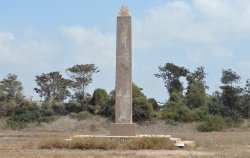
Caesarea Obelisk
| Present Site: | Eastern Circus (Hippodrome), Caesarea, Israel N 31°29'55.1"(32.498647) E 34°53'55.0"(34.898606) |
| Pharaoh: | Unknown. Probably Caesareans made this with the stone quarried in Aswan, Egypt |
| Measurement: | 10.5 meters high for the obelisk itself 1.4 meters high for the pedestal (Another source says; it was 14 meters when it was discovered.) |
| Weight: | Estimated 80-100 tons |
| Stone: | Red granite |
About The Site:
Caesarea (Keysarya) is a harbor town which was built by Herod the Great (Reigned 37 BC - AD 4) in around 30 BC, facing the Mediterranean Sea, in Galilee (present Israel).
This region, which was called Galilee, at that time, became the dominant place of Herod the Great shortly after Julius Caesar was assassinated in 44 BC, Herod the Great had been certified as the Jewish King from the Roman Senate. Then, in around AD 6, this region became a Province which was directly ruled by Roman Empire, and Caesarea was flourished as the Capital of the Jewish Province. But the town fell into decline after the Muslim conquest in 7th Century, and then the town came alive again during the Crusader period in 13th Century. Then, the Muslim again conquered soon.
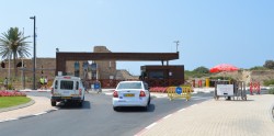 Entrance Gate for National Park
|
All of them became the ruins, and these areas facing the Mediterranean Sea became the Caesarea National Park. The current town of Caesarea is located a little north of old Caesarea (ruins and beachs), and the railroad station is located in the inland.
The goal, the obelisk is standing on a rectangular site which has once been the Eastern Circus (Hippodrome) located in about 500 meters east from the Entrance of the Caesarea National Park.
The antiquities of the Roman Empire era have been left in ruins such as the old port, amphitheater and aqueduct. The amphitheater is now kept in a usable state, the the quite wide area of Caesarea National Park. On the other hand, many antiquities are pretty desolate and abandoned. In addition, there are many restaurants and shops as a resort area.
Just for your reference, this town is often called "Caesarea Maritima" or sometime "Caesarea Palestine (Caesarea Palaestinae)", "Herodian Caesarea" in order to distinguish it from Caesarea Philippi in Syria.
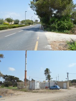 (above) Entering here to the site of Eastern Circus (Hippodrome)
Along Route 6511, East from the National Park Entrance Gate (bottom) A base station for mobile phone |
How To Get There:
Firstly, we should go to Caesarea National Park, using Israel Railways. The nearest staton is Binyamina (Station), 35 minutes by fast train, 44 minutes by local train, from Tel Aviv Center - Savidor [Central Station].
By Taxi: From Binyamina to Caesarea National Park, using taxi is recommended since the public bus service is not often. The fare was Shekel 60 (USD 20) as of August 2014. Since the Israeli price is very high, there would be no other choice.
As I mentioned above, the obelisk is in the site of Eastern Circus (Hippodrome), about 500-meter east from the National Park Entrance Gate. After getting off at the Entrance Gate (Main Gate), walk the east direction, about 400 meters along Route 6511, there is a entering way (passage) on the right side (south side) which is narrow and unpaved. (See the photo left) Then go into the site.
This how to go is, we go back from the Entrance Gate (Main Gate). However, I think this is better for finding the entering point for the obelisk site.
When we return to the railway station (Binyamina), we should walk back to the Entrance Gate (Main Gate), and ask the National Park staff to call a taxi. There is no vacant taxi cruising this street (Route 6511).
By Bus: Just for your information, there are two routes of public bus service, instead of taxi.
One is departing from Binyamina (Station), #9 bus. Since this bus doesn't go to the National Park, we get off at Rothschild (bus stop) on Route 6511, and walk west direction, about 600 meters along Route 6511, there is a entering way (passage) on the left side (south side) which is narrow and unpaved. (Same as above)
Another bus is departing from Caesarea-Pardes Hana (Station), which is one station before Binyamina. This is #77 bus for Kibuts Sdot Yam, goes to Entrance Gate (Main Gate) of Caesarea National Park (bust stop name is "Antique Center"). When I visited here in July 2014, the bus #77 departs once an hour, but no service in the day time when I checked in October. Hence, we should check in advance the departure time table of #77 at the website of BUS.CO.IL. After getting off at "Antique Center" (Entrance Gate of National Park), we take a same way above.
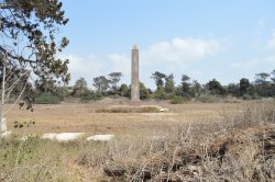 Obelisk Standing at the Site of Eastern Circus
We Must Proceed Through the Weeds. |
Although there is no signboard at the entering point, but we must not be confused, because this is the only one route directing south. After proceeding the passage about 200 meters, there is a base station for mobile phone with high rise iron tower. This is a good land mark for the obelisk site, as this can be seen from the National Park.
The passage from the front of the base station is interrupted in the middle, it's a lush vacant lot. But we can confirm the the obelisk, standing in the vast vacant lot. We must proceed through the weeds. But there were places to weed fewer here and there. Around the obelisk is in a vacant lot of the rectangle, but the weeds were not growing, because there was a trace, such as digging the soil, it might have been a field until spring. Such scene can be seen at the picture posted on the wikipedia website on "Caesarea obelisk". Although this picture was took in November 2007, the weed may be reaped regularly as the ruin of the ancient monument.
About The Obelisk:
There is a description board both in English and Hebrew at the foot of the obelisk. According to this, the vacant lot is a site where has once been an Eastern Circus (Hippodrome). This means, this is the eastern one of two Circuses which were built in Caesarea. It's unknown whether this name was used in the era of Roman Empire's Province. According to this description board, it was built Province which is directly ruled by description board, it was built in AD 2nd Century, and was in use until the beginning of the 7th Century.
Caesarea was a Province which was directly ruled by Roman Empire. Since this obelisk was discovered from the underground of the ruin of Hippodrome (Circus), this is considered this was originally erected as the decorative centerpiece of the hippodrome, which was built in the 2nd century.
 Finally I got here !
|
To build the obelisk at the spina [central reservation] of the oval stadium (Hippodrome) had become customary in Ancient Rome. Another obelisks such as World's largest Lateran Obelisk and the Flaminio Obelisk of Piazza del Popolo were erected at the spina of the Circo Massimo [Latin: Circus Maximus], and the Vatican Obelisk was erected it as the spina of the Caligula Circus. Outside Rome, Tuthmosis III Obelisk in Istanbul, Obelisk in Tyre, Lebanon, and the Obelisk of Arles were also erected for the Circus (Hippodrome).
This obelisk has no inscription. But it's known the stone is a red granite which was quarried in Aswan.
The obelisk fell down sometime between the 7th and 13th centuries, most probably in the beginning of the 7th century after the fall of the Roman Empire and the Muslim conquest of the region.
This obelisk was discovered broken in three separate pieces in 1974, during the excavation works by The Joint Expedition to Caesarea Maritima. It was once proposed to set it up in the Land of Israel Museum in Tel Aviv, but it was decided to re-erect it at the original cite - hippodrome in Caesarea. The obelisk was put back together with titanium pins and epoxy adhesives and missing pieces of the obelisk were replaced with concrete to complete the restoration. This project was carried out by IAA (Israel Antiquities Authority)'s Department of Conservation, and it was officially erected on June 18, 2001.
It's said, the obelisk is 10.5 meters high for the obelisk itself, and 1.4 meters high for the pedestal. On the other hand, there is an Excavation Document which says, it was more than 14 meters, and more than 80 tons when it was discovered.
Notes For Pictures:
If you ask the National Park staff, they will tell you the location of the obelisk, as they know about this. However, little people visits here. In other words, nothing was provided for the visitors. No sign and/or guide, no clear passage for this cultural heritage. I thought more convenience must be provided. This may be preserved until the next excavation research. I think this is the most lonesome obelisk in the World, I felt a kind of strange sense of accomplishment.
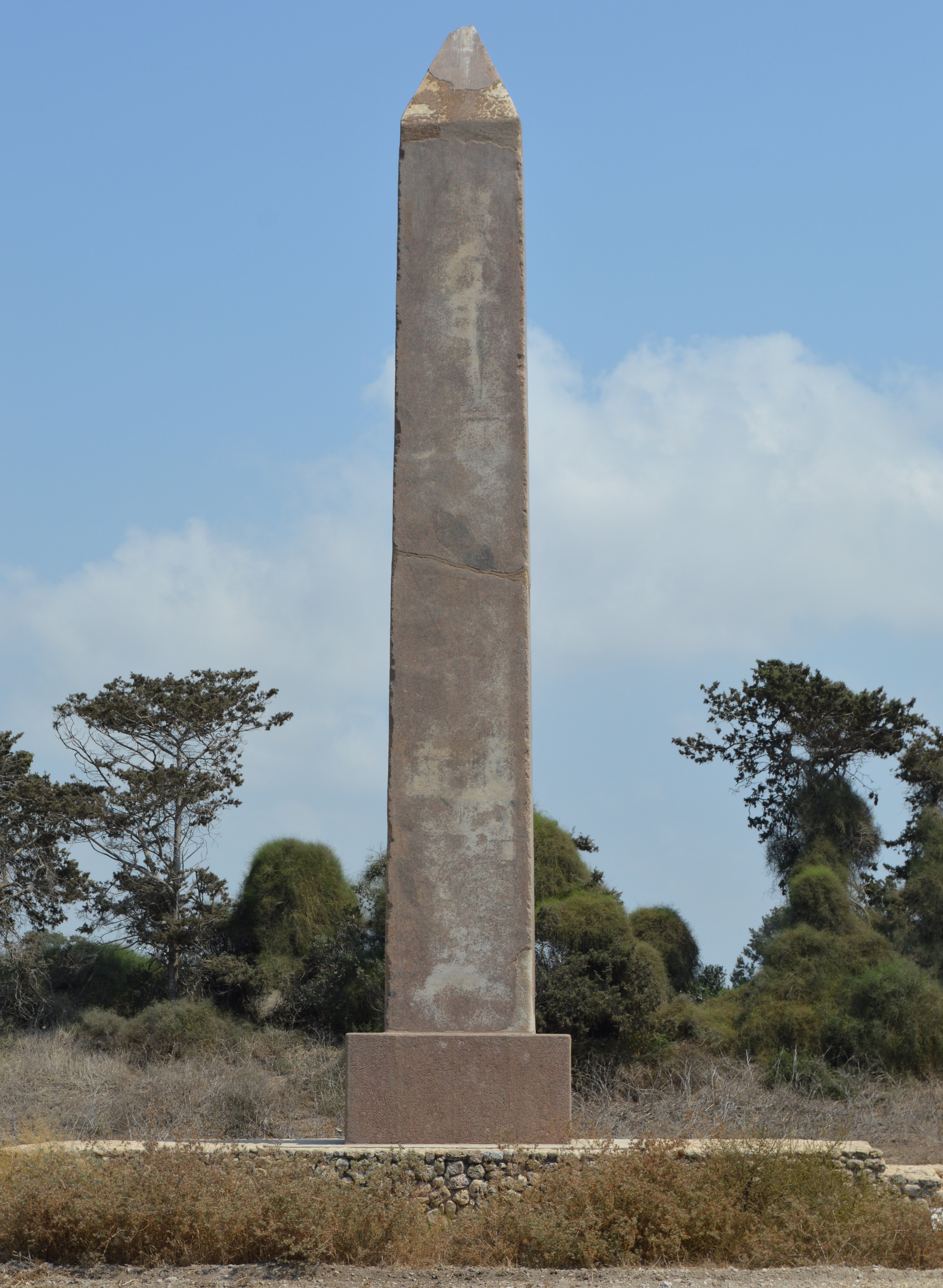 West Side |
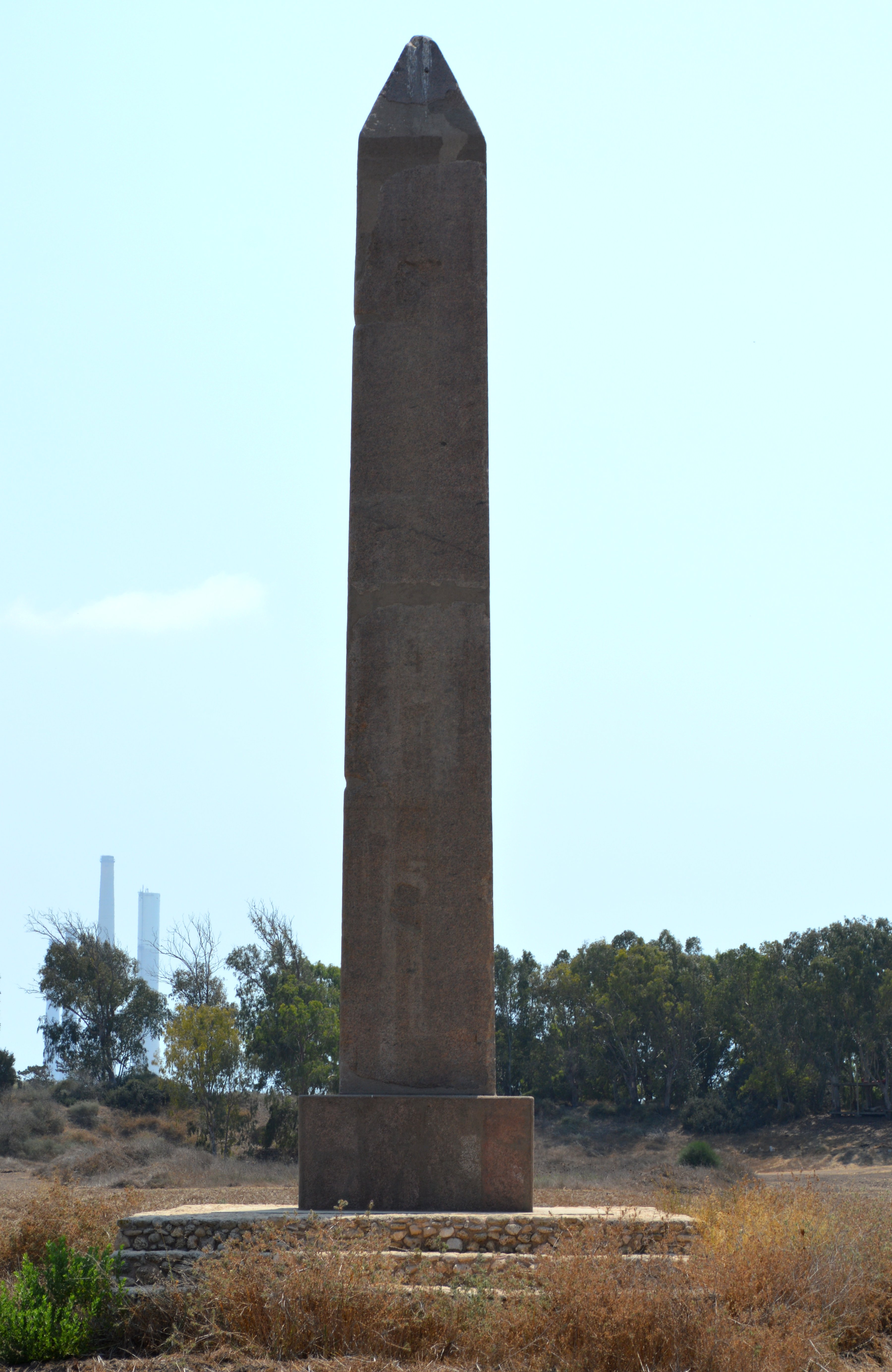 North Side |
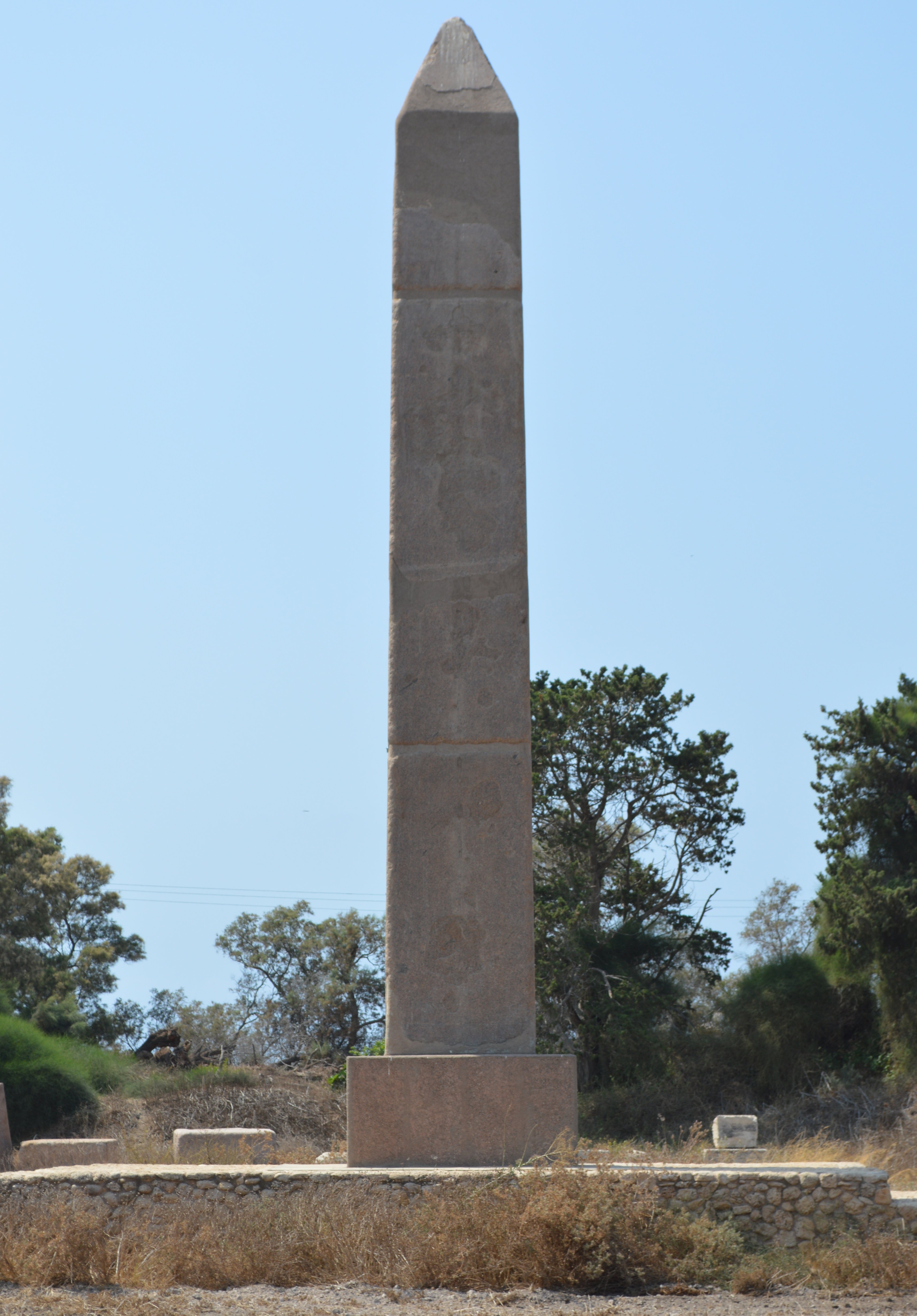 East Side |
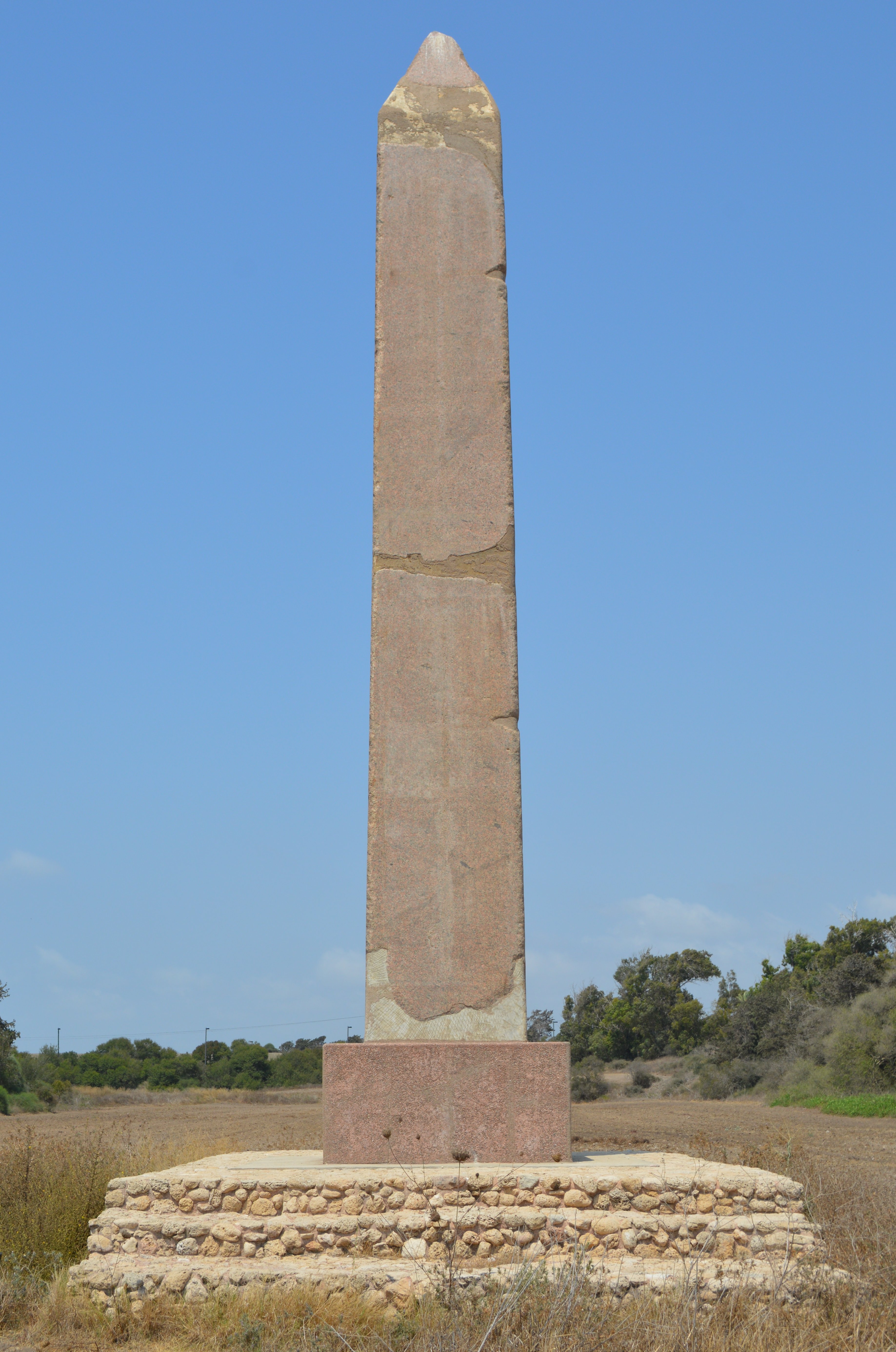 South Side |
|||
August 18, 2014 by Hiroyuki Nagase (For high definition image, please click the picture) | ||||||
Copyright Hiroyuki Nagase nagase@obelisks.org and Shoji Okamoto okamoto@obelisks.org