Source: https://fr.wikipedia.org/wiki/Tanis
|
| |
|
Source: https://fr.wikipedia.org/wiki/Tanis |
Obelisks in Tanis Ruins (Nile Delta)
| Present Site: | San el-Hagar, Egypt N 30°58'39.8"(30.977714) E 31°52'51.4"(31.880932) |
About The Site:
Tanis is in Nile Delta, Egypt, where is about 140-km northeast of Cairo, a name of town in Ancient Egyptian Era, and this town is currently called San el-Hagar.
Tanis has once been a capital in 21st - 23rd Dynasty, Third Intermediate Period (11th - 9th century BC). Although Tanis was a capital, but there was another capital town in Upper Egypt, Thus Egypt was not formed as an Unified Kingdom.
Formerly, Tanis has once been considered as Pi-Ramses (or Pi-Ramesses, or Per-Ramses, which means House of Ramses) which is the new capital built by Ramses II (19th Dynasty). However, after 1960s, such theory was denied by the development of Egyptian Archeological Study, and the real Pi-Ramesses is currently identified at the vicinity of Town Qantir, about 30 km south of Tanis Ruins.
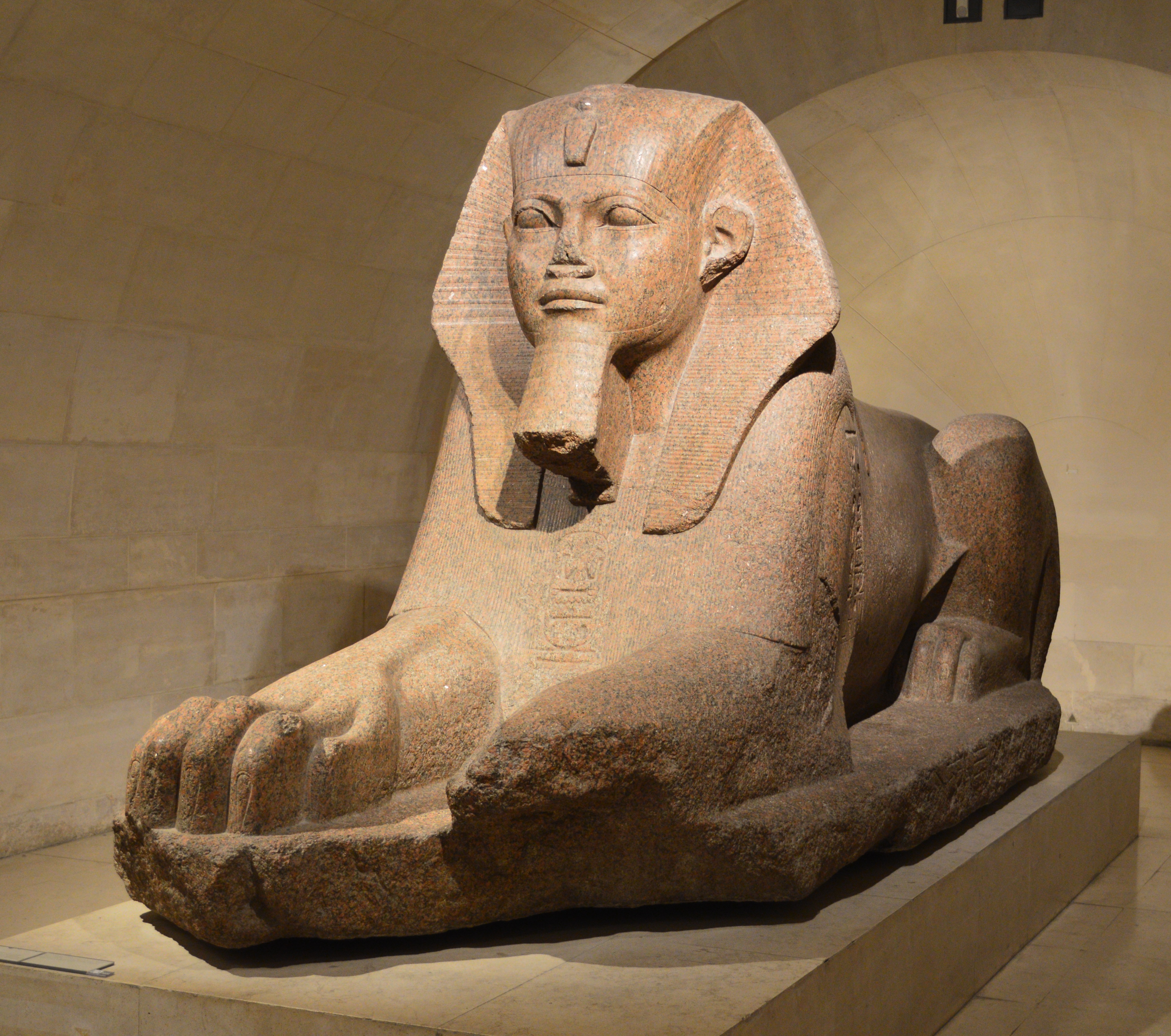
Sphinx excavated in Tanis, currently exhibited in the Louvre
|
The study work on Tanis Ruins was begun at the time of Napoleon's expedition to Egypt in 1798. Then, French Egyptologist Jean-Jacques Rifaud excavated the Ruins in 1825 and discovered the red granaite Sphinx which is currently exhibited in the Louvre (Louvre Museum) (Left). Also in 1883 and 1886, British Egyptologist Sir William Matthew Flinders Petrie (commonly known as Flinders Petrie) excavated the Ruins. His findings are reported in two books, and the obelisk is referred by one of them (TANIS Part 1 1883-4), which the pdf version is available through downloading at free.
After 1929, French Archeologist Pierre Montet, who has been working in the excavation of Byblos, Lebanon, has made a large-scale excavation study of Tanis ruins over more than 10 years and the whole picture became clear. However, although the name of Ramses II was written in the stone excavated at the ruins of Tanis, the antiquities belonged to King Psusennes of the 21st dynasty, and didn't relate to Pi-Ramses. So, after 1960s, the theory that Tanis and Pi-Ramses are different place was accepted, as mentioned above.
Regarding the ruins of Tanis, the Wikipedia French version [and its English version as well] is a good reference.
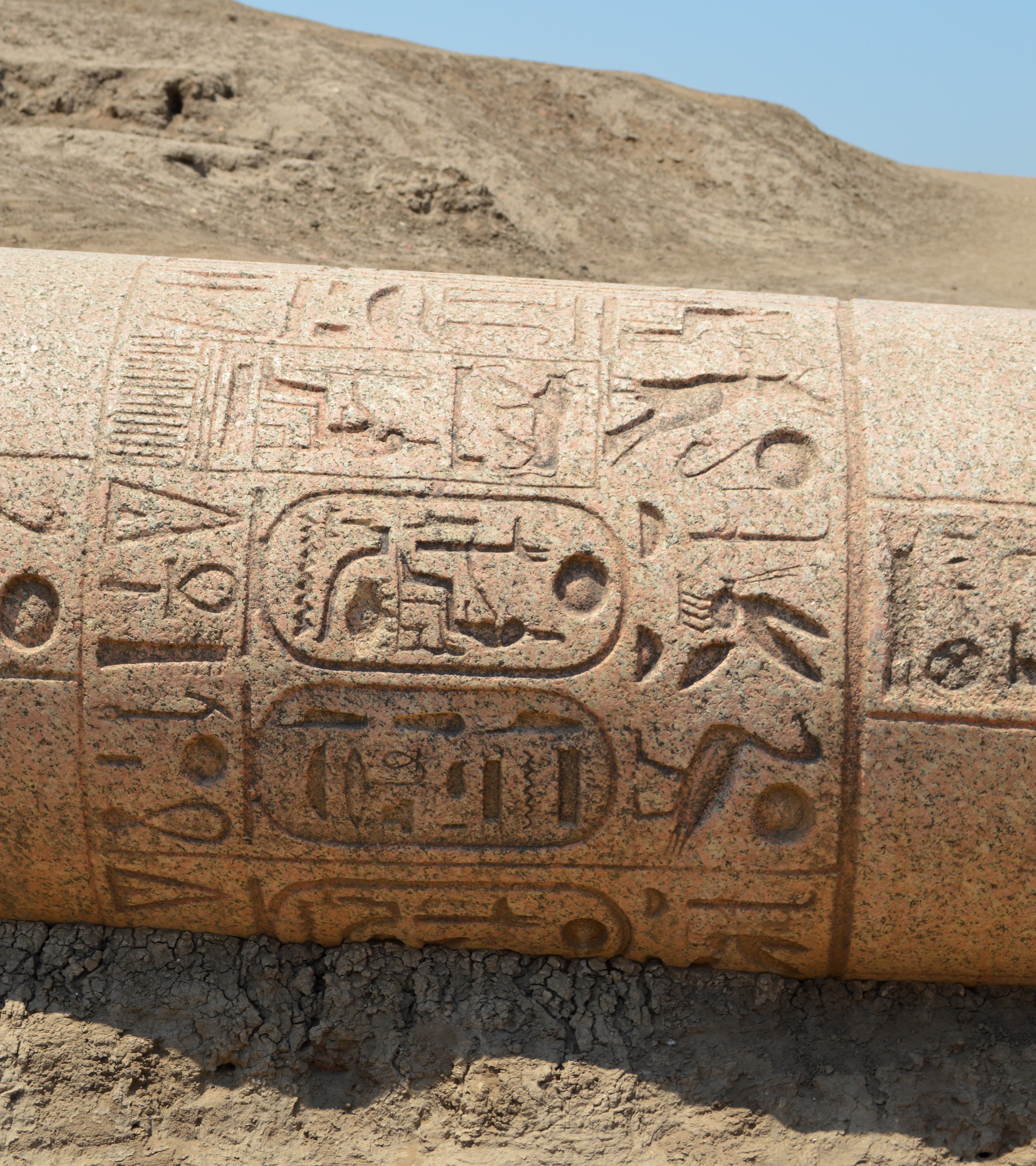
Fragment of column engraved the name of Osorkon II, 22nd Dynasty, Third Intermediate Period
|
Current ruins of Tanis are like a desert about 1 km square. Through the satellite image of Google Maps, the difference of a desert area and the surrounding land is clearly understood.
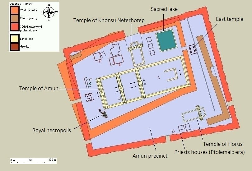
In the ruins of Tanis, the main buildings are the Great Temple of Amun, the temple of Muto and the temple of Const, and the Royal Tombs of 21st and 22nd Dynasties are found in the temple grounds. Among those ruins, the Great Temple of Amun is a large-scale one with a total length of about 200 meters and extends east-north-eastward from the central part of the ruins of Tanis. The ruins' visiting course is also made to go toward to the back of the Great Temple of Amun.
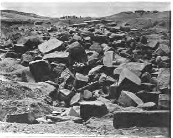
VIEW DOWN THE WHOLE TEMPLE TO THE PYLON. Looking West.
Tanis Part I,1883-4,W.M Flinders Petrie,1889 |
In addition, although the ruins of Tanis are thought to have been developed for tourism decades ago, unfortunately the maintenance thereafter is inadequate. For example, in the royal tomb of Sheshonq III, the stone coffin and the rerelief on the wall of the cemetery room has been excavated and left as exposed. The decayed iron pipe frameworks left around this cemetry room, but it seems to have once been covered as the awnings of sunshine.
| |
|
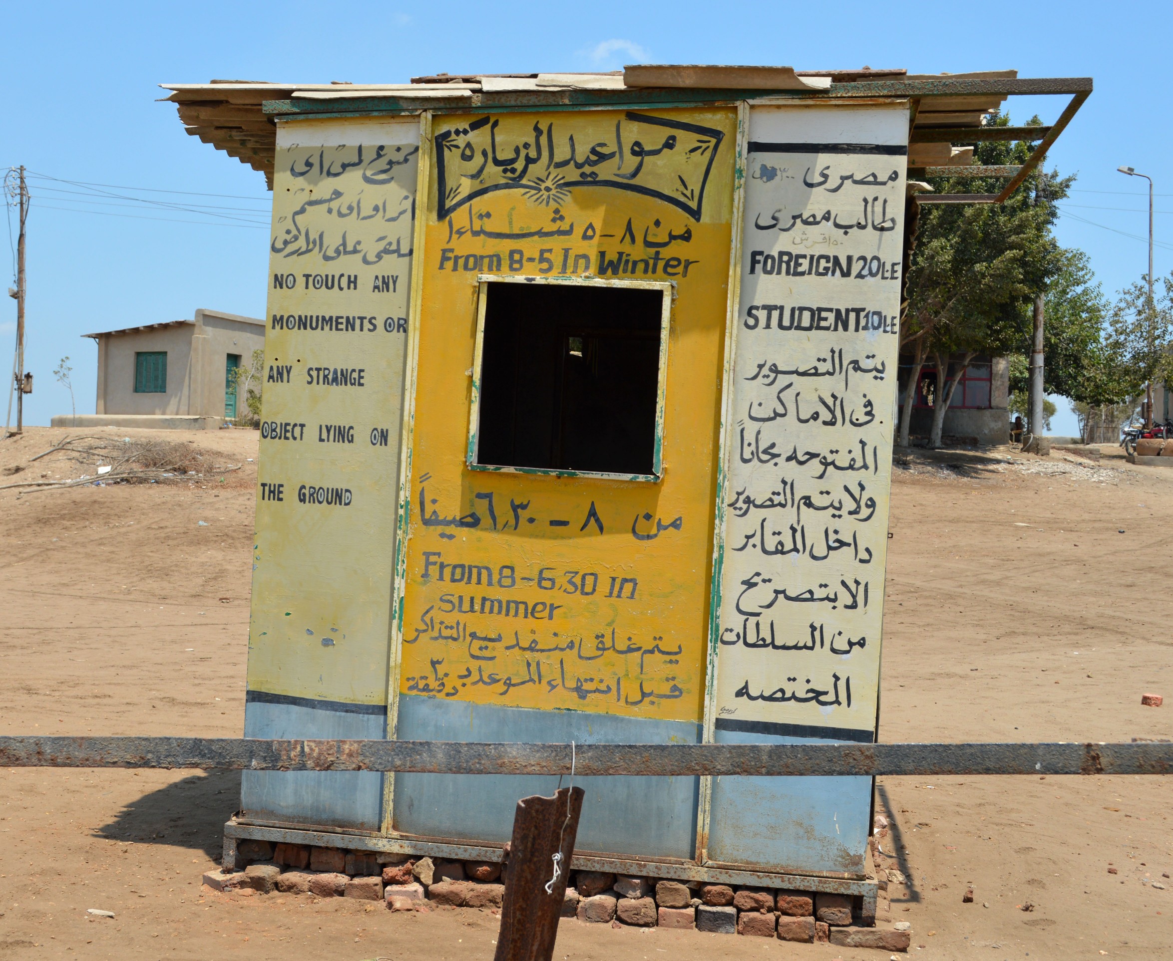
Abandoned Ticketing House
in Tanis Ruins |
How To Get There:
Tanis Ruins is located outside of the town which is currently called San el-Hagar, where is in Nile Delta, about 140-km northeast of Cairo. It's difficult to get there by transferring a bus from Cairo, and it's rather realistic way to charter a local travel company's car. Also, it's difficult to get there by a Cairo taxi as the taxi driver doesn't know the location.
Although Tanis is an well-known ancient ruins, but there are no travel agencies regularly holding local tours to visit Tanis due to a drastic decrease of tourists. We have to rent a dedicated car personally in case of visiting Tanis.
It takes about 2 hours each way, despite of the road between Cairo and San el-Hagar is a well maitained highway to the middle. We need to accompany a guide who can speak English, as we may receive an inspection and/or security check on the way.
Formerly the security in Egypt was good, I was able to go to San el-Hagar individually with a bus or a shared minibus, but now the situation has completely changed from that time, so we should refrain from reckless personal behavior. According to the Foreign Travel Advise by UK Government, "See our travel advise before travelling" (as of January 2017). Even when the local travel agency provids a dedicated car, the travel agency needs to notify the tourist police in advance for security reasons. When I visited again in 2016, a tourist police officer accompanied me.
There is a poor and oblique ticketing house at the entrance of the ruins area. But this is abandoed and not in use at present, as no visitors come. So, we can go enter in the ruins area without any procedures. The ruins' management office is a neat building made of concrete, but the office is not noticeable, so it seems to be built this ticketing house instead of a signboard.
|
|
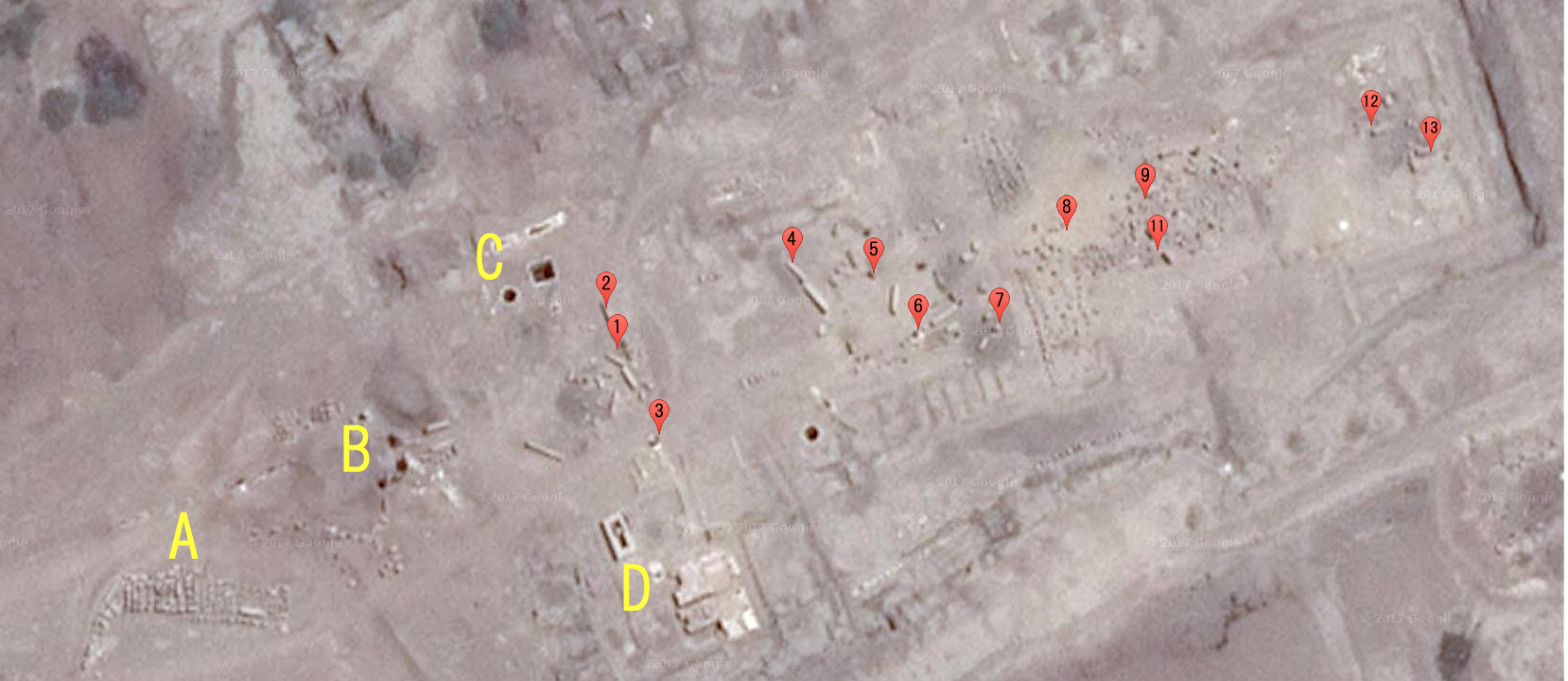
Satellite Picture of Amun Temple in Tanis
The alphabet and the numbers were added for convenience for the explanations below. #10 is omitted due to be close to #9. |
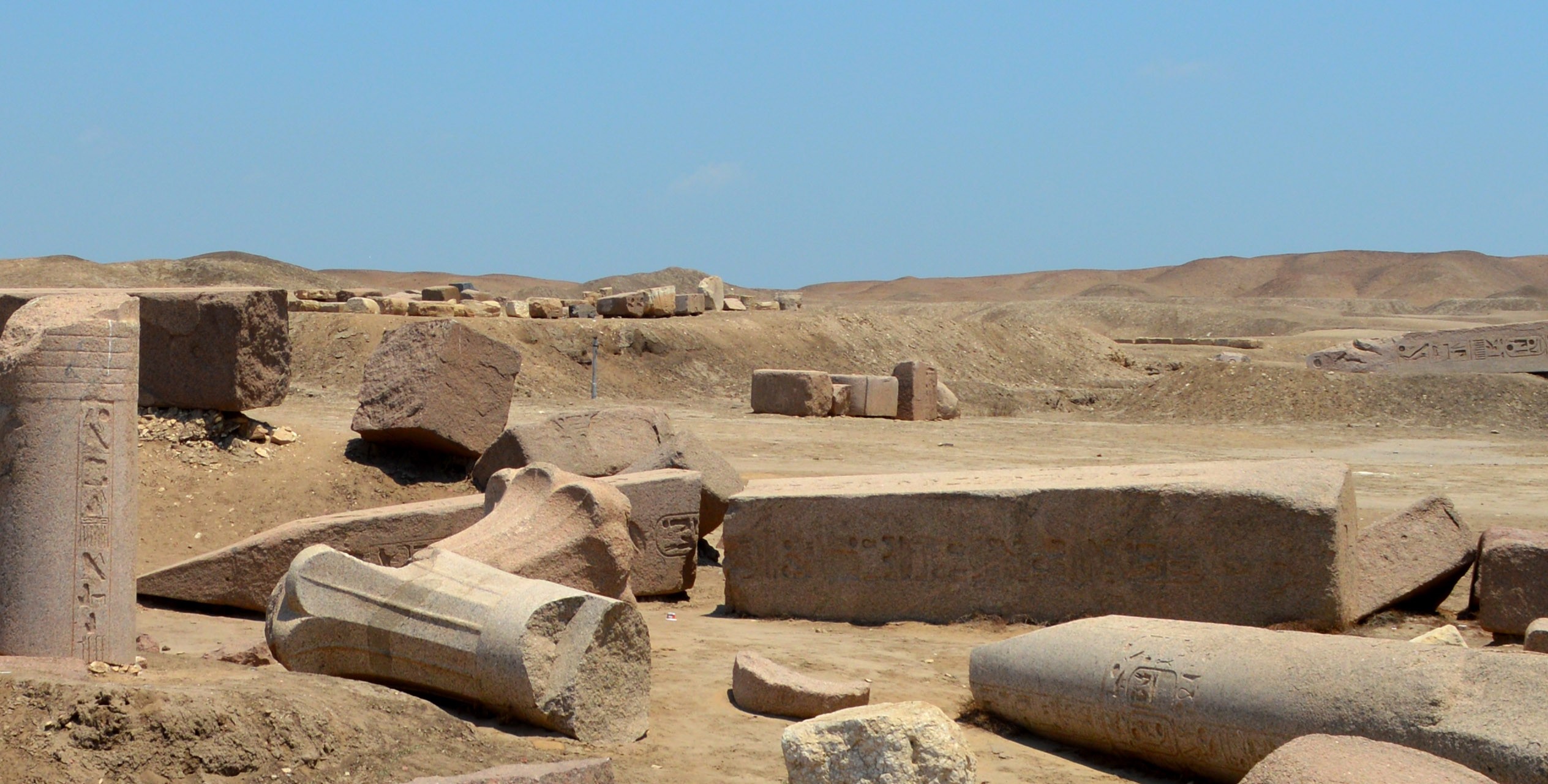
Major Interest Points before Great Temple of Amun:
The only the stone columns and obelisk fragments etc. are scattered, and we cannot see the the remains, even if we come to the remains of the Temple of Amun. Hence it may not be the interest points for the tourists. The noticeable stone statues excavated from Tanis Ruins are being carried to the Louvre Museum and the Egyptian Museum, so almost nothing remains here except obelisk fragments. For tourists who don't have a specific interest in the obelisk, I think rather the area before the Temple of Amun is more interesting.
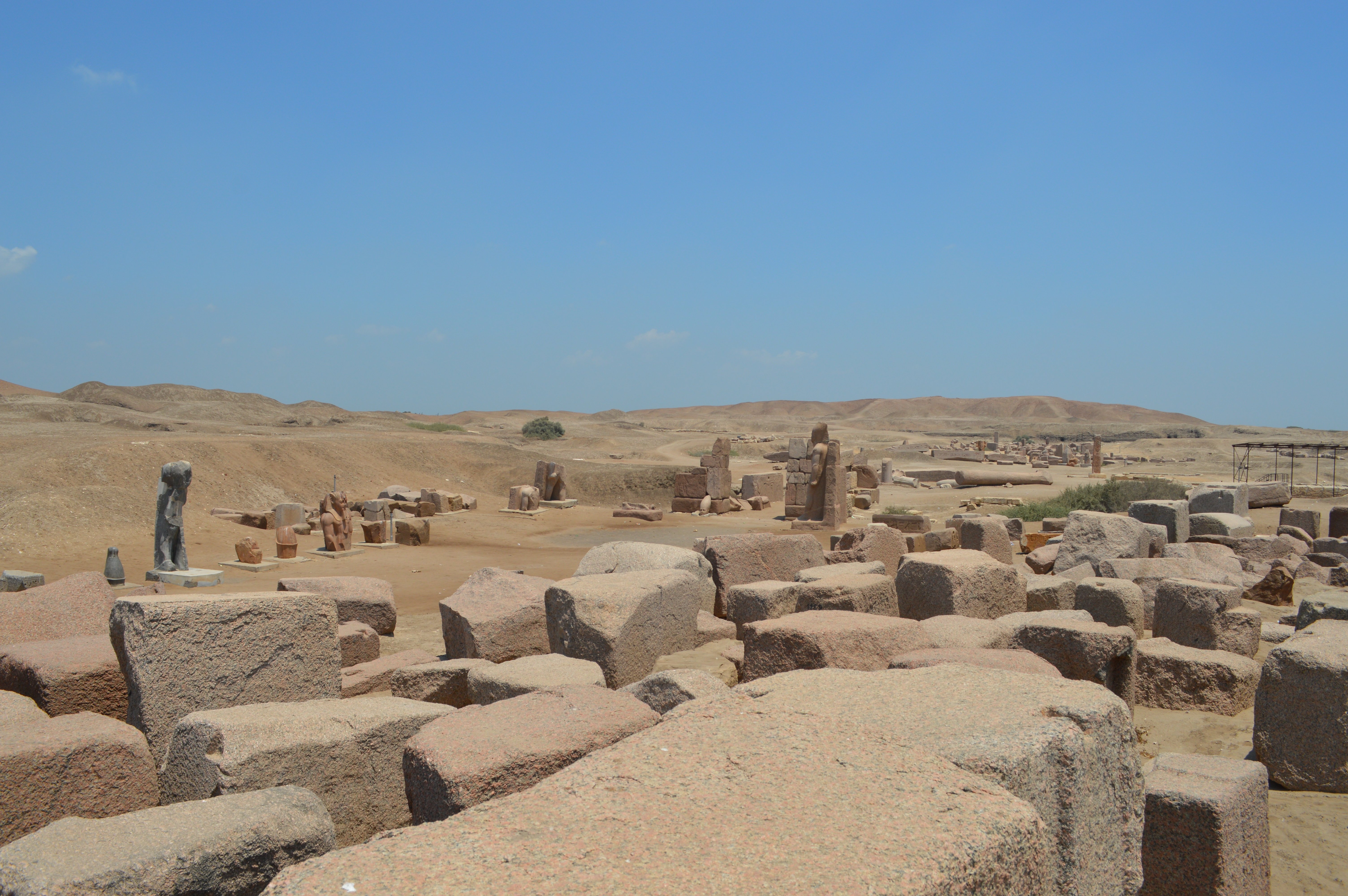
Figure 1
|
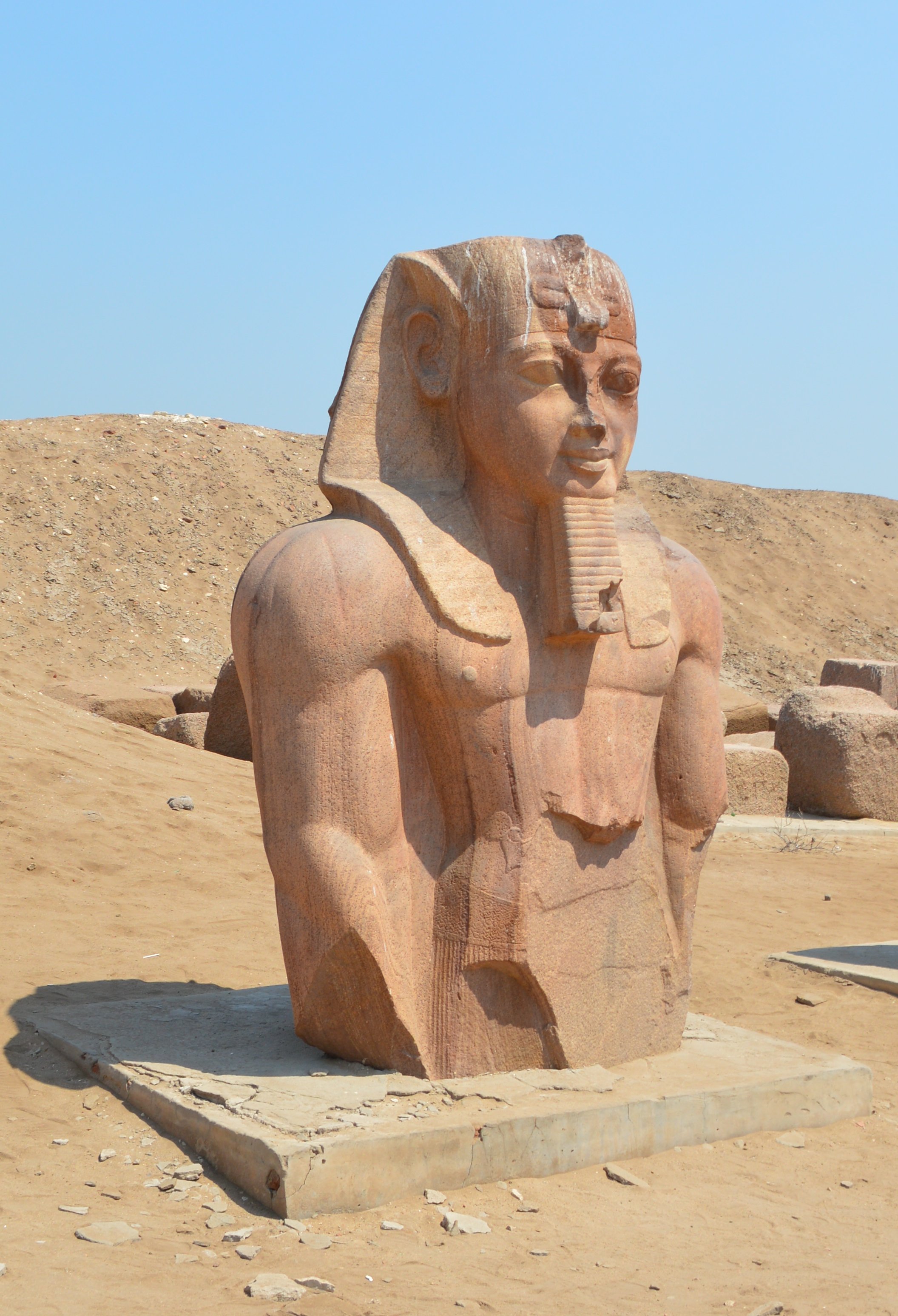
Figure 2
|
||
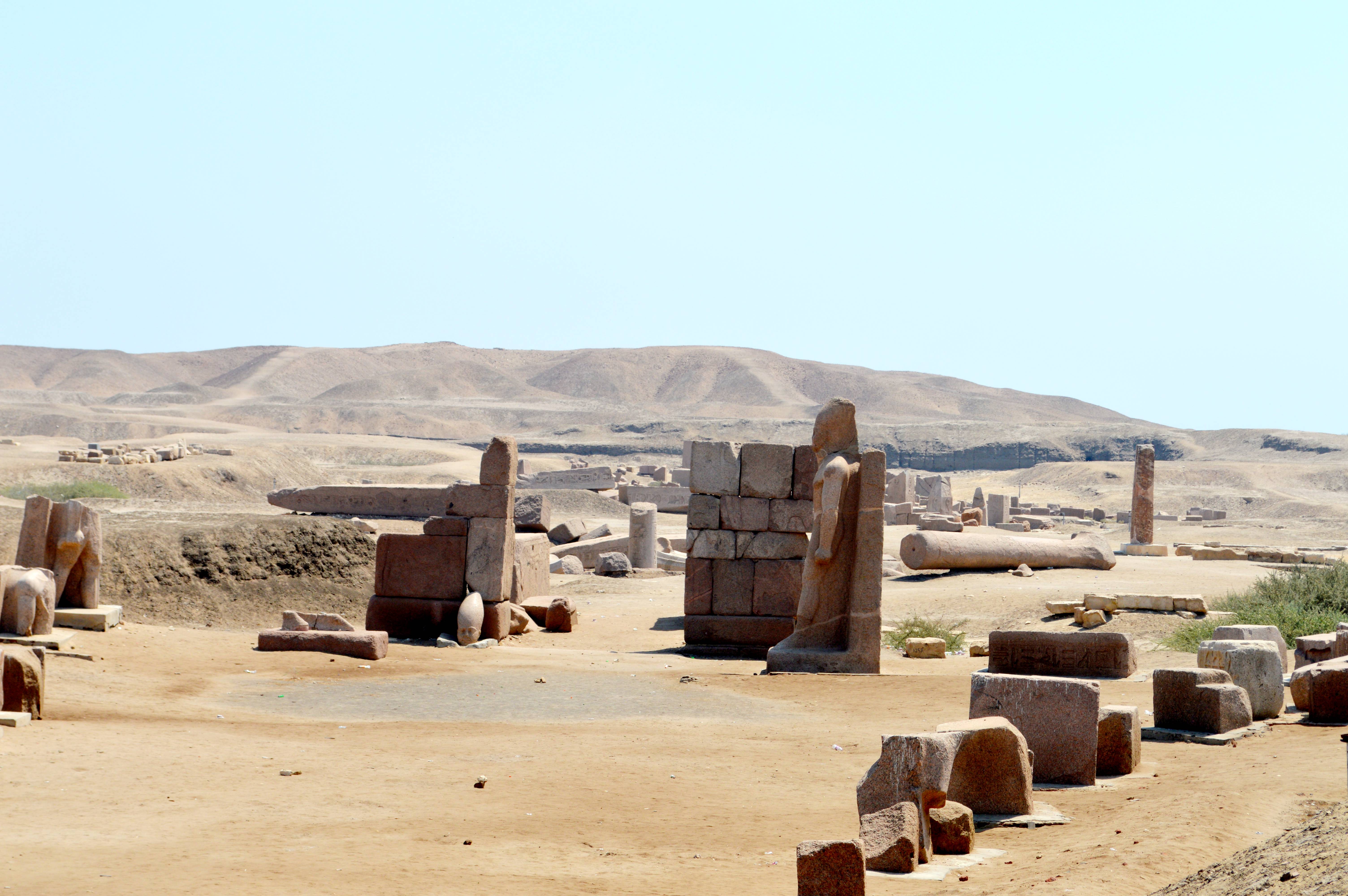
Figure 3
|
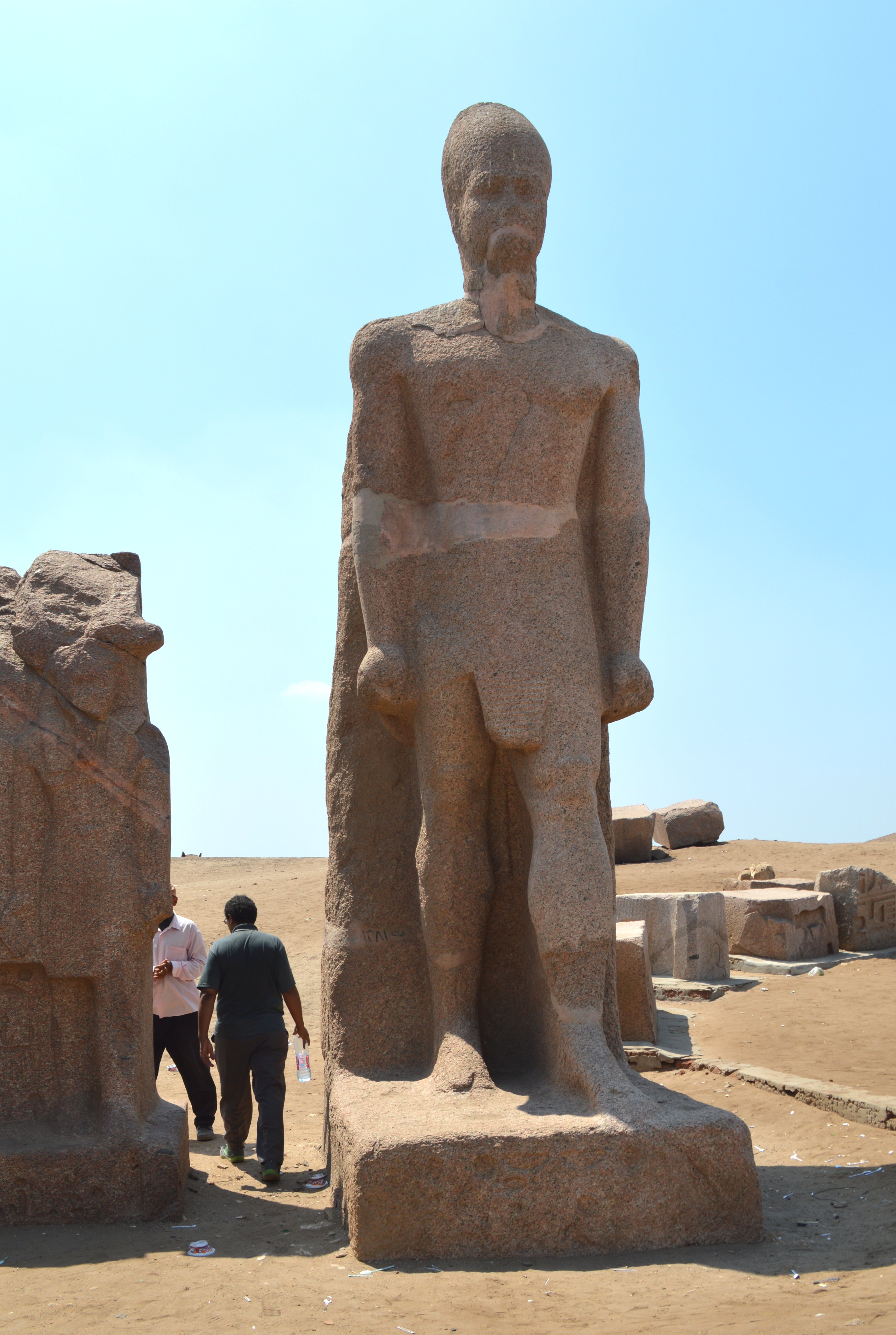
Figure 4
|
Area A
Walking through the passage leading from the management office of the ruins of Great Temple of Amun in Tanis, the first thing that is noticed is the place where large stone materials are gathered together on the south side of the passage (Figure 1). Stones of about 50 cm to 1 m in length are probably the stones which were used for the External wall of the Temple of Amun and the foundation of the pylon, and they have been carried and placed here when the excavation. It is natural that the remains of the Amun Temple are no longer confirmed as such large quantity of stones were carried away from their original locations and the sun-dried bricks which were main building materials have also been discarded.
On the north side of the passage, the stone statue of Ramses II (Figure 2), fragment of crown pieces of stone statues, etc. are displayed. Among the excavated antiquities of Tanis, stone statues and precious metals with high artistic value were brought to the Louvre Museum and the Egyptian Museum, but remained noticeable things among others that are left here are probably displayed here.
Area B
This area is where there is a remains called "Western Gate" (or Sheshonq Gate) (Figure 3) which is the entrance of the Temple of Amun. Even though it is a "Western Gate", only a small part of the gate, left and right sides, are repaired, and most of the stone materials of the gate were taken away elsewhere. Just to the right side (south side) of the Gate, a large stone statue (Figure 4) of Sheshonq III (the 22nd dynasty, reigned c.825-773 BC) which is restored and stands is eye-catching. When approaching the Western Gate, we can see the fragments of the huge obelisk etc. lying beyond the Gate.
Area C
There are the remains of two wells here. One is a circular form (about 4-meter diameter), and another one is a square form (with a side of about 6 meters) (Figure 5), which can be seen in the satellite picture of Google Maps. Both are huge ones with a depth of about 8 meters. These wells were discovered by French Research Team in 1933. The inner wall of the well is made of masonry, and stairs are set up there, so that we can step down to the bottom of the well. Figure 6 is the view from the bottom of circular well. It shows the stone materials elaboratively processed were stacked up and made the curved surfaces. It was interesting me as a tourist.

|
|

|
Area D
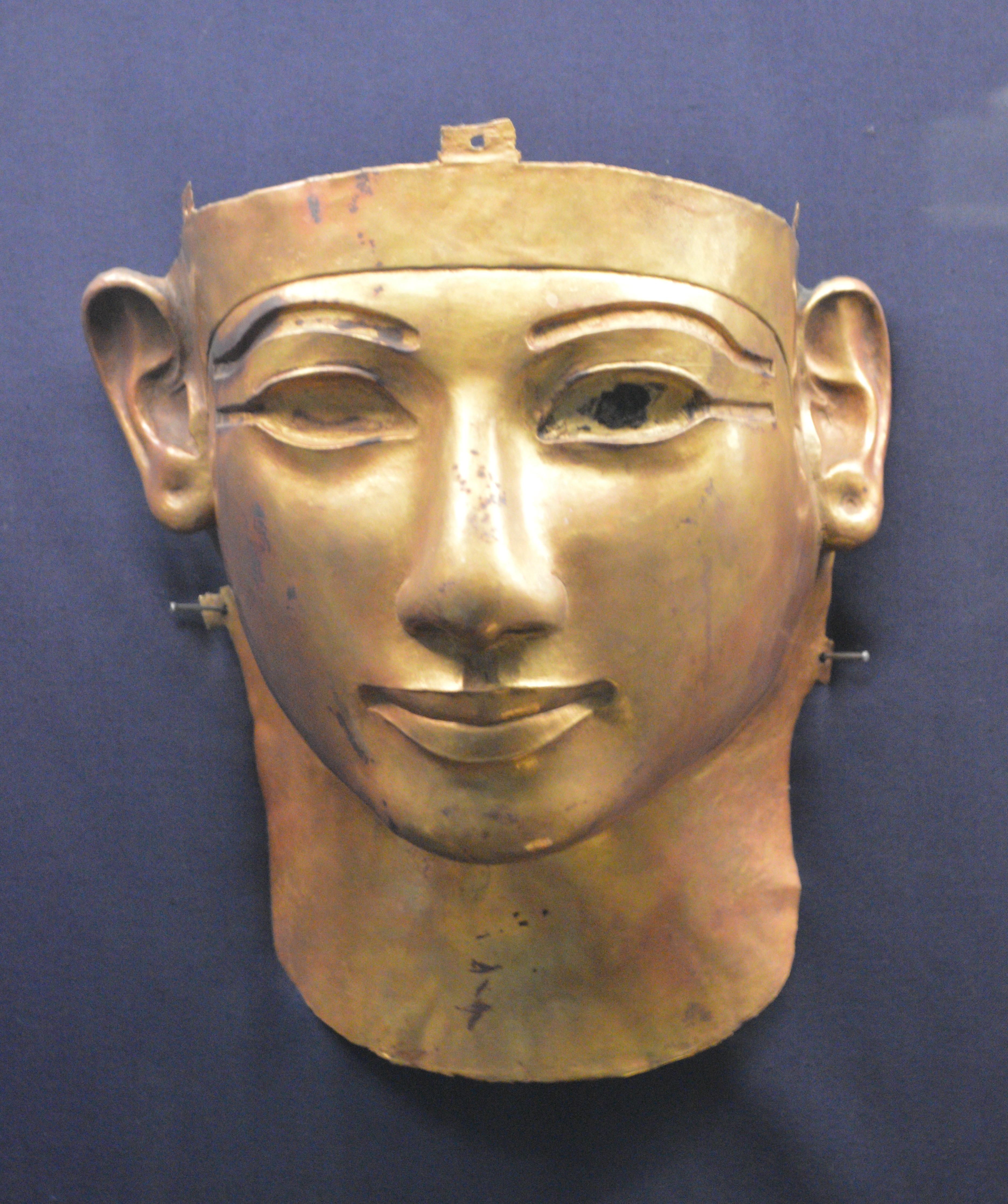
This is an area of royal tombs for from the 21st through 22nd Dynasty, which is called "Royal Necropolis". Here is an important ruin in which the golden mask of Psusennes I of 21st Dynasty (Left), the golden mask of Sheshonq II of 22nd Dynasty (Middle), and the stone coffin of Sheshonq III were subsequently discovered during the excavation research in 1939-40. And in 1946, the golden mask of General Wendjebauendjed (Right) during the reign of pharaohs Psusennes I was discovered at NRT-III (3rd Tomb) by Pierre Montet. At present, the uncovered stone coffin is exposed (Figure 7) in the grave, and the relief on the tomb's wall and the inscriptions can be looked down from above. Figure 8 is a wall of royal tomb of Sheshonq III, and his birth and the coronation names can be confirmed.
Those findings such as the golden masks and the ornaments of roya family are exhibited in the specific room named "The Royal Tombs of Tanis"
on the upper floor of Egyptian Museum in Cairo.
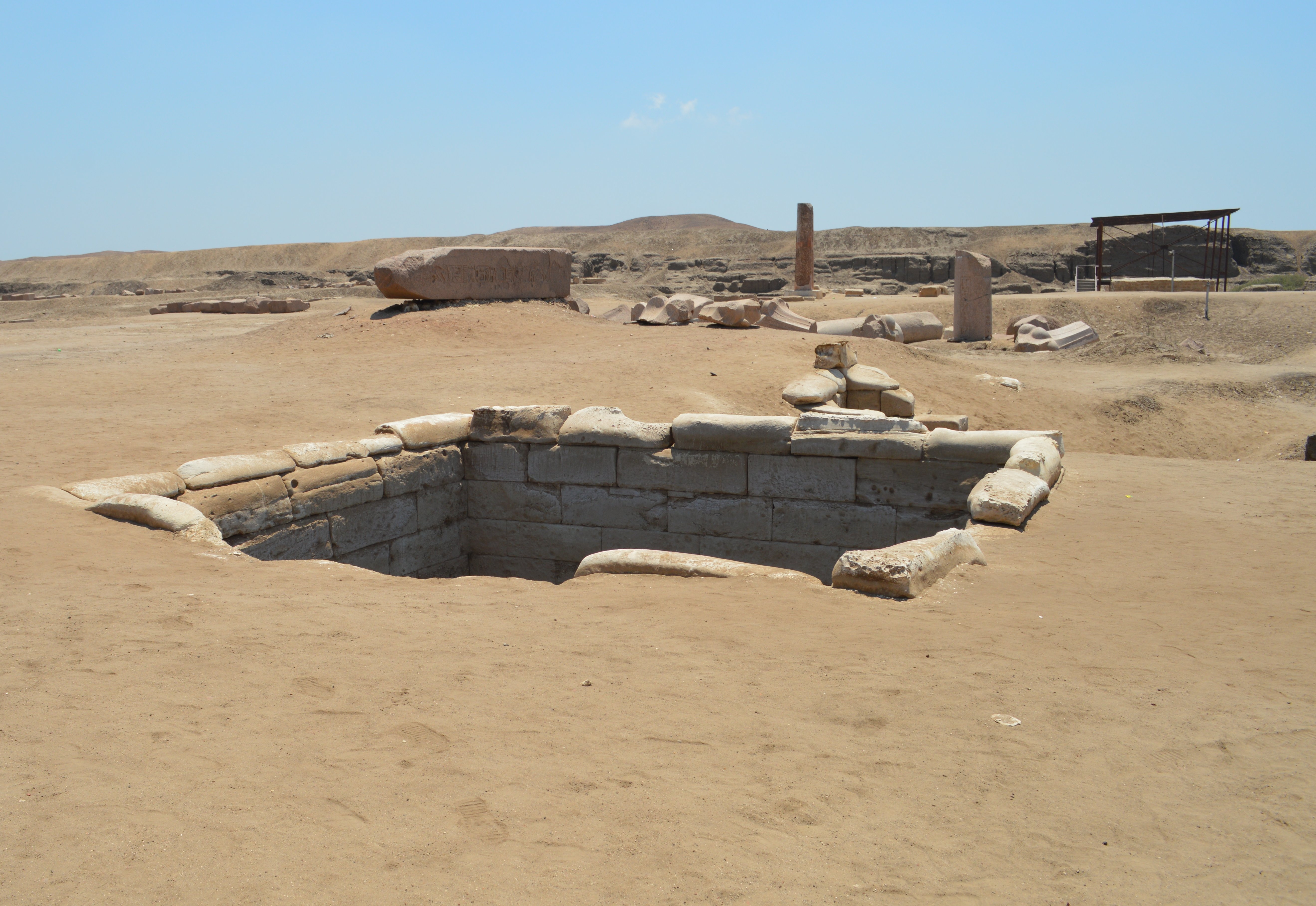
Figure 5
|
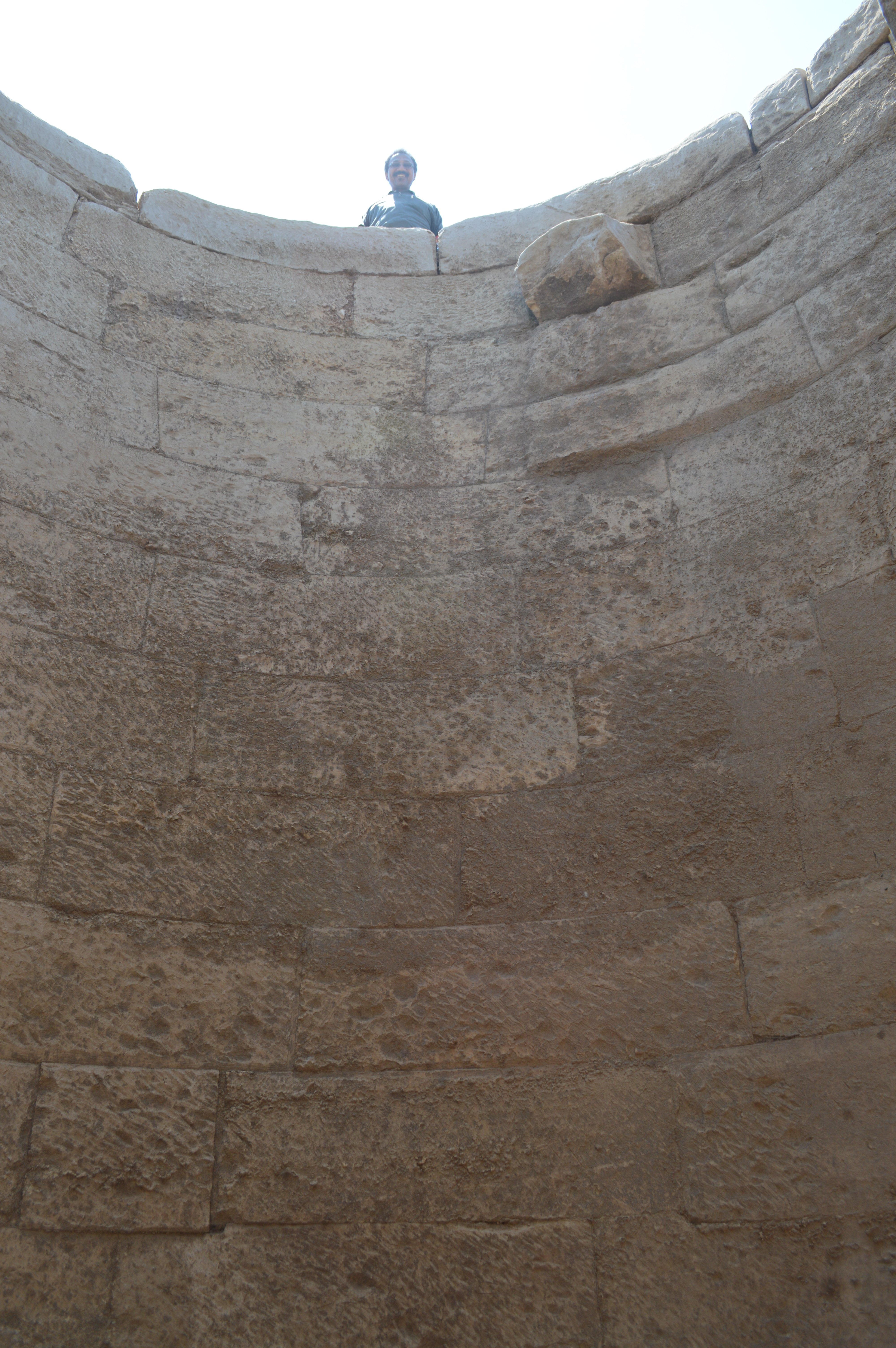
Figure 6
|
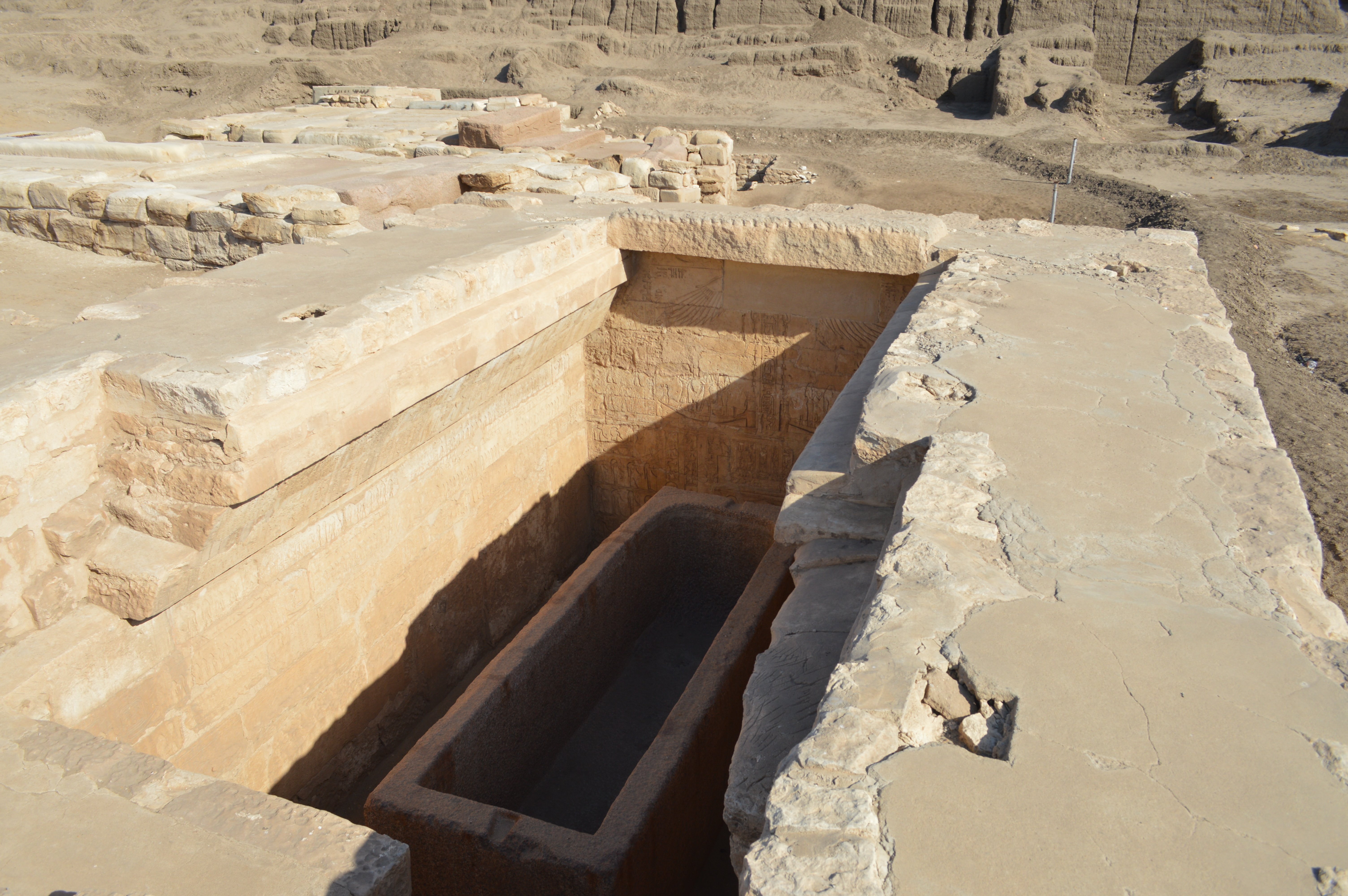
Figure 7
|
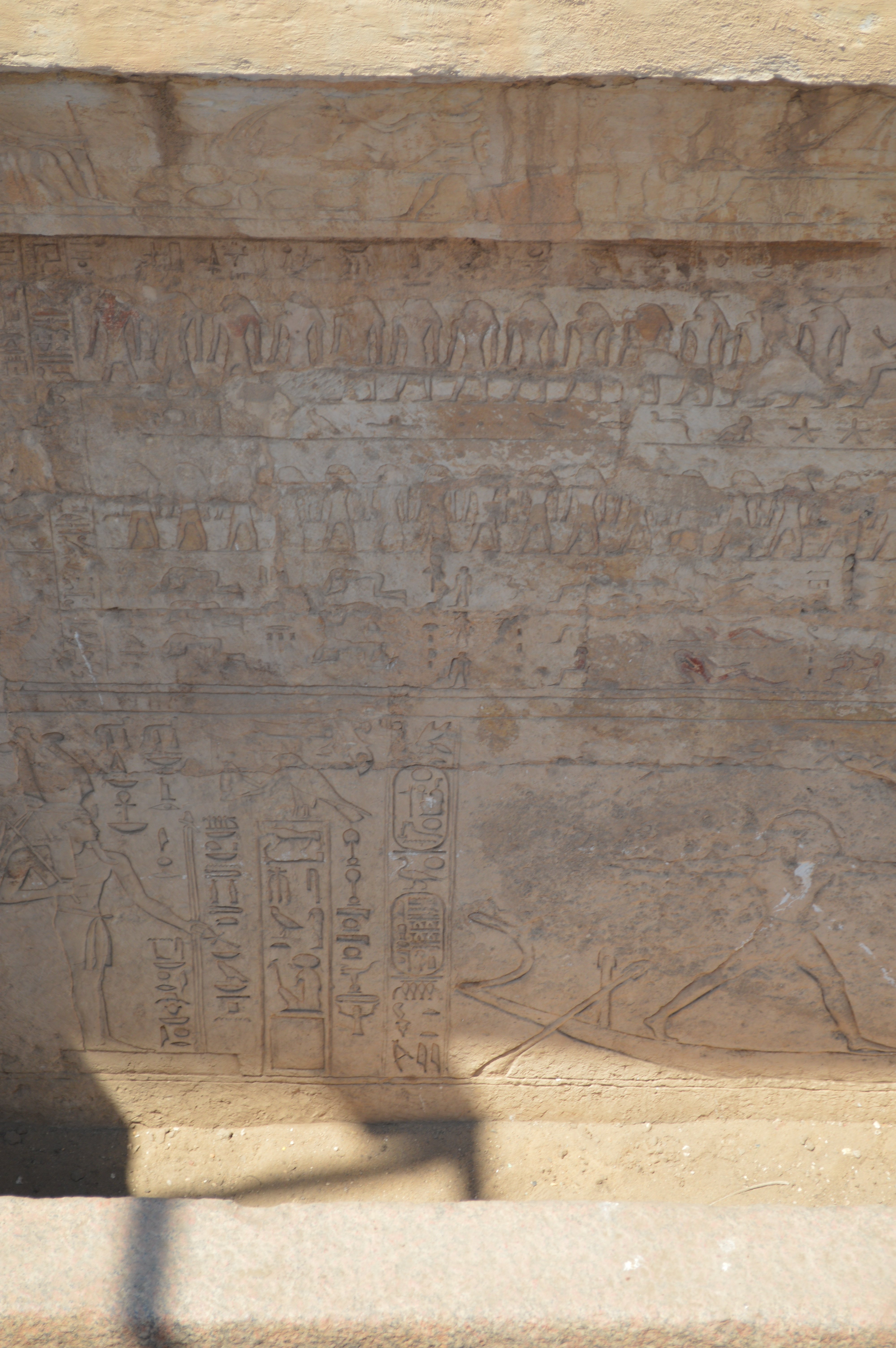
Figure 8
|
| |
|
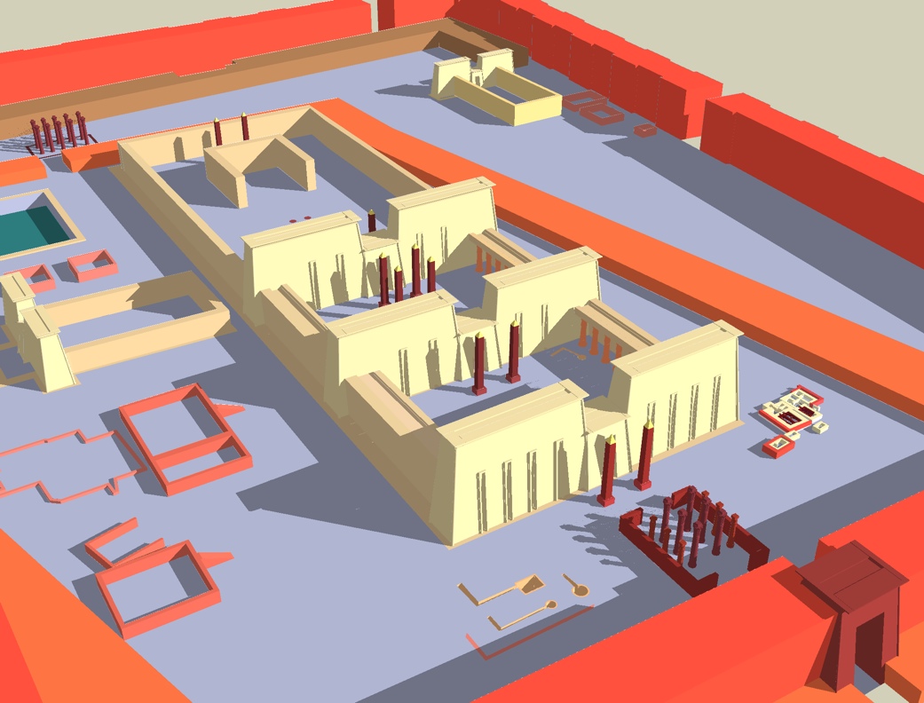
Restored Plan of of Amun Temple
Source: https://fr.wikipedia.org/wiki/Tanis |
About The Obelisk:
When I was reading the Wikipedeia (French version) on Tanis, I become curious about the phrase that it might have collapsed due to the earthquake during the Byzantine Era as the obelisk is falling in the same direction. In fact, some of the fallen large obelisks that are visible in the satellite picture of Google Map are lying toward northwest. However, I did confirm at the site, not all obelisks were falling in the same direction.
The Restored Plan of Amun Temple in Tanis is posted on the page of Wikipedeia (French version) on Tanis (Right Figure). 12 large obelisks are drawn in this illustration. But the size of fallen obelisks in Tanis is not same in fact. In addition, many obelisks that are currently left in Tanis are thought to have been brought to another place from the place that was originally collapsed due to excavation work etc.
I have visited Tanis three times, in 2014, 2016 and 2017. At the third visit, I measured the location of all obelisks (fragment) with using GPS, and I was able to pinpoint the exact location.
♦ As a result, there were twelve (12) pieces of obelisks that could confirm the pyramidion part.
♦ Besides this, there were also two pieces of obelisks, which the top portion was missing.
♦ Beyond that, there are three obelisks which were carried away from Tanis. (1) Obelisk in Messalla Garden, Gezira Island (2) Obelisk at the front garden in the Egyptian Museum (3) Obelisk in the Cairo International Airport.
Most obelisks currently exist in Tanis were moved to another places in order to excavate the ruins buried beneath the collapsed obelisk during long-term excavation by Pierre Monte. For this reason, it is quite difficult from the place where it is currently located to infer which fragment is paired. Therefore, I will try to explain while referring to Flinders Petrie's "TANIS Part 1" written when the original situation of Tanis was kept before excavation by Pierre Monte.
The "Obelisk Number" below corresponds to the numbers in the satellite picture above.
|
Obelisk 1
This obelisk lies directly in front after the entrance of the Great Temple of Amun, or "Western Gate" (Right Figure). Remnants of the columns are scattered around here. This is a very slender obelisk, especially the pyramidion part is unusually long and slender shape. This is largely broken into 2 parts. It's 6.37 m for upper part, and about 6.4 m for lower part, about 12.8 m long in whole total. The thickness at the bottom is 1.4 m. The corner of the shaft has worn away, but the inscription itself is clear, as the inscription has been engraved very deeply.
The inscription in the enlarged photograph at the upper portion (Figure 10 & 12) continues with the horus name, coronation name, and the birth name of Ramses II. Since there was no other fragment that would be paired around here, so I looked for the pair of this obelisk. As a result of comparing the pictures, I found that the obelisk in the Cairo Airport has many similarities such as slim shape and different horus names on 4 sides. However, referring to the inscription on Flinders Petrie's "TANIS Part 1", it turned out that this obelisk is south obelsik on the Obelisk, which is written as "Obelisk of the Hall". On the other hand, the obelisk in the Cairo Airport was confirmed to be north obelisk of "Middle Pair of Obelisks in Temple". Therefore, this was not a pair.
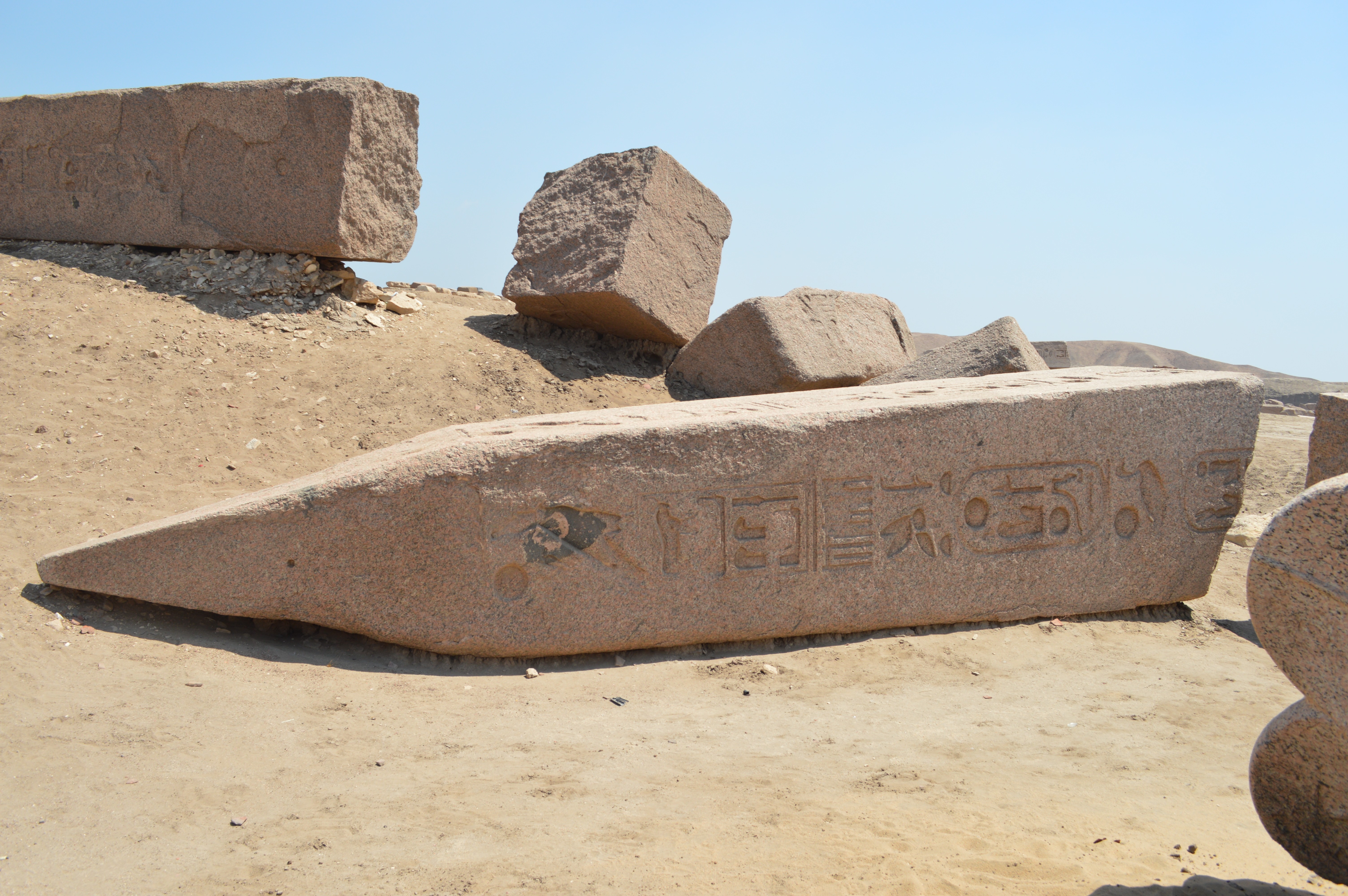 Figure 10: Upper portion (west side) |
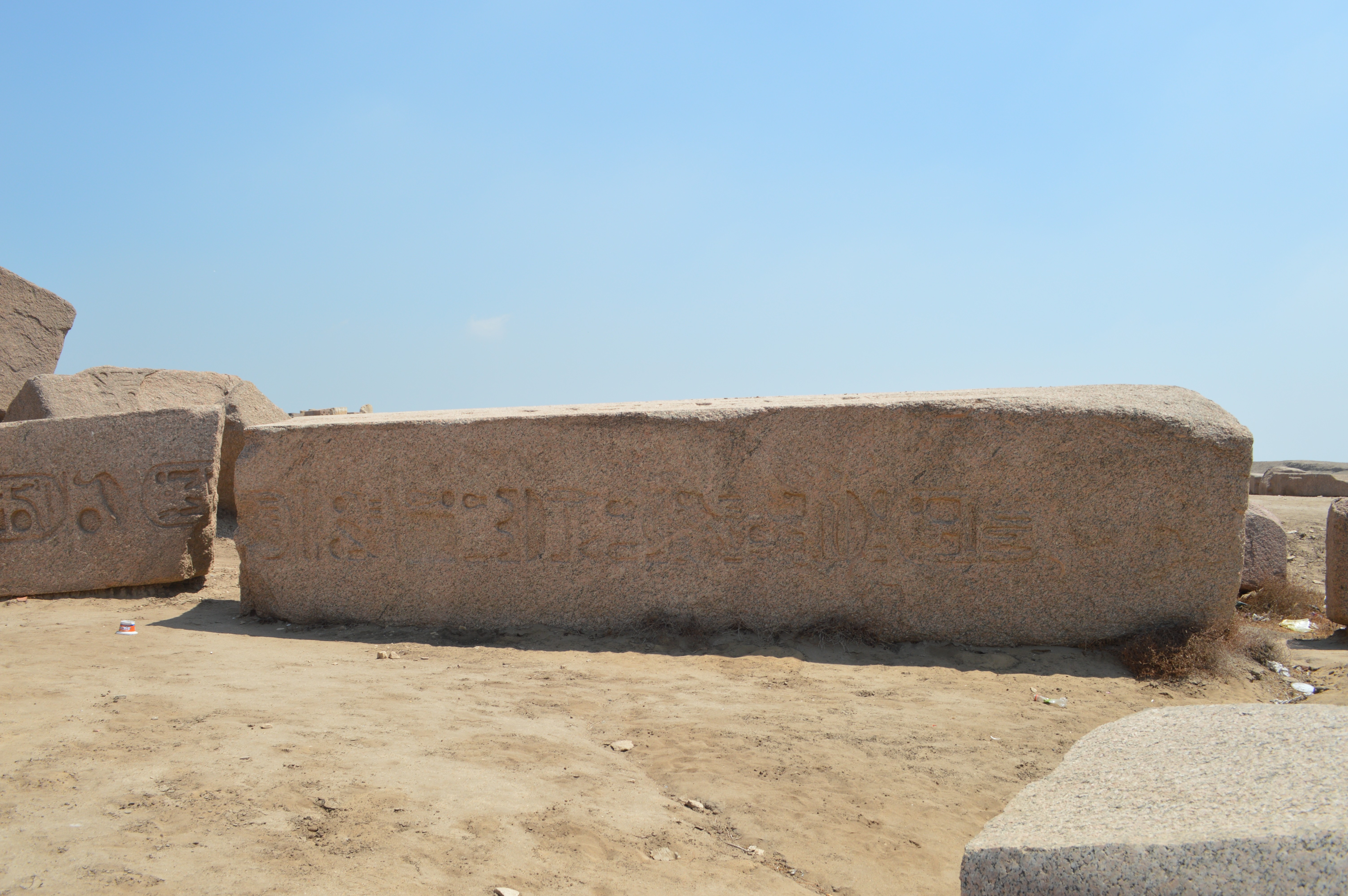 Figure 11: Lower portion (west side) |
|
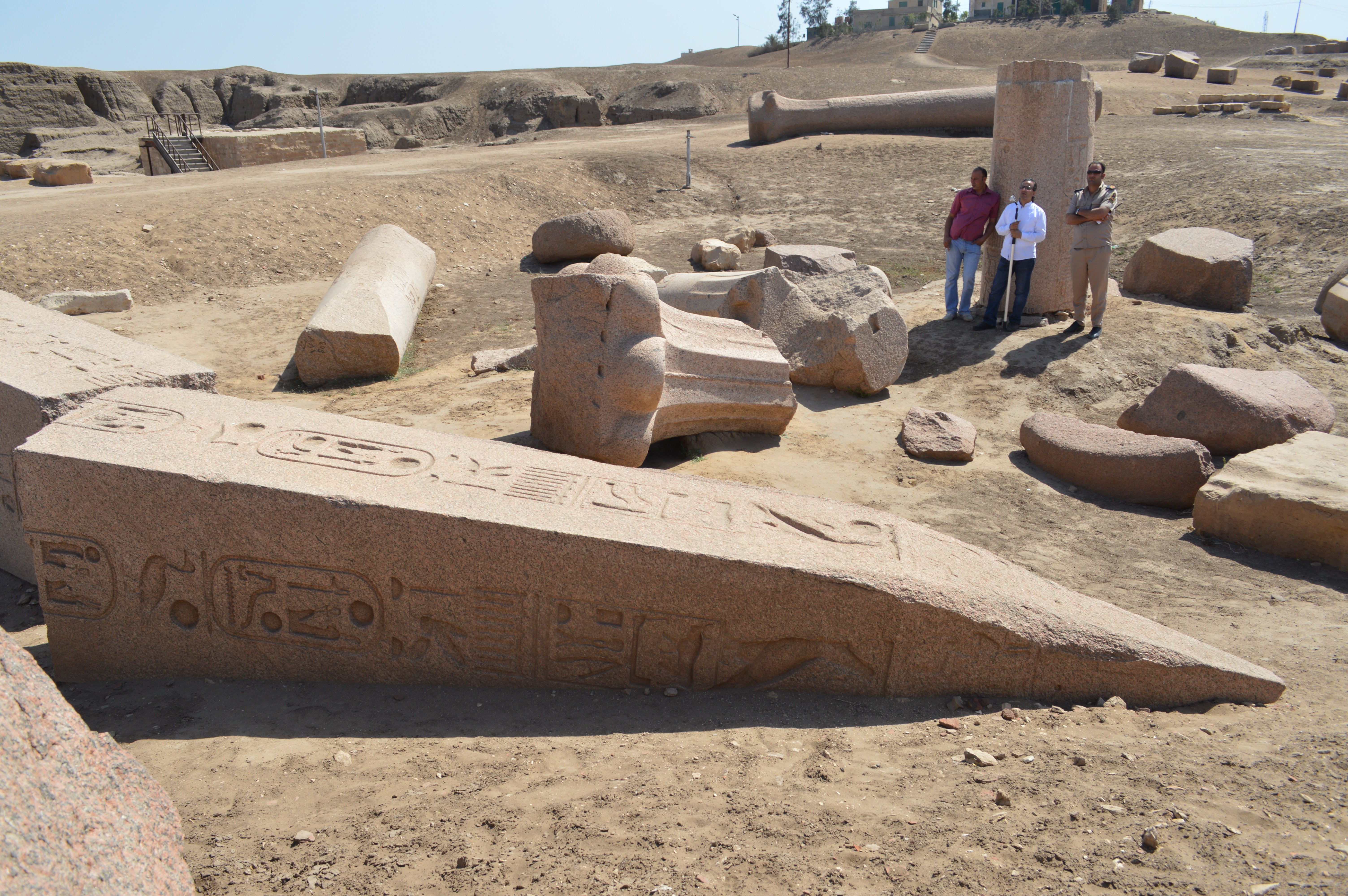 Figure 12: Upper portion (east side) |
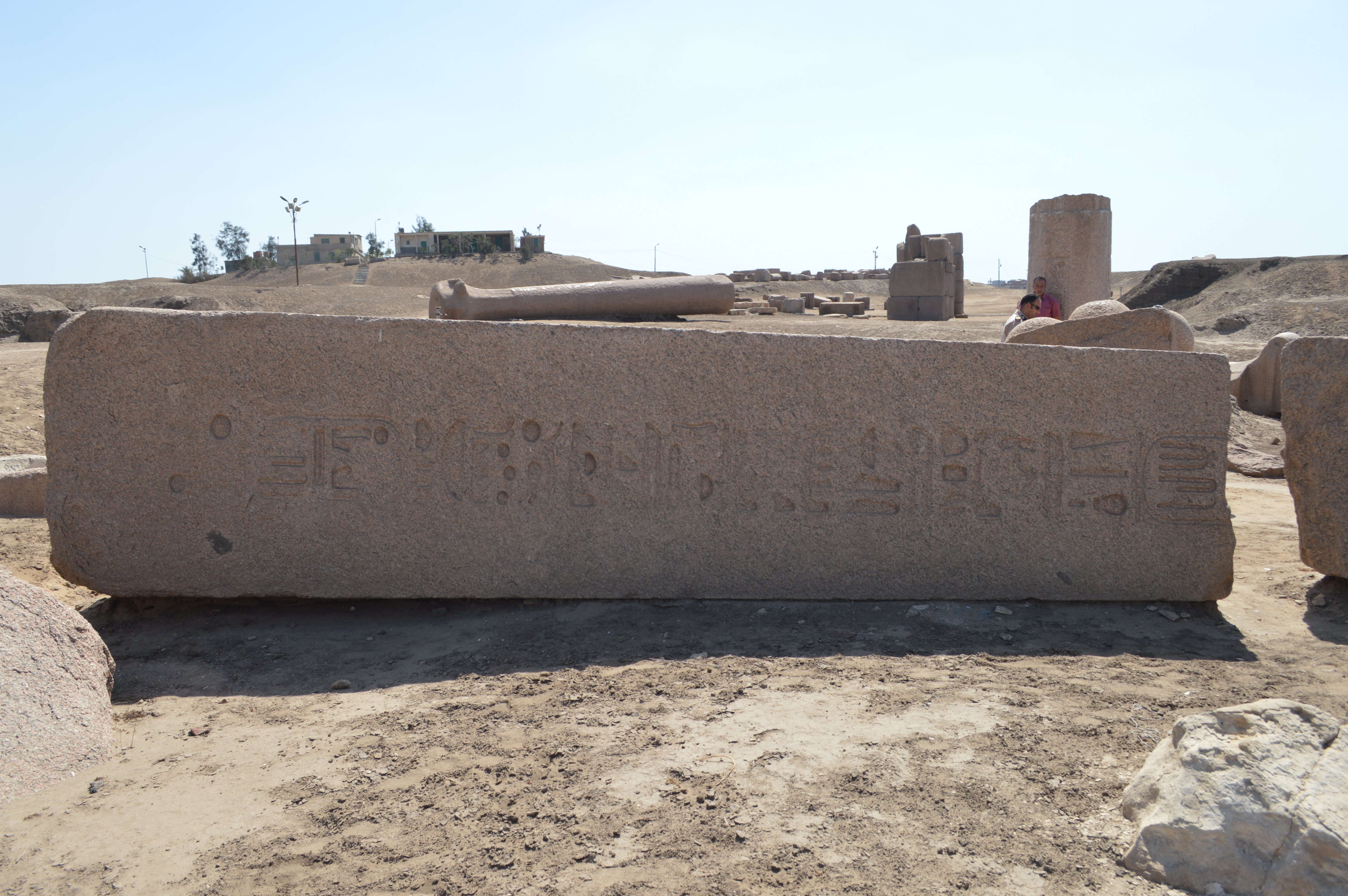 Figure 13: Lower portion (east side) |
|
Figures 10 & 11: August 5, 2014 Figures 12 & 13: April 27, 2016
by Hiroyuki Nagase (For high definition image, please click the picture) | ||
|
Obelisk 2
When walking ahead to the back along the Amun Temple's avenue, we can soon see this large and massive feeling obelisk lies at the north side of the avenue. The whole is broken into four, the lower three are rolling so as to be stacked one on top of another with a thickness of around 1 m.
I cannot clearly estimate the total length of the obelisk because the damage of the inscription of lower portion is so intense, but the upper portion occupies about 80% of the whole, and since it's about 10.6 m in this portion alone, I assume the total length would be about 14 meters. The thickness of the lowermost part of the upper portion is about 1.6 m. The person who is in the picture only above the knee is on the left side of Figure 16, so that we can see how this obelisk is big and thick compared with this person.
On the inscription on the west side (Figure 15) continues with the horus name, coronation name, and the birth name of Ramses II. But the inscription after the birth name cannot be read due to the severe damages. Its reverse side, the inscription on the east side (Figure 16), although the preservation state is pretty good. The horus name is a rare notation, and the horus name has different notation on each face. Referring to Flinders Petrie's "TANIS Part 1", I noted that the inscription on west side is North Obelisk of the obelisk which is written as "Obelisk of the Hall", and it was recorded as a pair with the obelisk 1 above. In my impression it was quite different from obelisk 1, so it was a little surprising to be paired with this obelisk. Currently the inscription on the eastern side is good preservation state, but it is not recorded in "TANIS Part 1". I guess this side was probably facing down when Flinders Petrie researched it.
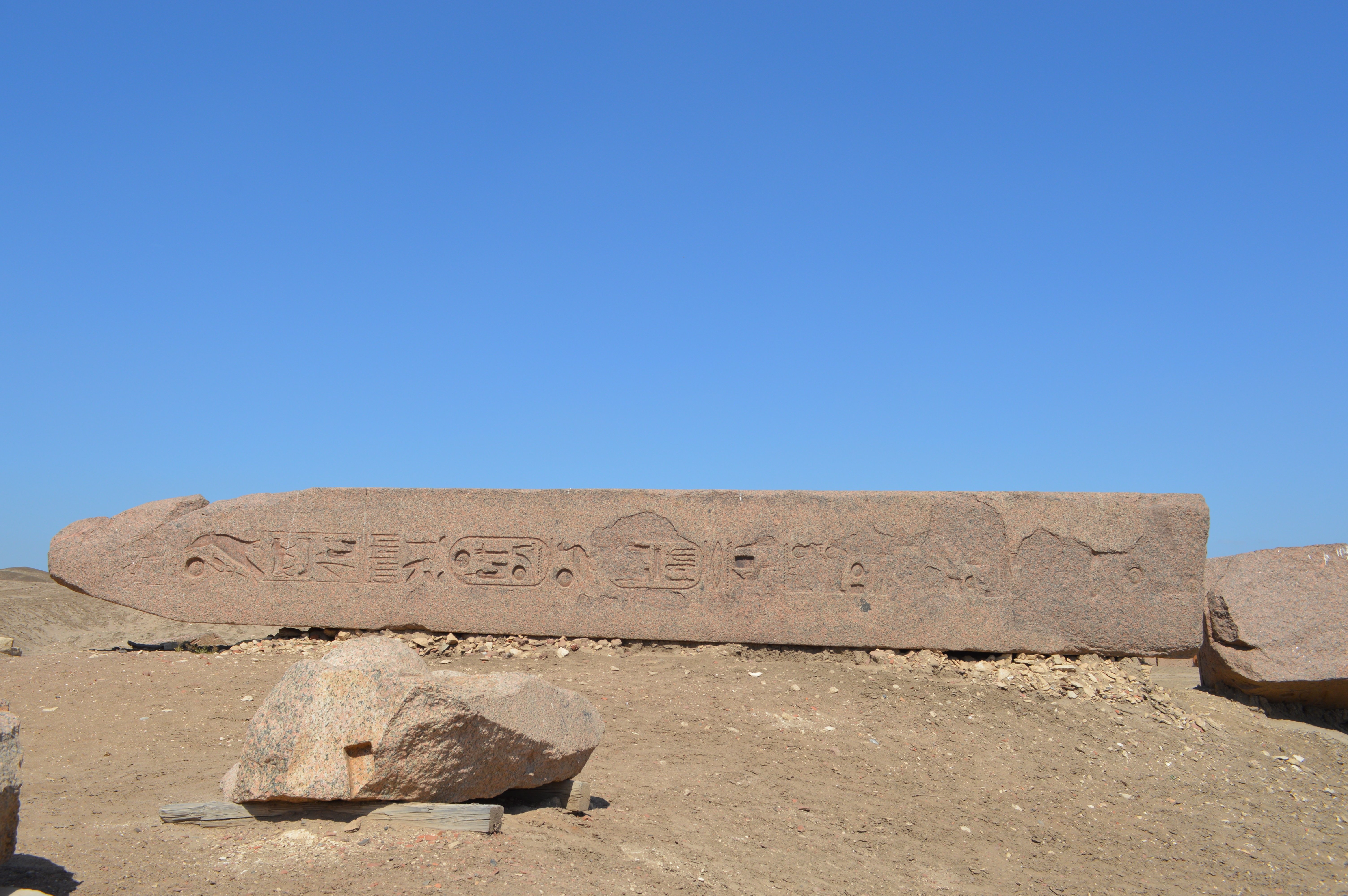 Figure 15: Upper portion, From west side |
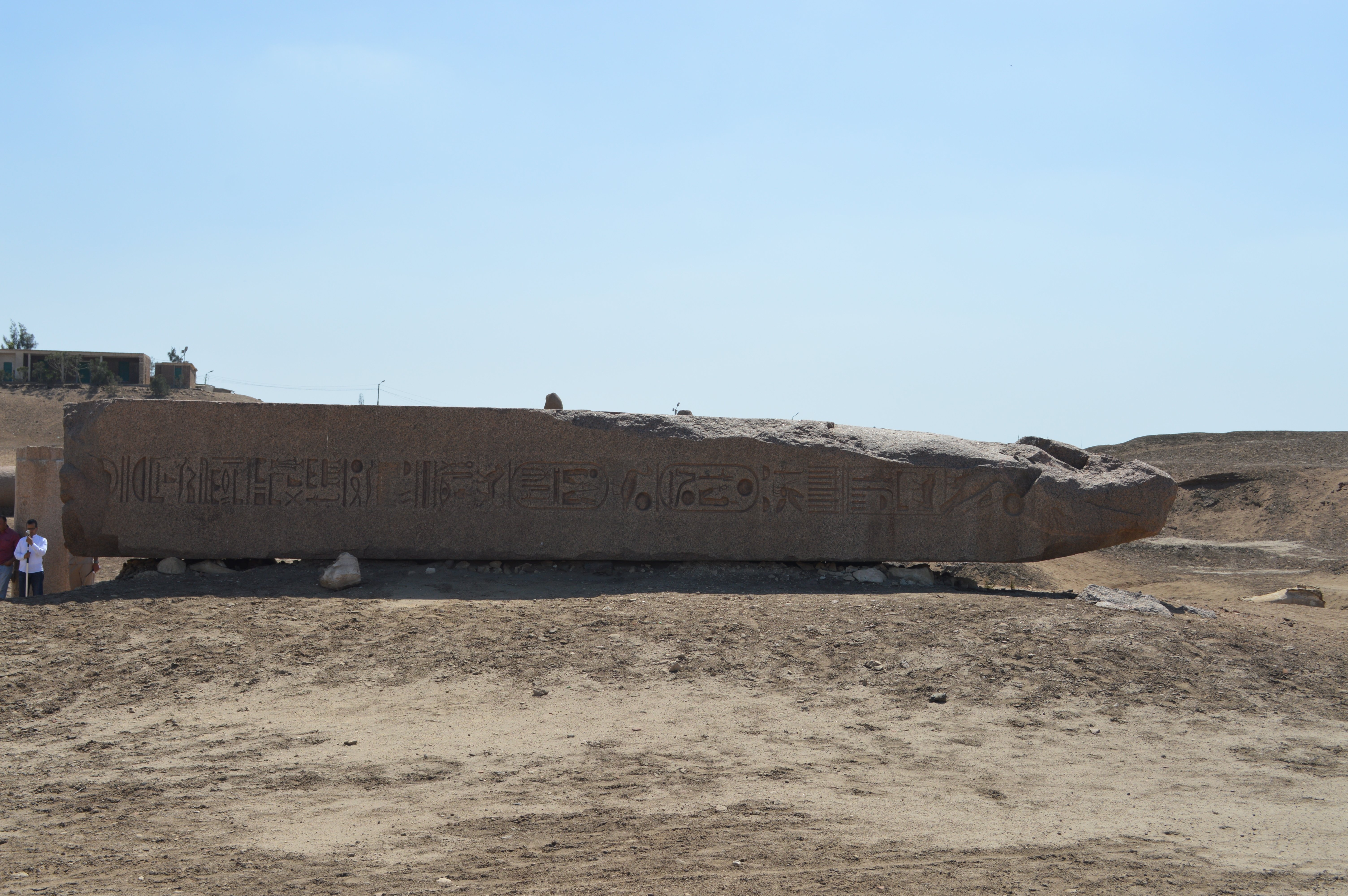 Figure 16: Upper portion, From east side |
|
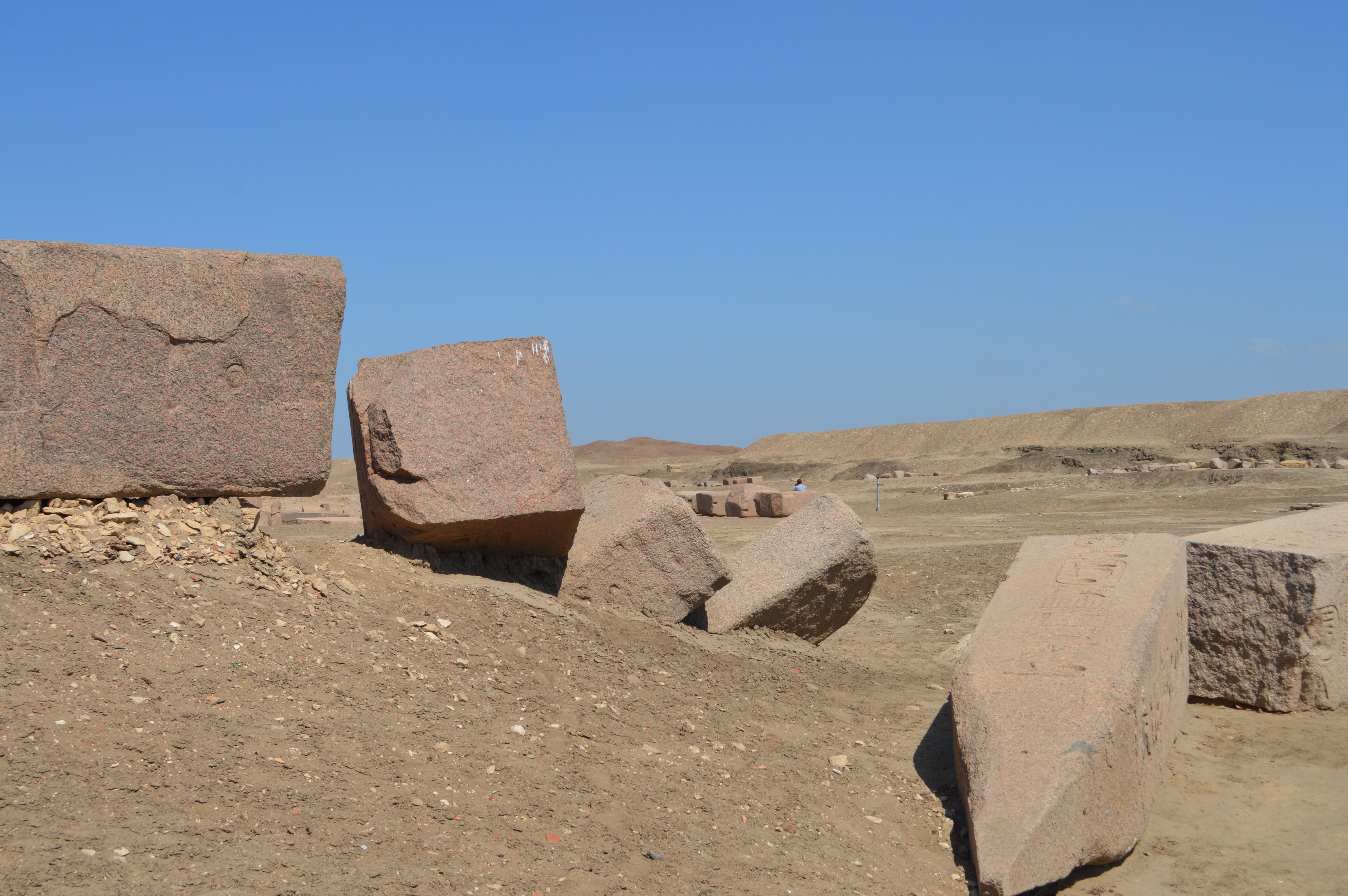 Figure 17: Fragment of lower portion, From west side |
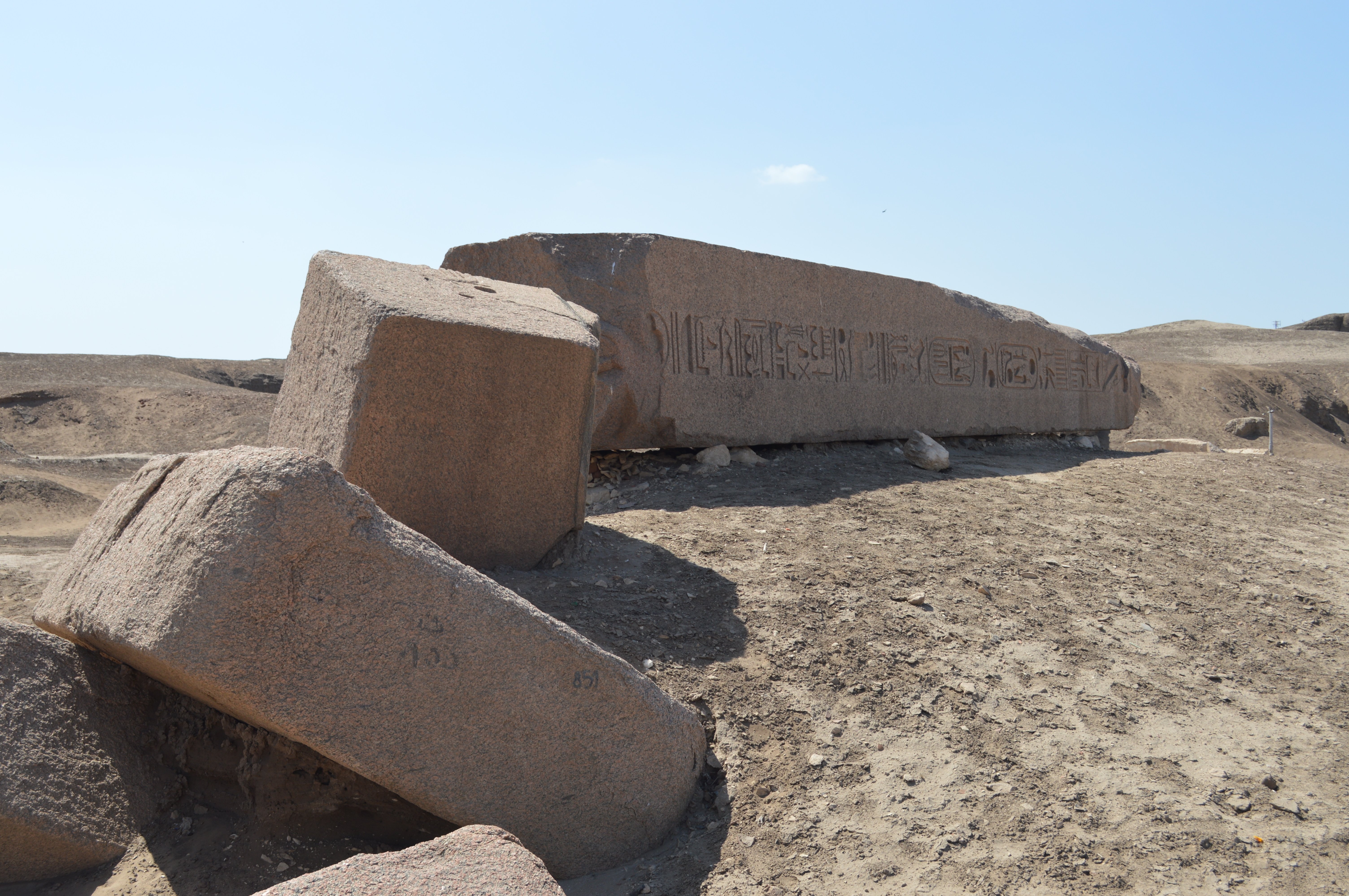 Figure 18: Fragment of lower portion, From southeast side |
|
April 27, 2016 by Hiroyuki Nagase (For high definition image, please click the picture)
| ||
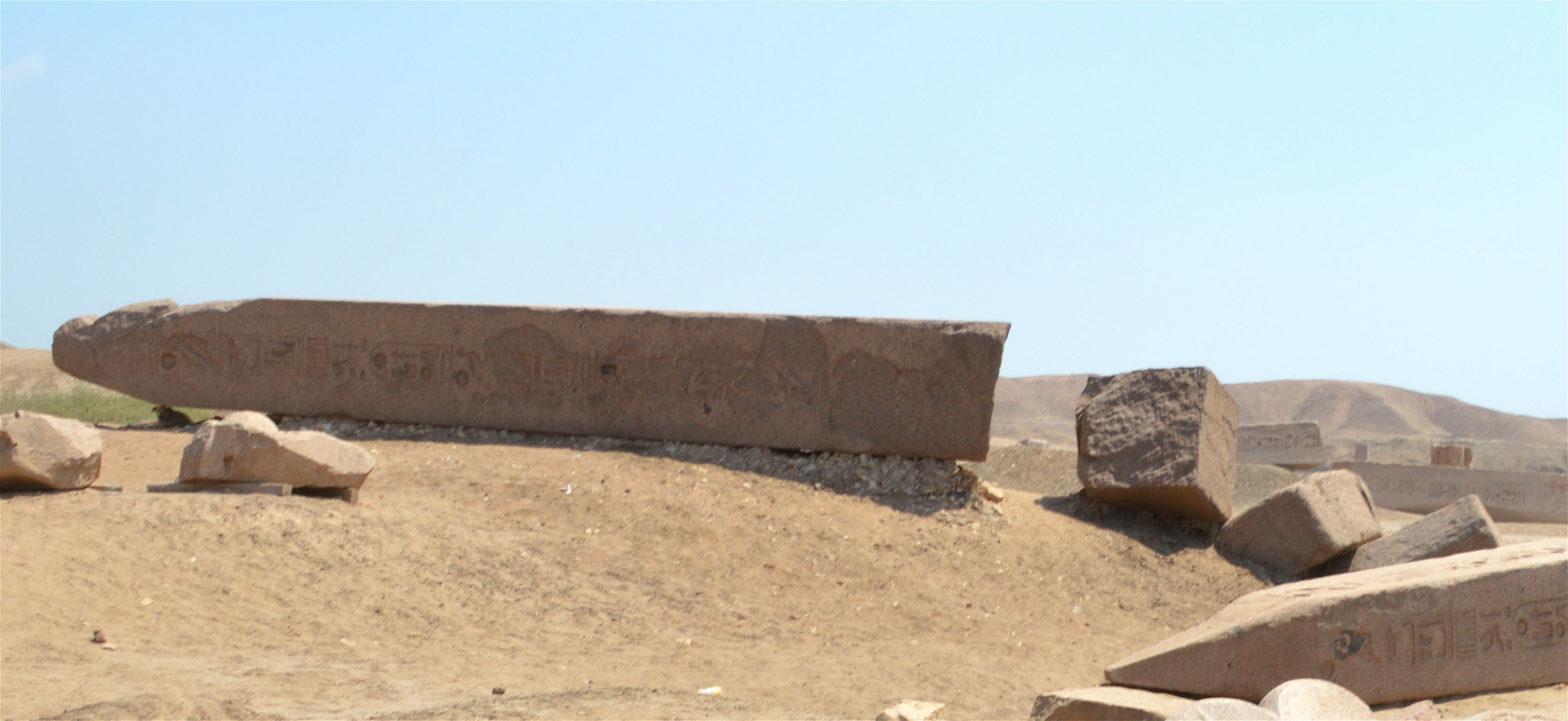
Obelisk 3
This is a standing obelisk near to the royal tomb of Sheshonq III, in the entrance area of Amun Temple. Present height of the main part is about 4.1 m. It was restored by joining two separated portions, and erected. Since the inscription starts from the end of the horus name, we can understand that the pyramidion and the top portion are lost. Also the lower portion is lost. Hence, the total length of original obelisk would be about 7 meters or so. The coronation and birth names of Ramses II can be read, but the weathering is proceeding and the preservation state is not very good. That is due to the materials is like conglomerate, which is not so common in other obelisks. Since the material is not ordinary granite, it can not be determined whether it is obelisk for appearance, but it is described as "In wall of Pylon, sandstone obelisk" in "TANIS Part 1". I searched for near here, but other stones like this obelisk's fragment were not found around here. Flinders Petrie is trying to identify it properly when obelisk is a pair, but this obelisk is described only one. I assume this was originally built alone, or the other one was already lost at the time of research by Flinders Petrie.
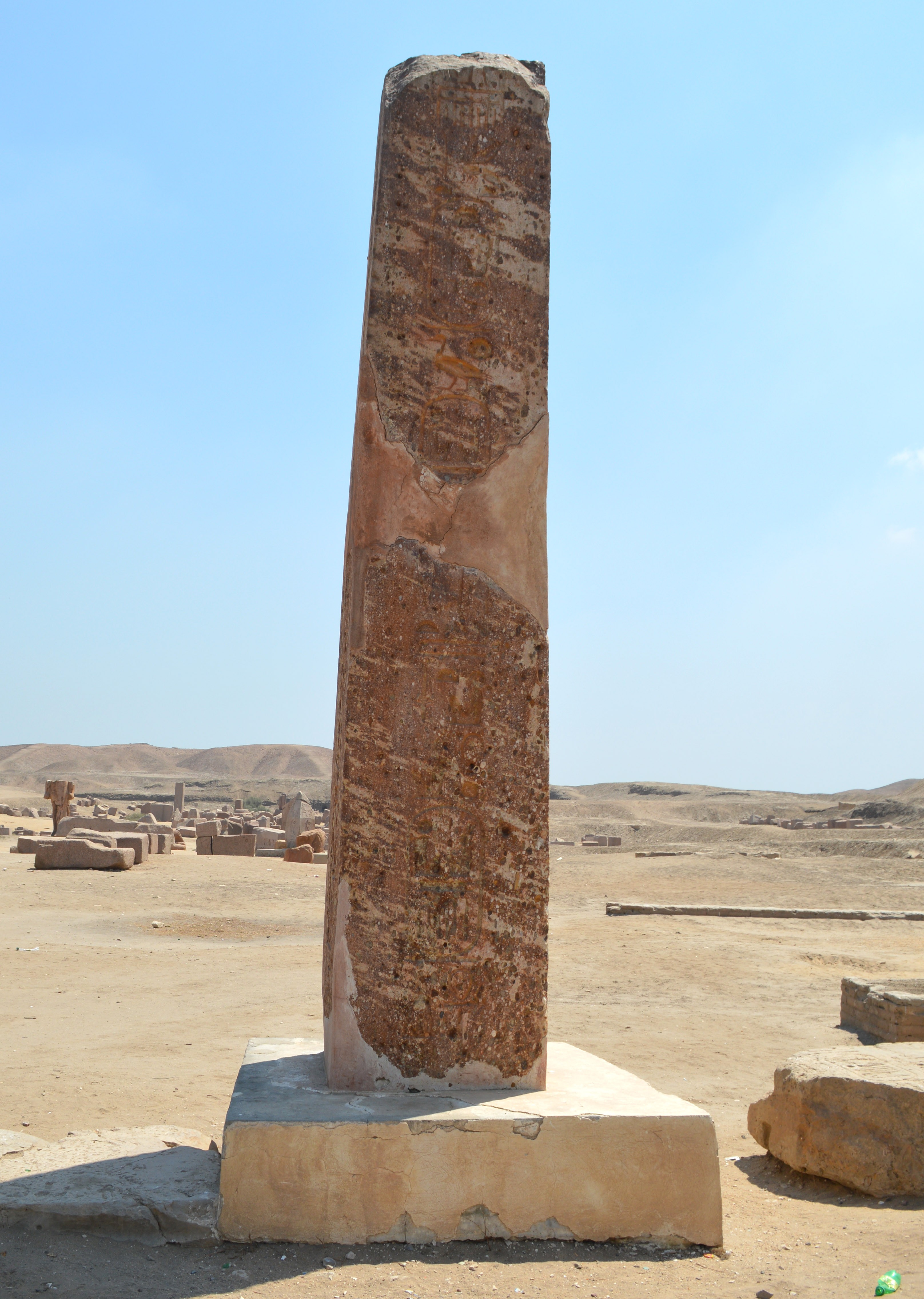 Figure 19: West side |
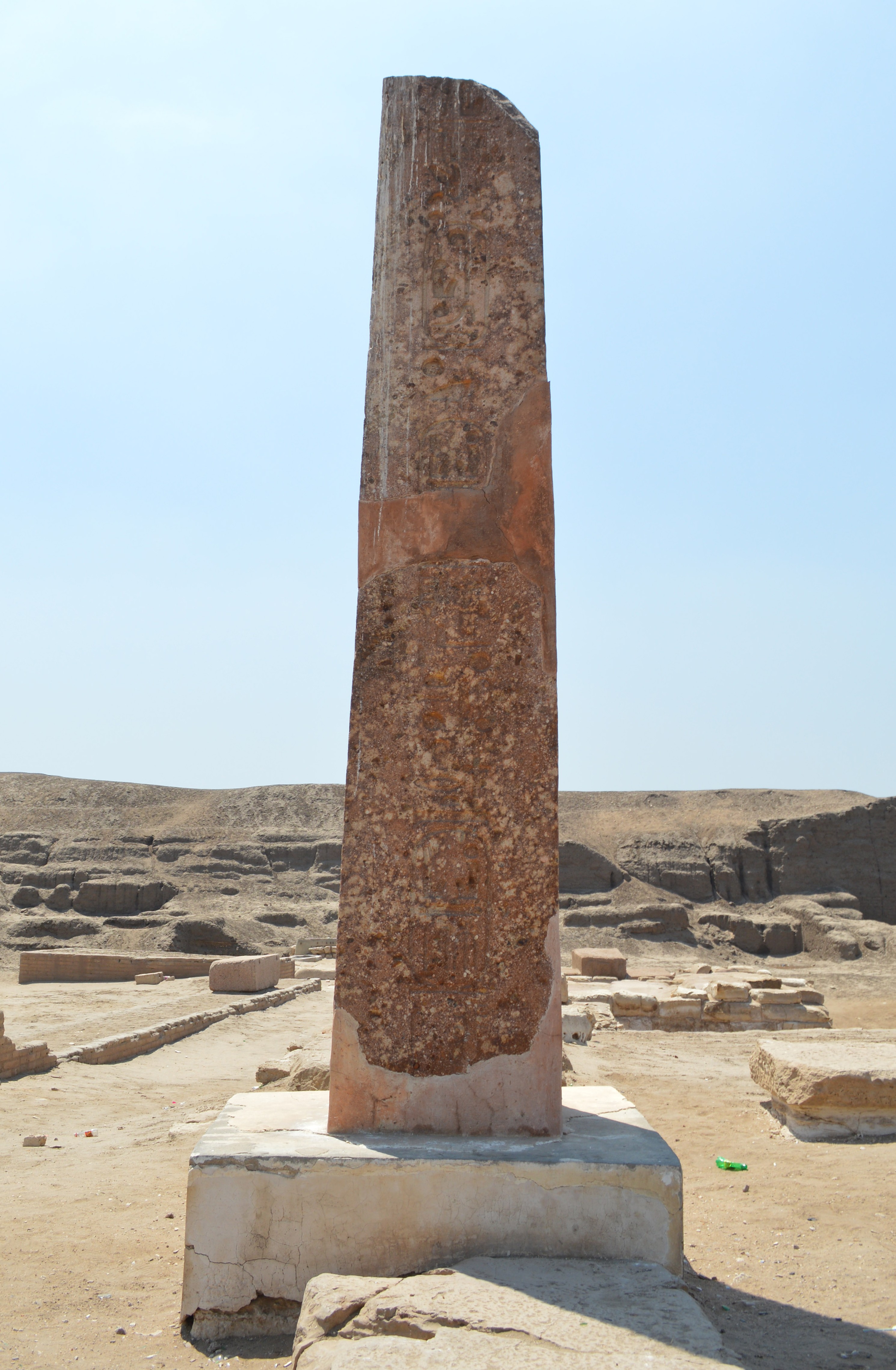 Figure 20: North side |
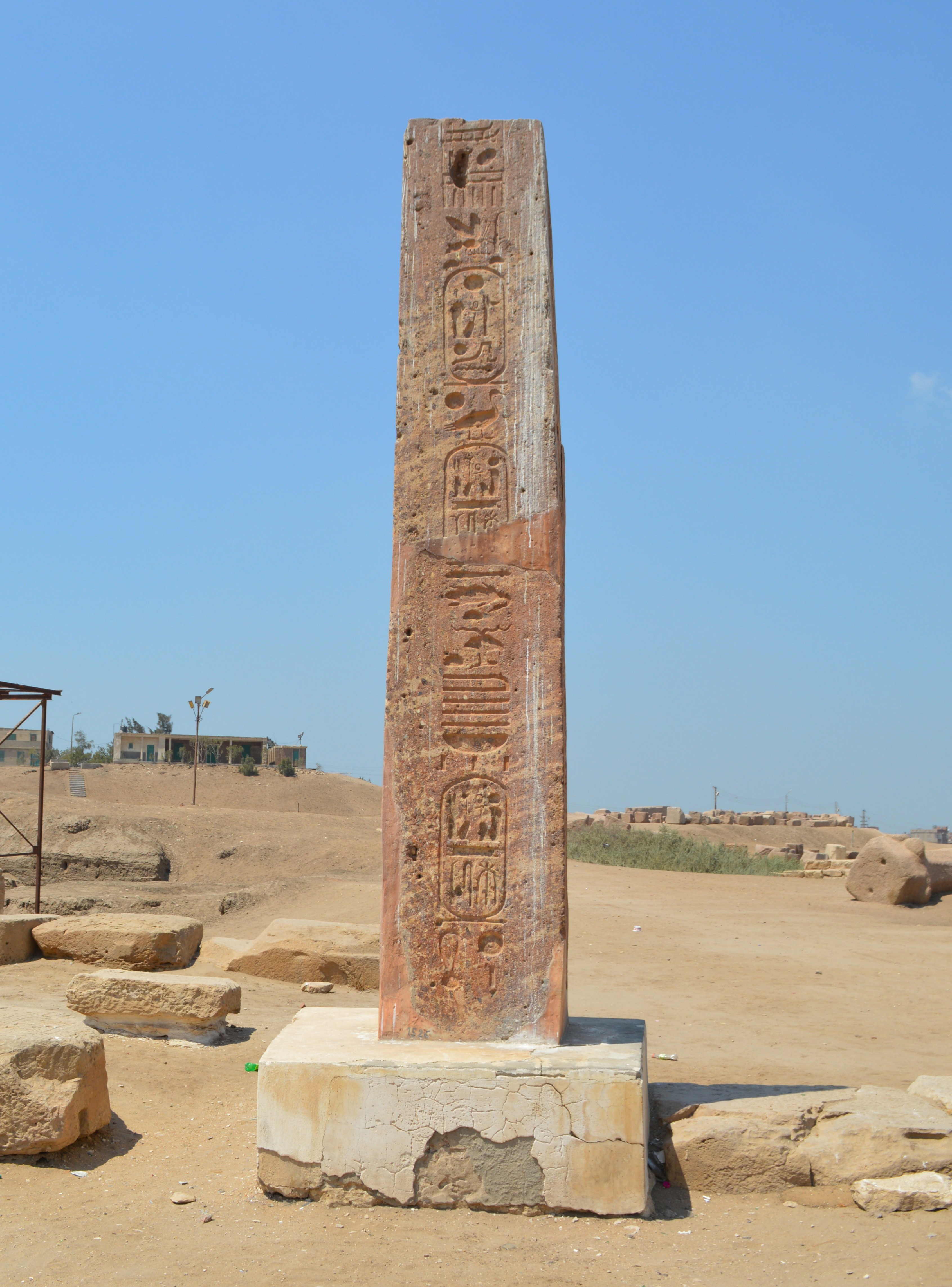 Figure 21: East side |
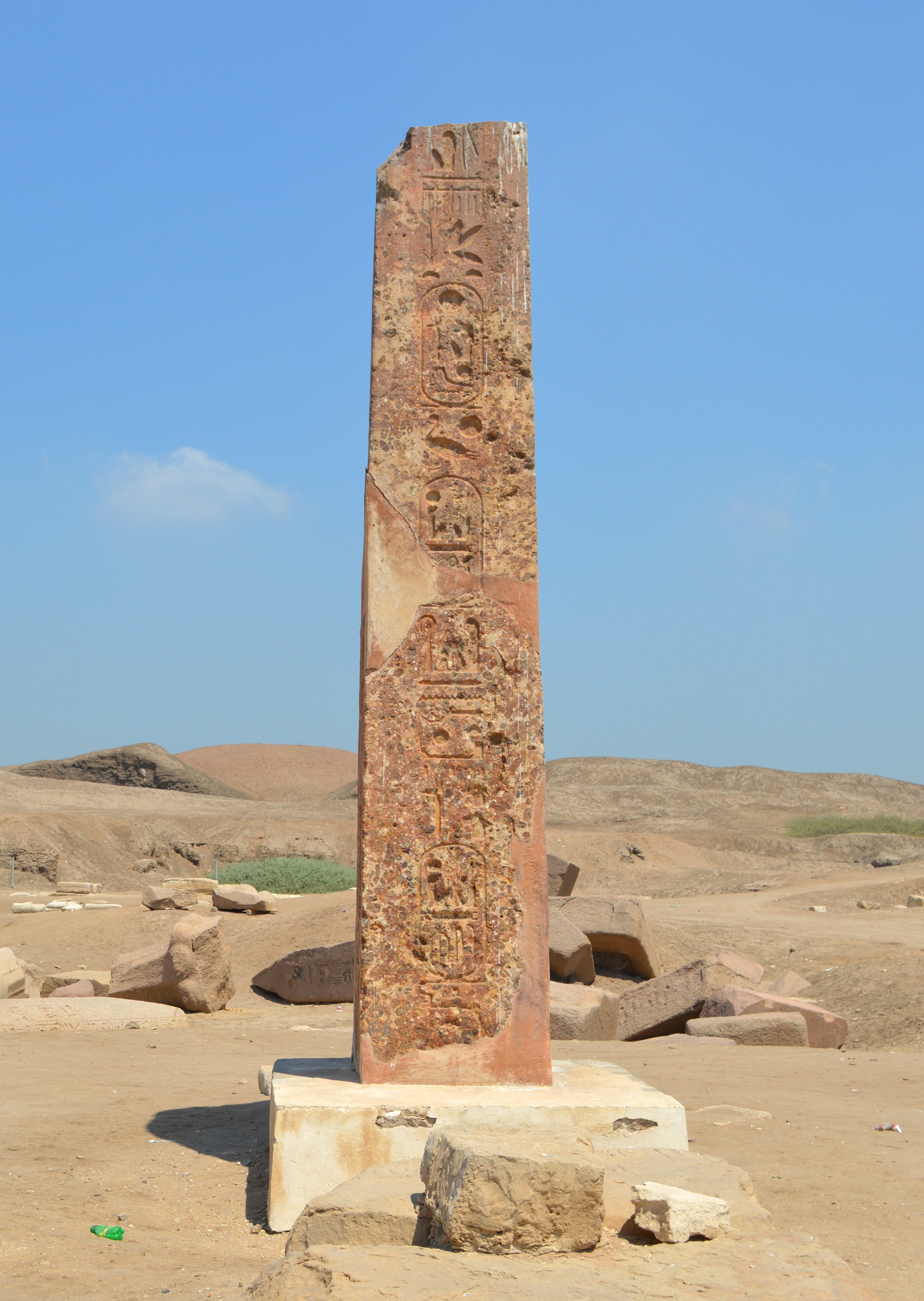 Figure 22: South side |
|||
August 5, 2014 by Hiroyuki Nagase (For high definition image, please click the picture)
| ||||||
|
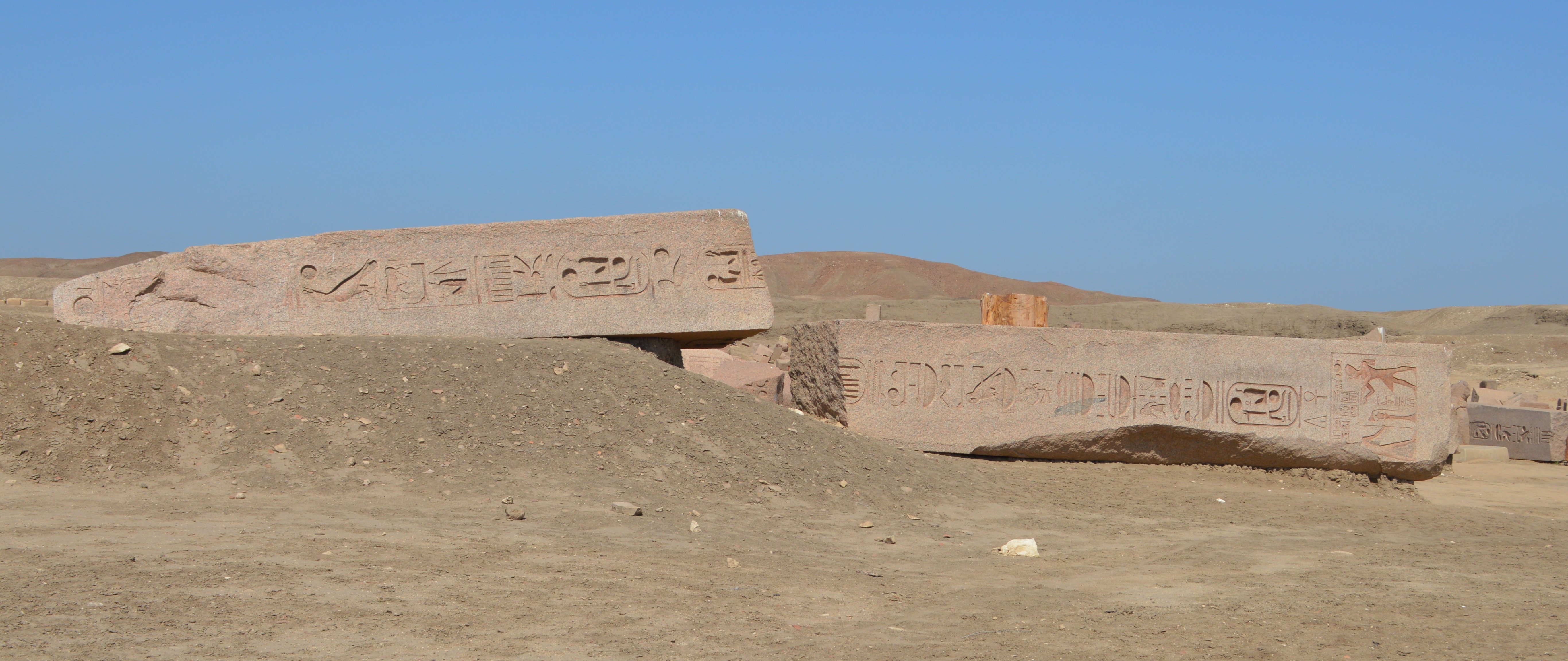
Obelisk 4
This large size obelisk is cracked in two and lying about 100 meters back (east direction) from the Obelisk 2. It is the largest obelisk existing in Tanis, and the upper portion is about 7.6 m, lower portion is about 8.75 m, and the thickness of the bottom is about 1.73 m.
As shown in Figure 23, although the pyramidion part is severely damaged, but the inscriptions after the horus name to the bottom have being well maintained the state of the time when this obelisk was made.
The inscription is engravd with neat and beautiful style, and continues with the horus name, coronation name, and the birth name of Ramses II. Comparing to the inscription posted in "TANIS Part 1", this corresponded to what is written as Western Obelisk in Temple. In "TANIS Part 1", this is also alone, and not recorded the other pair of obelisk.
This obelisk, the lowest portion is left in good condition. Moreover, because it is sideways, we can see the bottom of obelisk, which is a very rare case. Figure 26 is the bottom face, but it is a shallow inscribing method, but we can see that it seems that something is inscribed. It's a matter of course that it is not a proper way of inscribing like the side face because it is a place we never see when the obelisk is standing, but it is interesting that it's not left as a plain.
It is hard to imagine in Japan where the earthquakes often occur, but there is no such thing liker a mandrel connecting the obelisk shaft (body) and the pedestal, and the obelisk shaft is simply placed on the pedestal. Also, since the weathering is not progressed, the original pattern of the red granite remains very well. We can understand that it was such a red color when the obelisk was built.
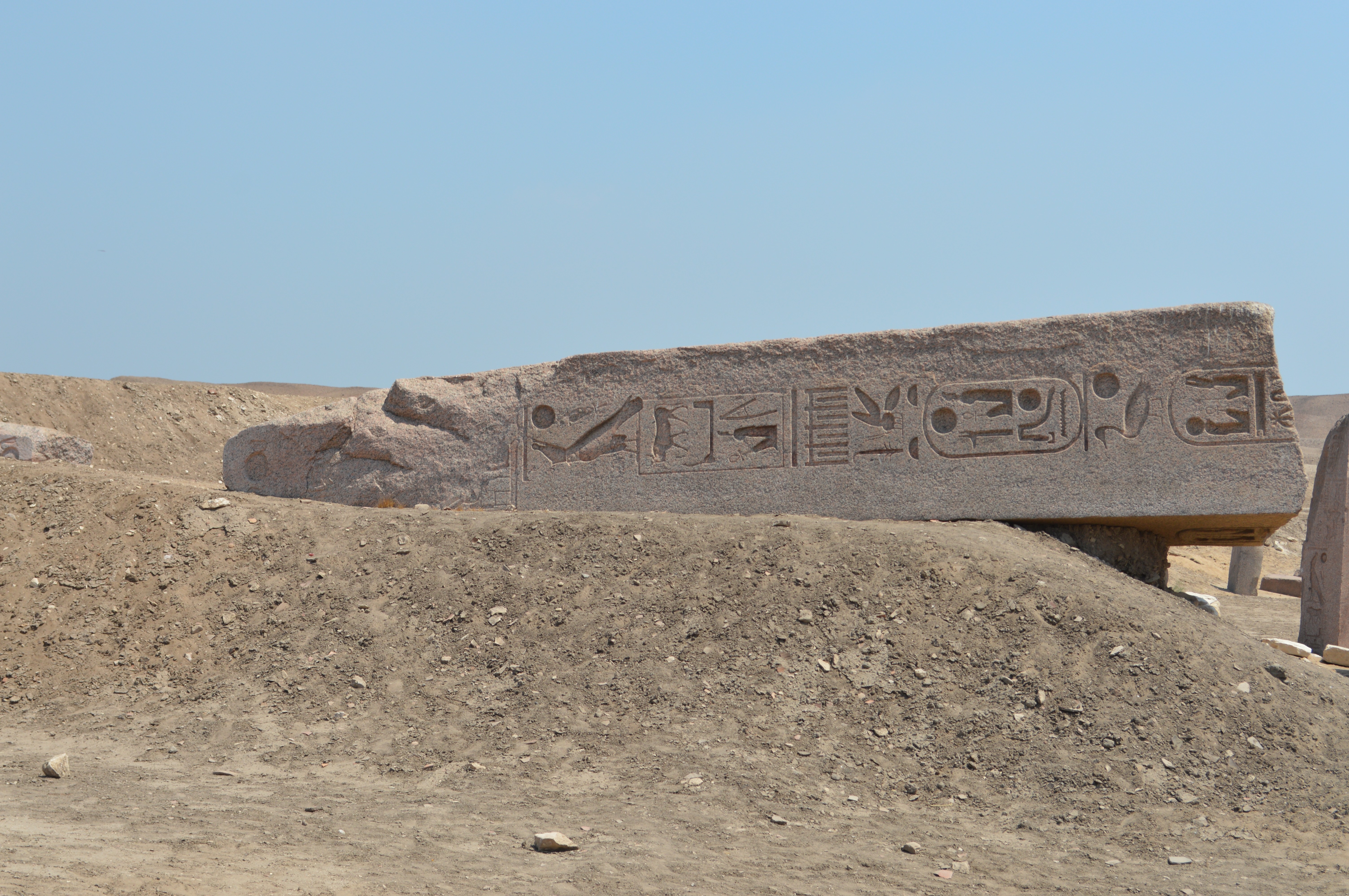 Figure 23: Upper portion (From west side) |
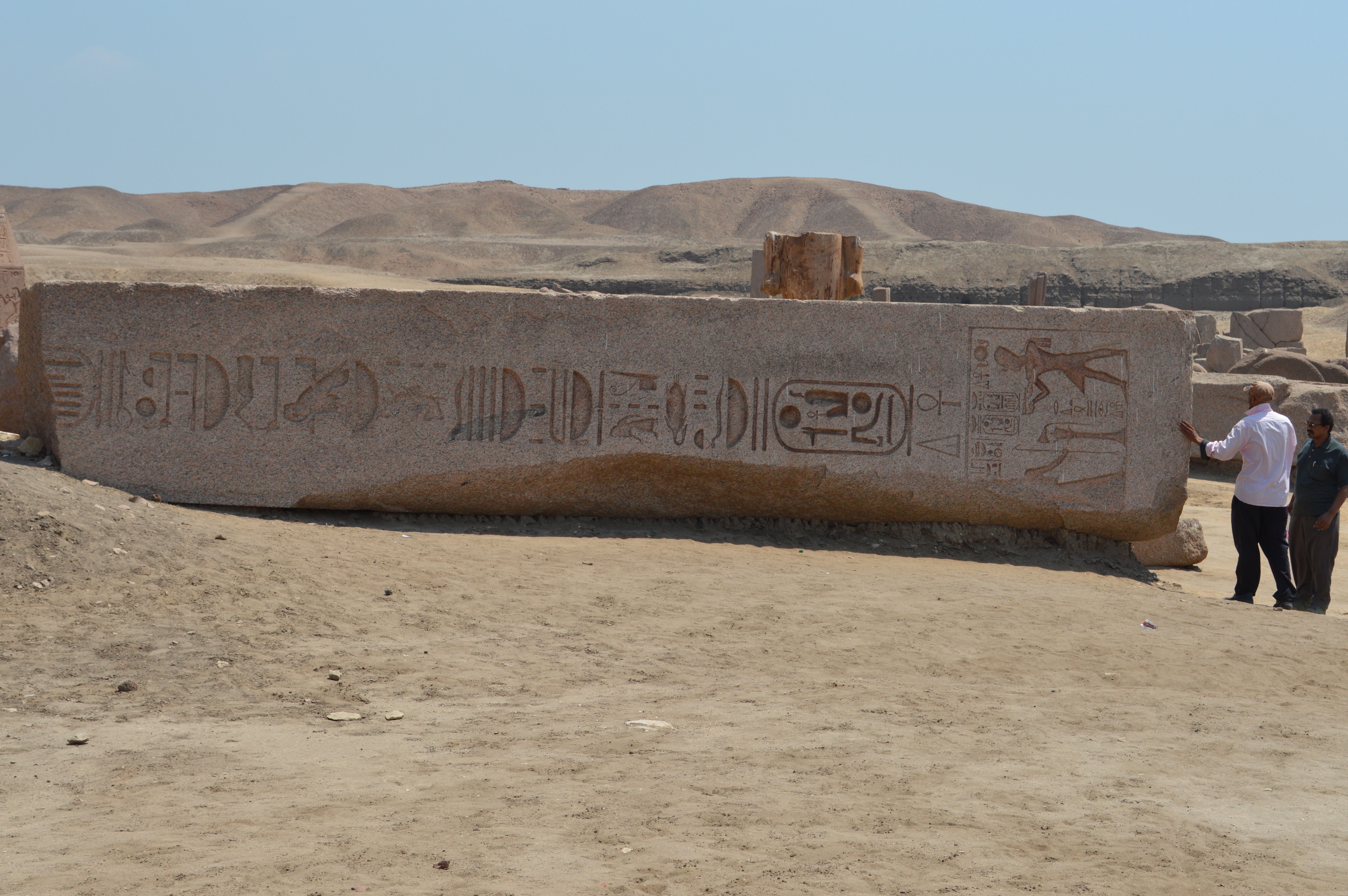 Figure 24: Lower portion (From west side) |
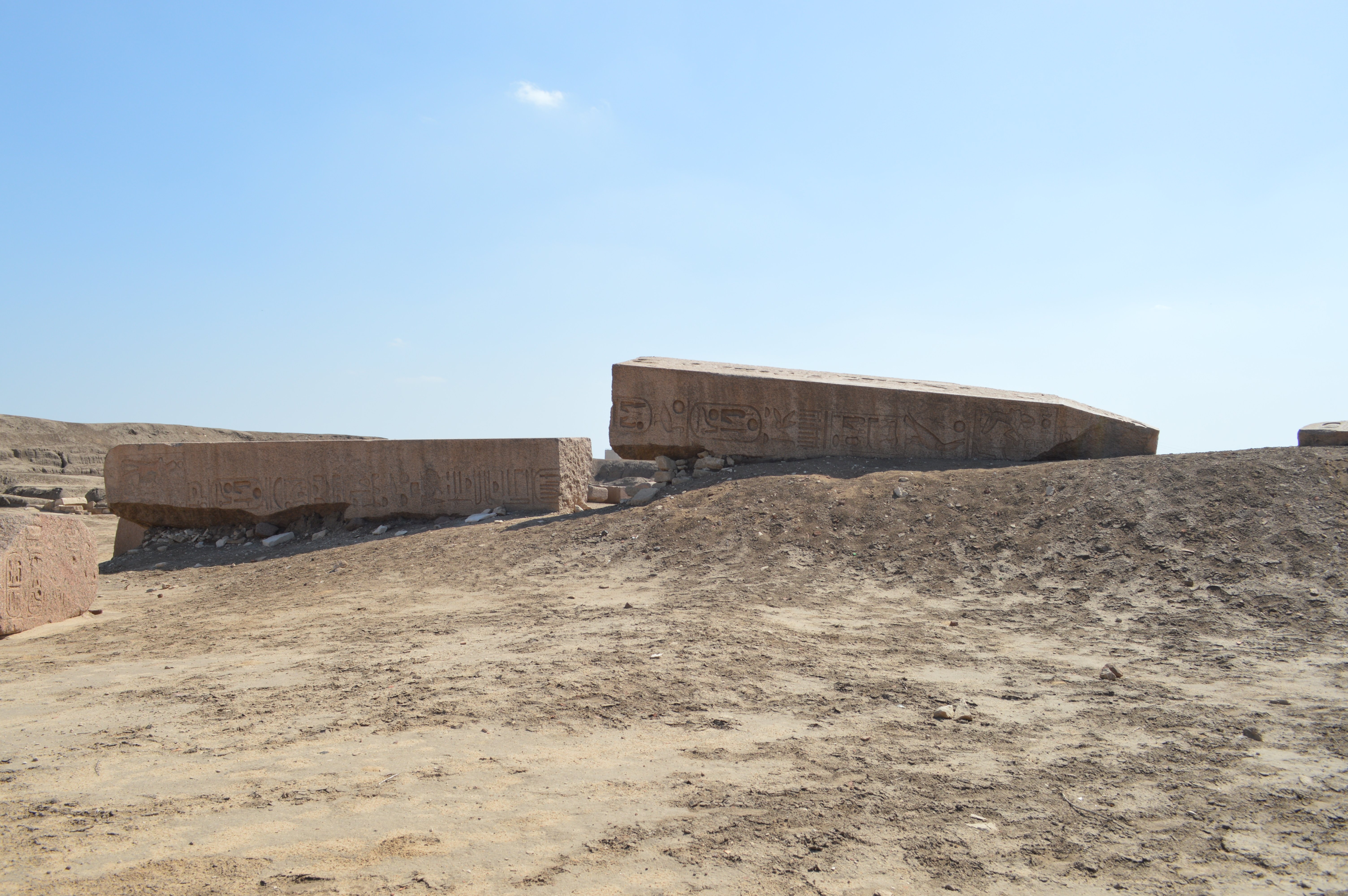 Figure 25: Whole obelisk (From east side) |
 Figure 26: Bottom face |
Figures 23 & 24: August 5, 2014 Figures 25 & 26: April 27, 2016
by Hiroyuki Nagase (For high definition image, please click the picture) | ||
Obelisk 5
There is an obelisk where only the top portion is standing beside the east of Obelisk 4 which is broken in two. The tip of pyramidion is lost, and in the lower portion, the coronation name of Ramses II is is broken in the middle. The west side is beautifully preserved and the inscription remains clearly to the meticulous details. However, the east side is severely damaged, and the corners are greatly missing. The characteristic of this obelisk is that under the pyramidion, there is depicted a figure that Ramses II gives offerings to God Osiris at the portion where the inscription usually begins with the horus name. The height is about 3.4 m, and restoration has not been done, and it's just placed on sand. The large fragments that are thought to be the lower portion of this obelisk are scattered around, but the state is not good.
Such obelisk was not described in "TANIS Part 1". I think this was buried under ground at the time of Flinders Petrie's excavation, or this may have been discovered during the subsequent excavation by Pierre Montet.
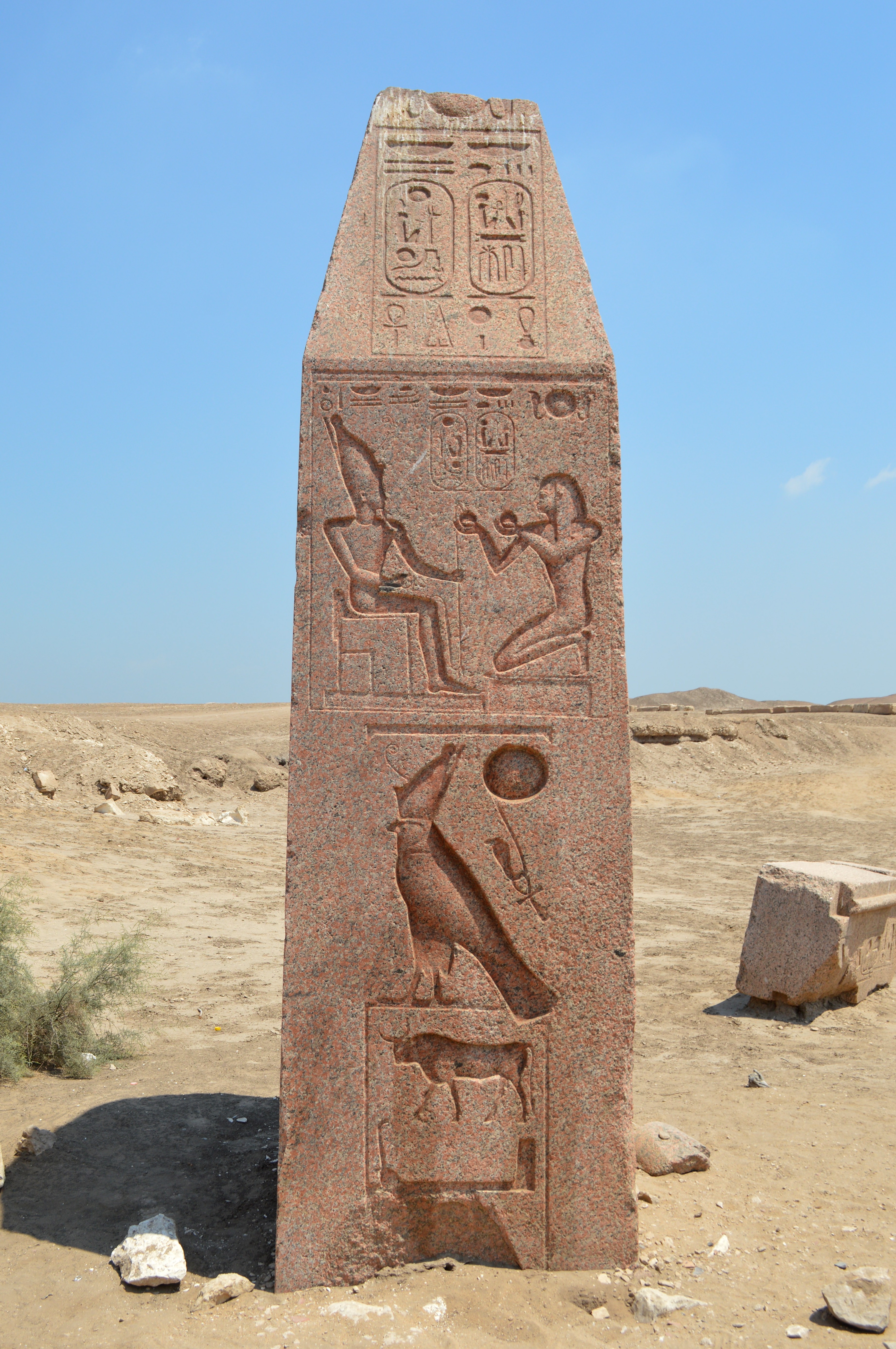 Figure 27: West side |
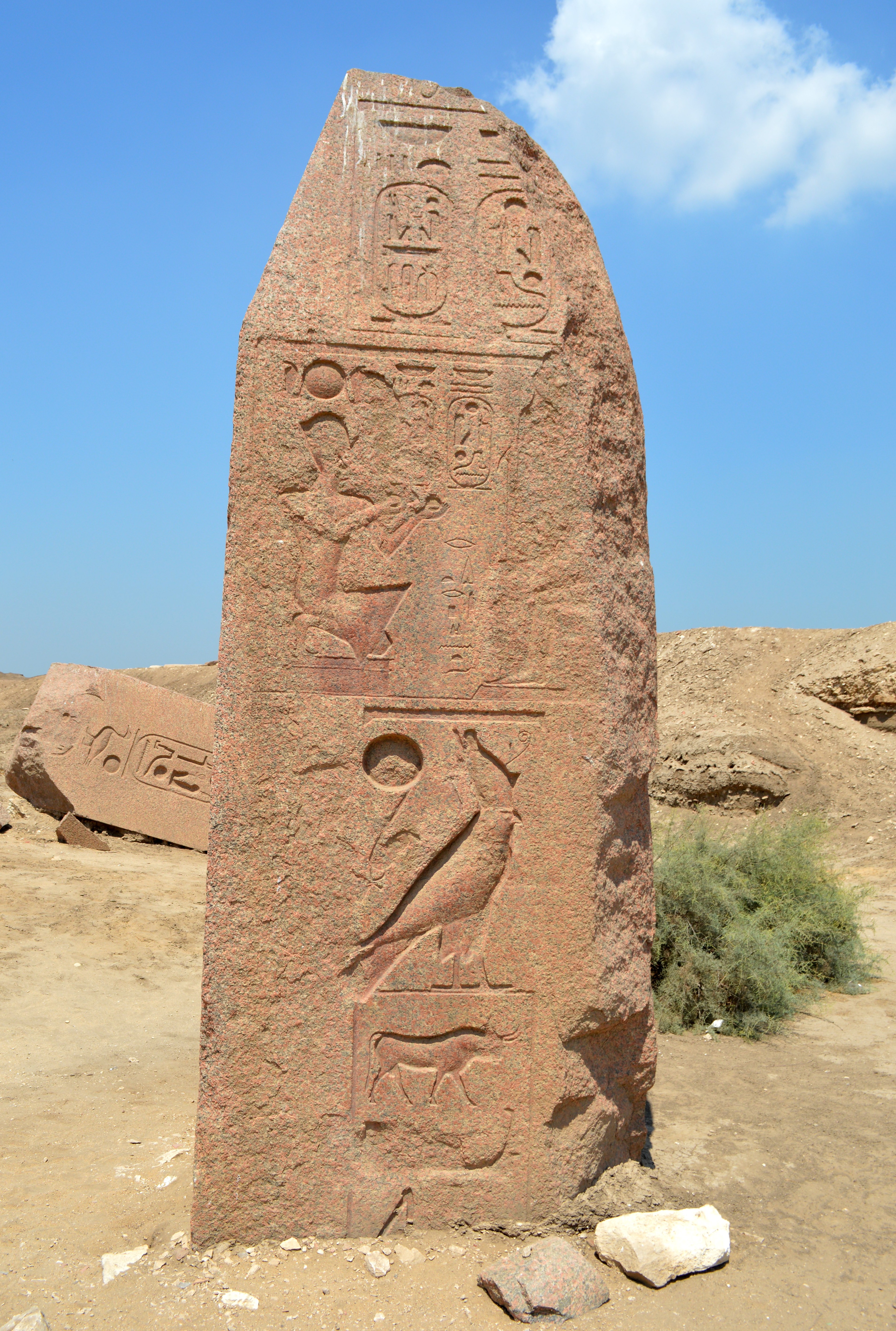 Figure 28: South side |
 Figure 29: East side |
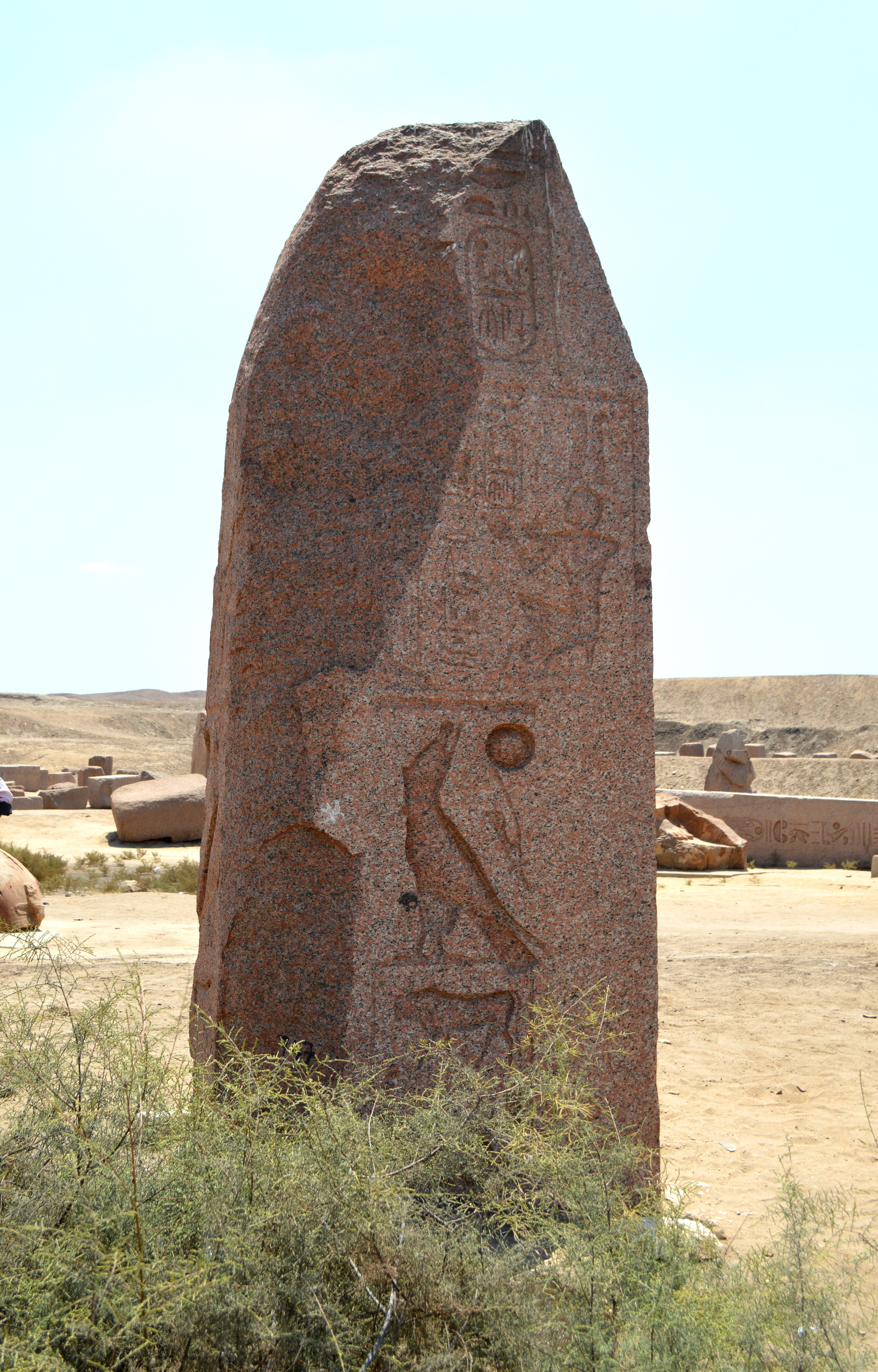 Figure 30: North side |
|||
August 5, 2014 by Hiroyuki Nagase (For high definition image, please click the picture)
| ||||||
Obelisks 6 & 7
In the east of royal tomb of Sheshonq III (Area D), there is an area where many fragments of Ramses II Obelisks are scattered.
Here are two obelisks, Obelisks 6 & 7, that are standing about 20 meters apart. Both seem to be kept with concrete-made base, not just to be abandoned. Both look as a pair obelisks, because they have similar shape, and their heights are about 3 meters respectively. However we look carefully them, we will notice that they are not a pair. The major difference is: the cartouches on the pyramidion of Obelisk 6 are written in two lines vertically, and the horus names are inscribed with different writing system on each face. On the other hand, the cartouches on the pyramidion of Obelisk 7 are written horizontally, the the horus names are same on each face.
Obelisk 6: Figures 31 & 32 show the standing top portion of Obelisk 6, and Figure 33 shows its main body which has about 7.5 m long, and lies beside of the top portion. This inscription coincides with the inscription of the South Obelisk of "Middle pair of obelisks in Temple" which is described in the Flinders Petrie's book "TANIS Part 1".
This Obelisk 6 is a pair with the Obelisk in Cairo Airport. This is verified with three (3) reasons below:
1. The Obelisk in Cairo Airport is the North Obelisk of "Middle pair of obelisks in Temple" in "TANIS Part 1".
2. On the Obelisk in Cairo Airport, the horus names are inscribed with different writing system on each face. This style coincides with Obelisk 6 in Tanis.
3. On the Obelisk in Cairo Airport, the cartouches on the pyramidion are written in two lines vertically. This style coincides with Obelisk 6 in Tanis.
Obelisk 7: This is in Figures 34 & 35, and its main body is in Figure 36. This is repaired by joining several fragments. This obelisk is not referred in the Flinders Petrie's book "TANIS Part 1". This was because probably fragmented into many small ones at the time of Petrie's excavation in 1880s.
In addition to Obelisks 6 & 7 above, there are two other fragments - Figure 37 and Figure 38.
Fragment in Figure 37: This fragment of main body is identified as "Southe Obelisk of East pair of obelisks in middle of Temple" which is described in the Flinders Petrie's book "TANIS Part 1", base on the inscriptions. On the other hand, the Obelisk in Messalla Garden, Gezira Island is "North Obelisk of East pair of obelisks in middle of temple" in "TANIS Part 1". Therefore, both are a "pair" obelisk. Also, the pair of this obelisk (in Messalla Garden, Gezira Island), an upper portion is currently exhibited in the Egyptian Museum, as "2. Obelisk of Ramses II (A)".
Fragment in Figure 38: This fragment of main body is identified as "Southe Obelisk of West pair of obelisks in Temple" which is described in the Flinders Petrie's book "TANIS Part 1", base on the inscriptions. This lies down at west side slightly apart from Obelisk 6.
Conclusion: In this area, I confirmed that the fragments of at least four (4) obelisks are scattered.
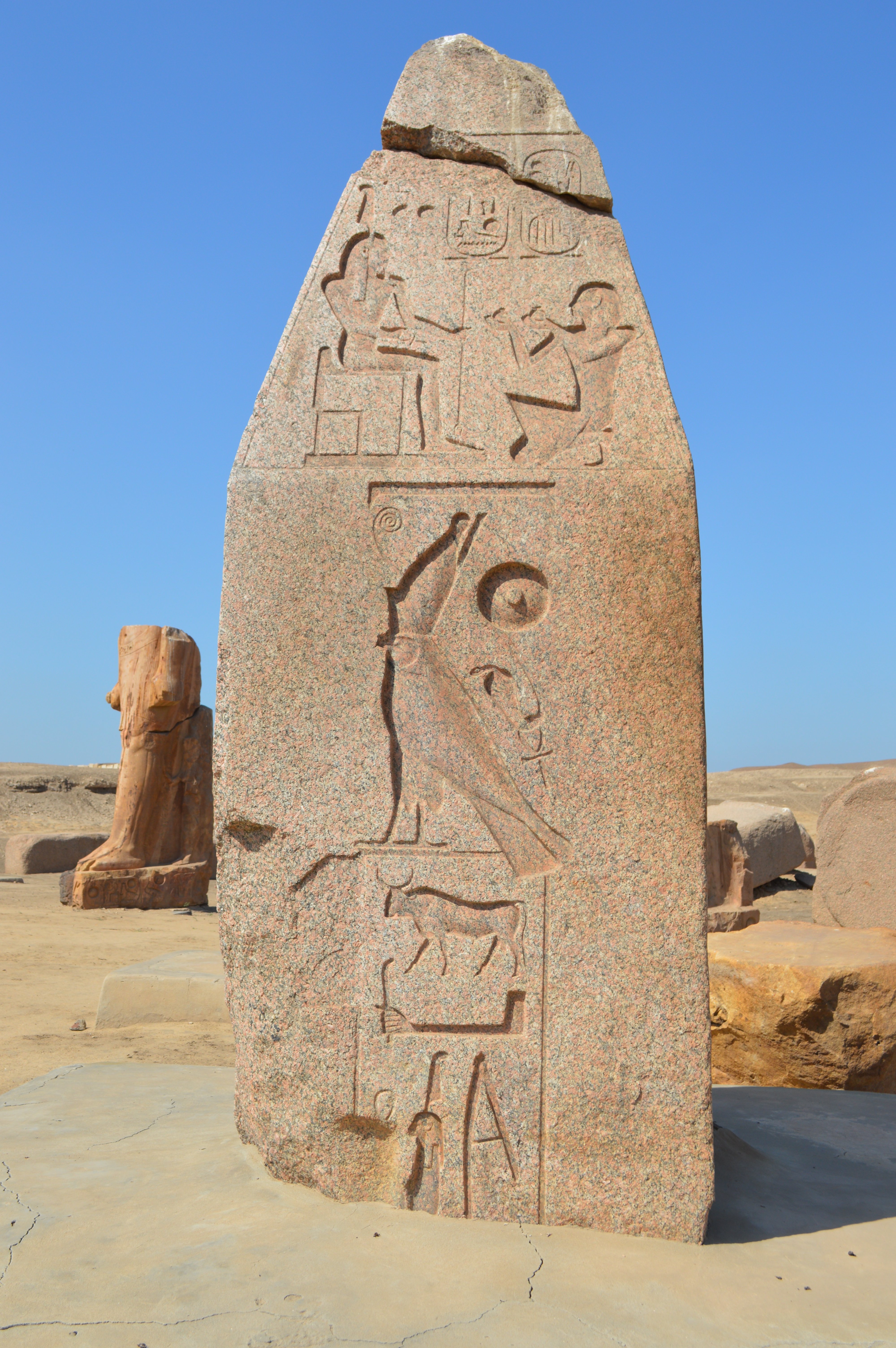 Figure 31: Obelisk 6, South side April 27, 2016 |
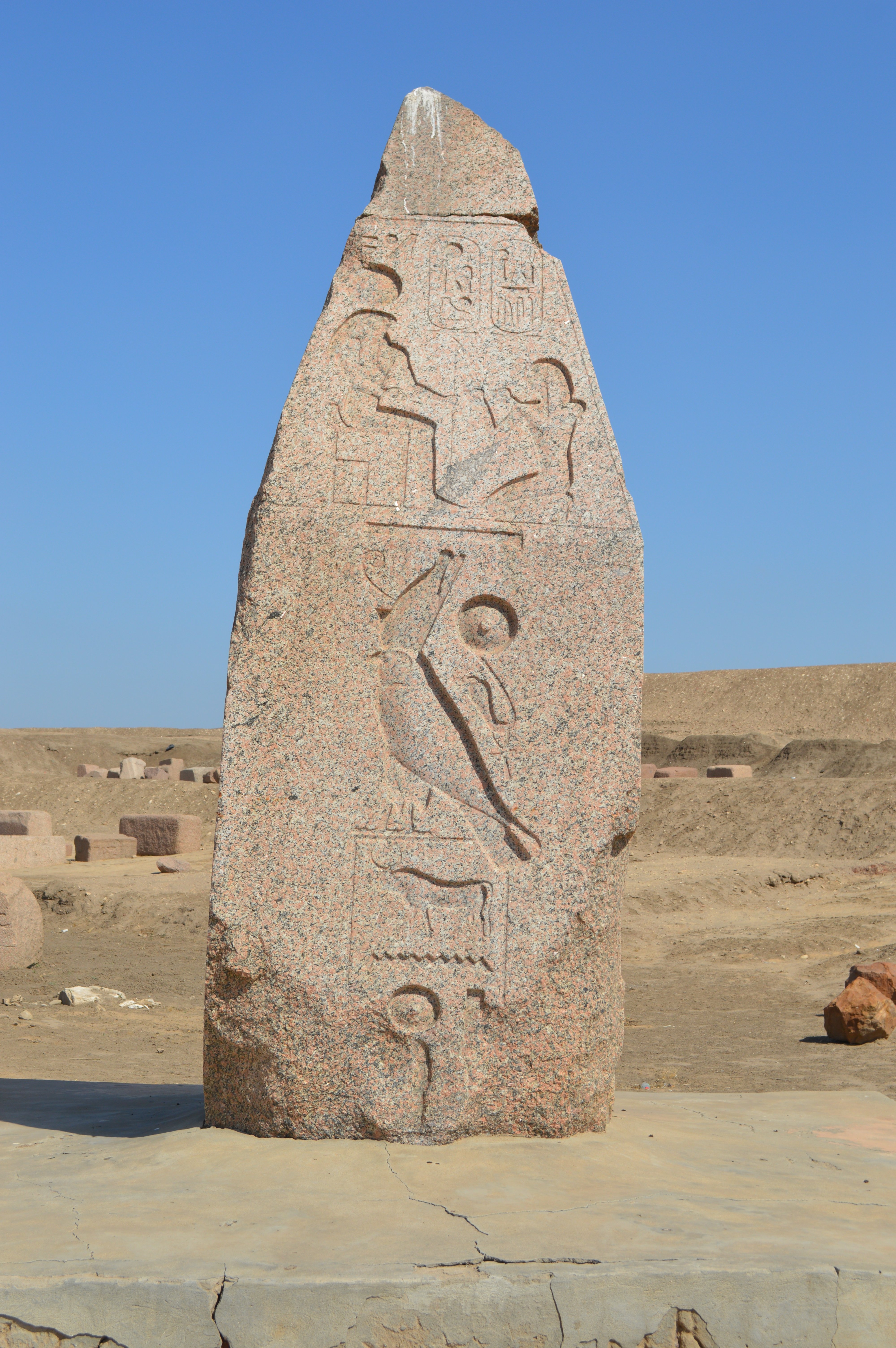 Figure 32: Obelisk 6, West side April 27, 2016 |
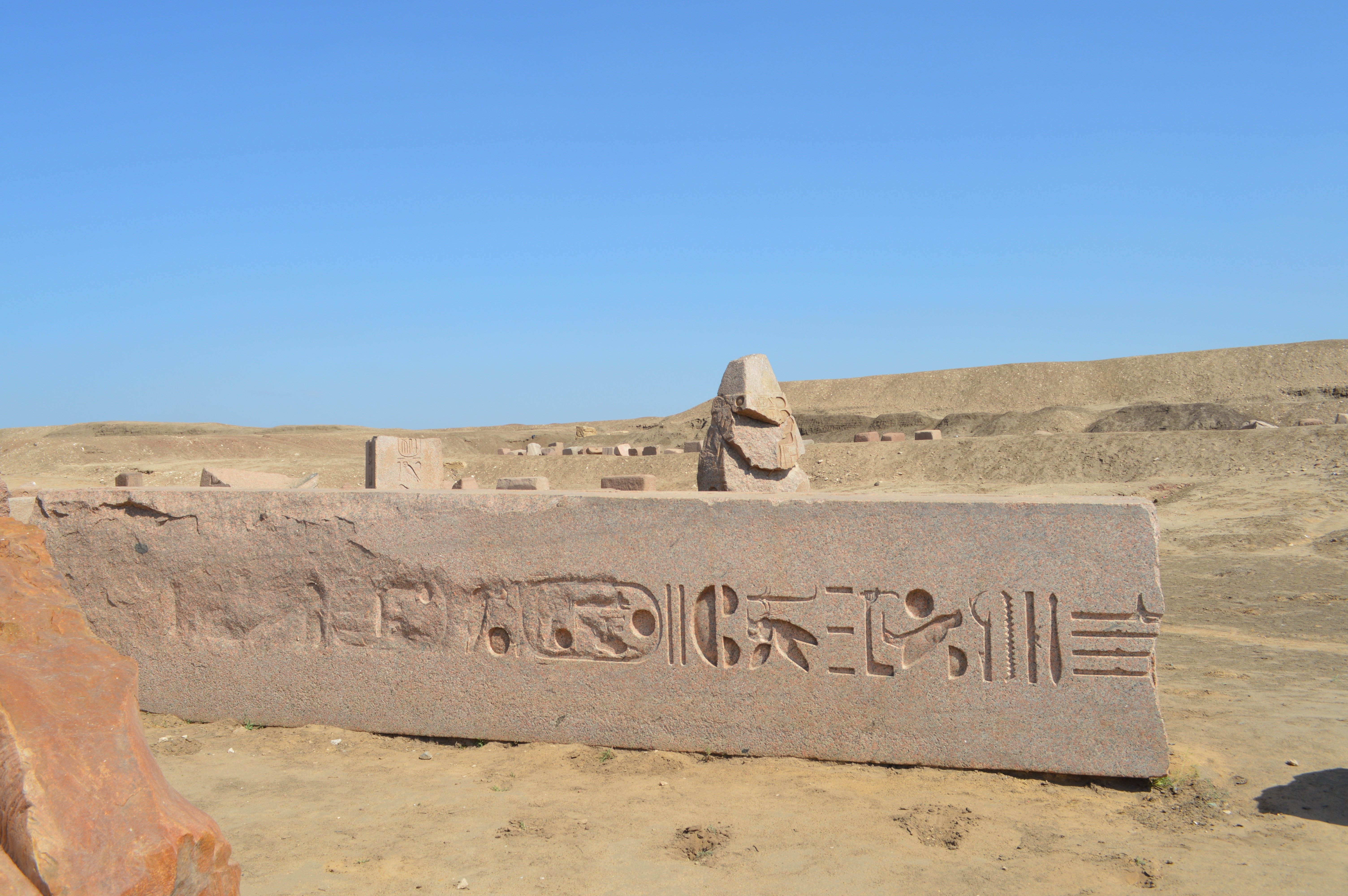 Figure 33: Obelisk 6, Fragment The top of Obelisk 7 is in back April 27, 2016 |
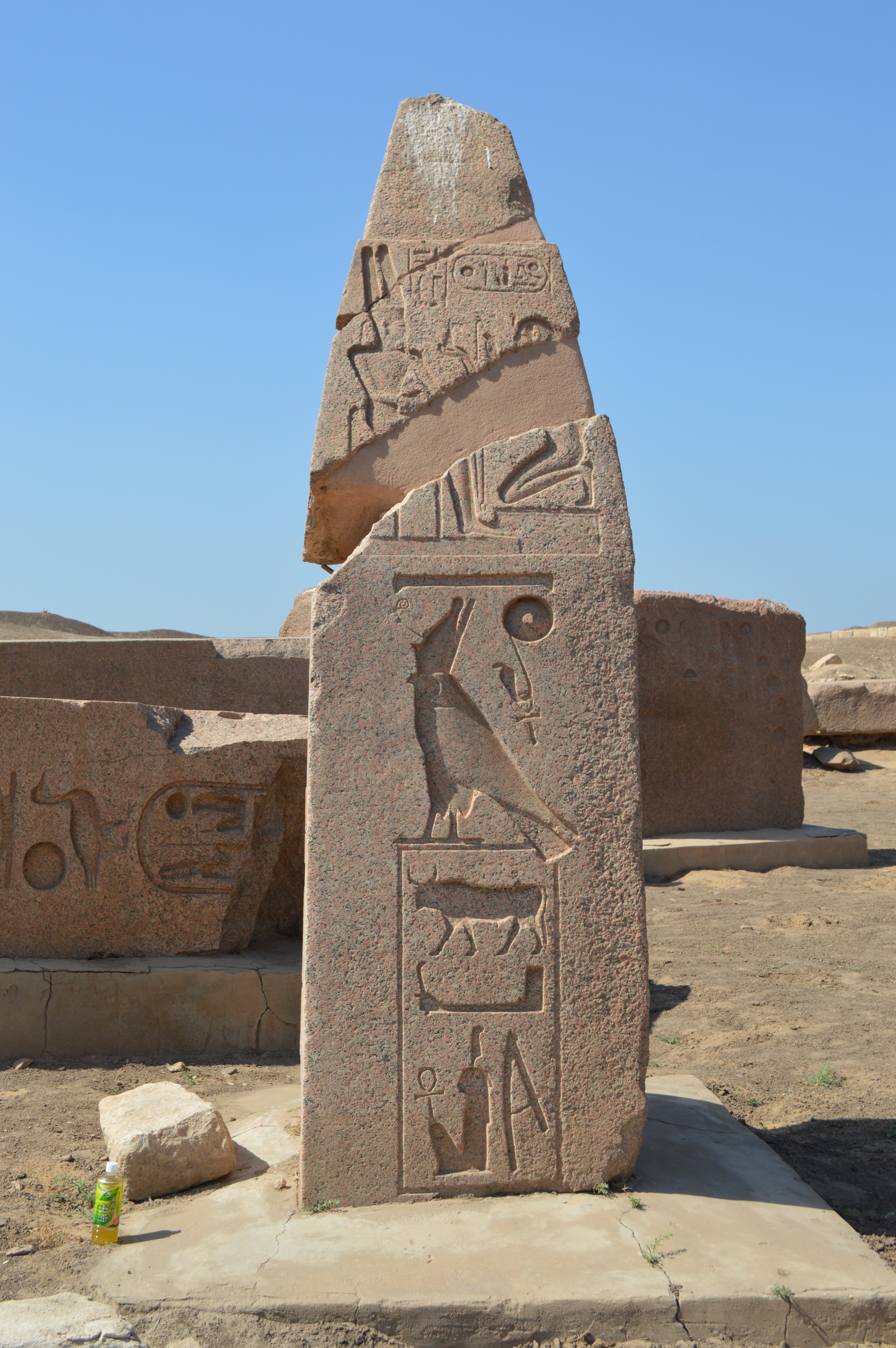 Figure 34: Obelisk 7, South side April 27, 2016 |
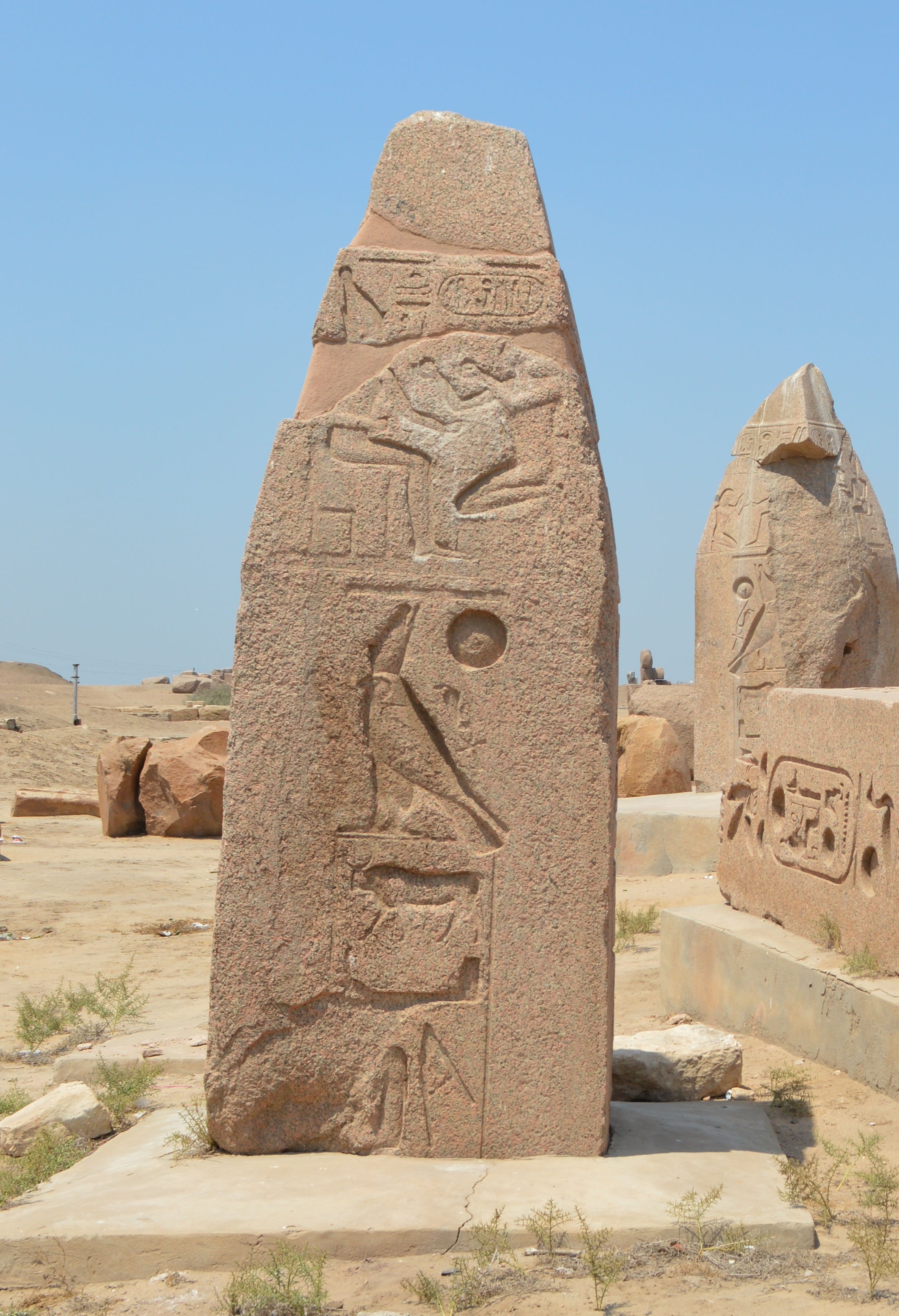 Figure 35: Obelisk 7, East side August 5, 2014 |
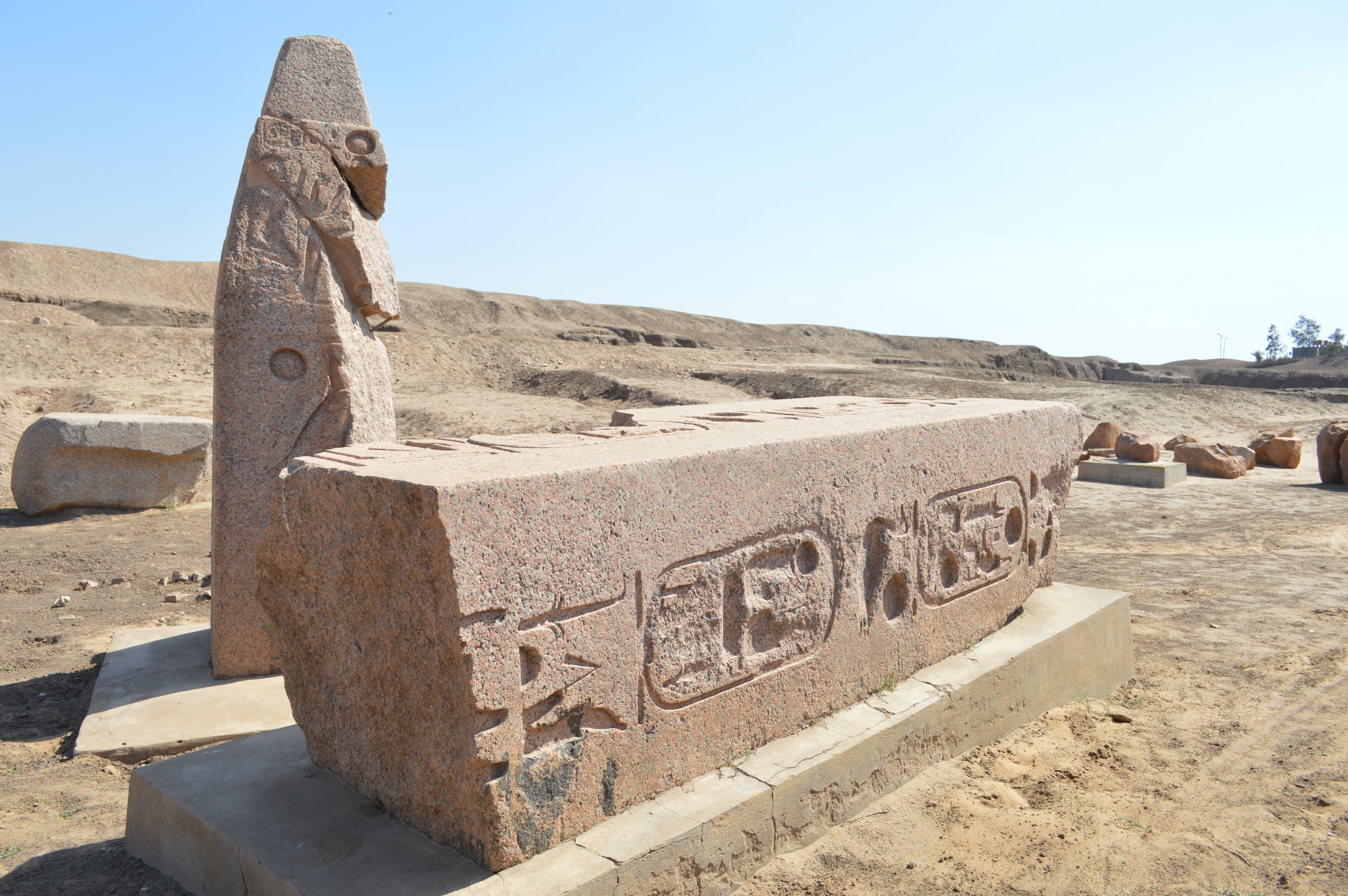 Figure 36: Obelisk 7, North side Not identified with the obelisk in "TANIS Part 1" as only the birth name and corination name of Ramses II are inscribed April 27, 2016 |
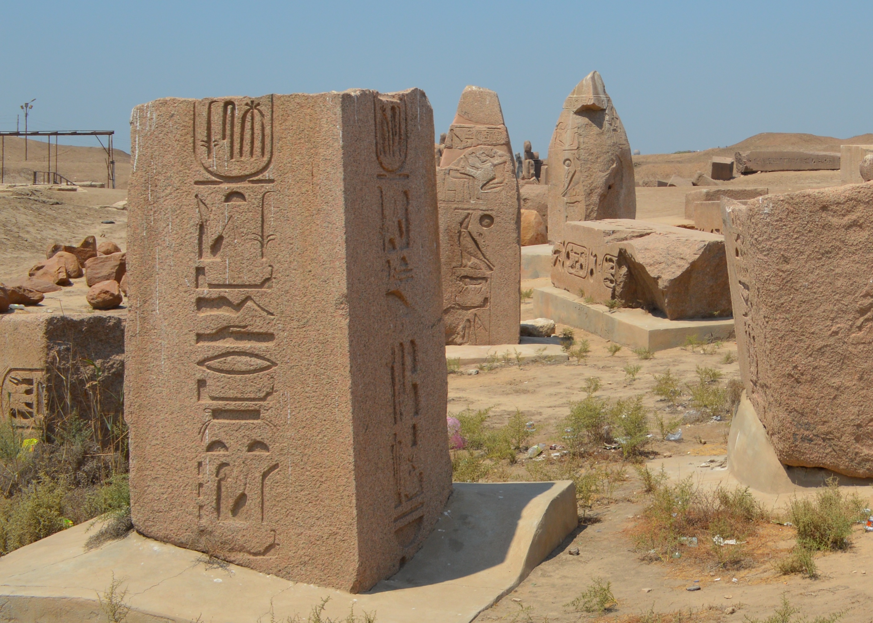 Figure 37: Another ragment, taken from East side Obelisk 7 in back, Obelisk 6 in further back August 5, 2014 |
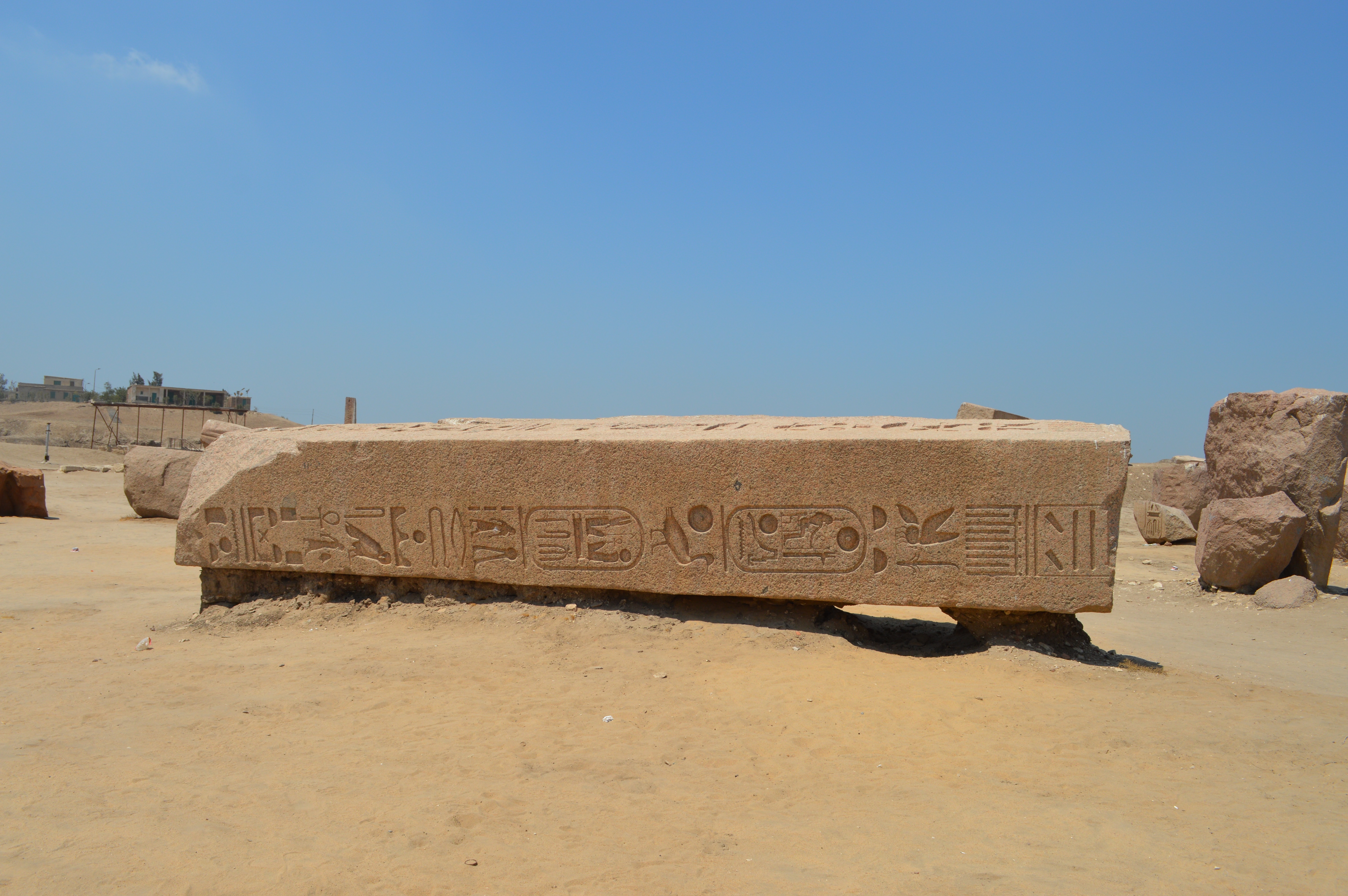 Figure 38: Another ragment, lies down at west sider slightly apart from Obelisk 6 August 5, 2014 |
|
by Hiroyuki Nagase (For high definition image, please click the picture)
| ||
Obelisk 8
Many fragments of obelisks and stone materials are gathered here. Among them, The top portion of the obelisk with two-line inscription was placed on the sand with half lacked. It's about 1.9 m long. It has broken vertically in half, but the state of the surface is good, and the inscription remains in fine detail. The top is gouged into a concave shape. I think that probably the metal component was fitted in the top part. This is an interesting example as normally we cannot see the top portion at a close distance when the obelisk is standing.
The remaining half of the piece was placed nearby.
 Figure 39: The top of obelisk with two-line inscription |
 Figure 40: Picture from the top |
|
April 27, 2016 by Hiroyuki Nagase (For high definition image, please click the picture)
| ||
Obelisks 9 & 10
Here are two fragments of the top portion of small-size obelisks, Obelisks 9 & 10, that are placed on the sand about 4 meters apart. They are considered the pair, as the styles are similar such as the relief that the king is offering to God Horus is enclosed by the trapezial frame.
Obelisk 9 is inclined, and Obelisk 10 stands a little inclined (almost vertically). The height of Obelisk 10 is about 1.7 meters. The top is gouged into a concave shape for probably fitting the metal component. FYI, the location of only Obelisk 9 is marked on the Satellite Picture (above on this page) since Obelisk 10 is very close.
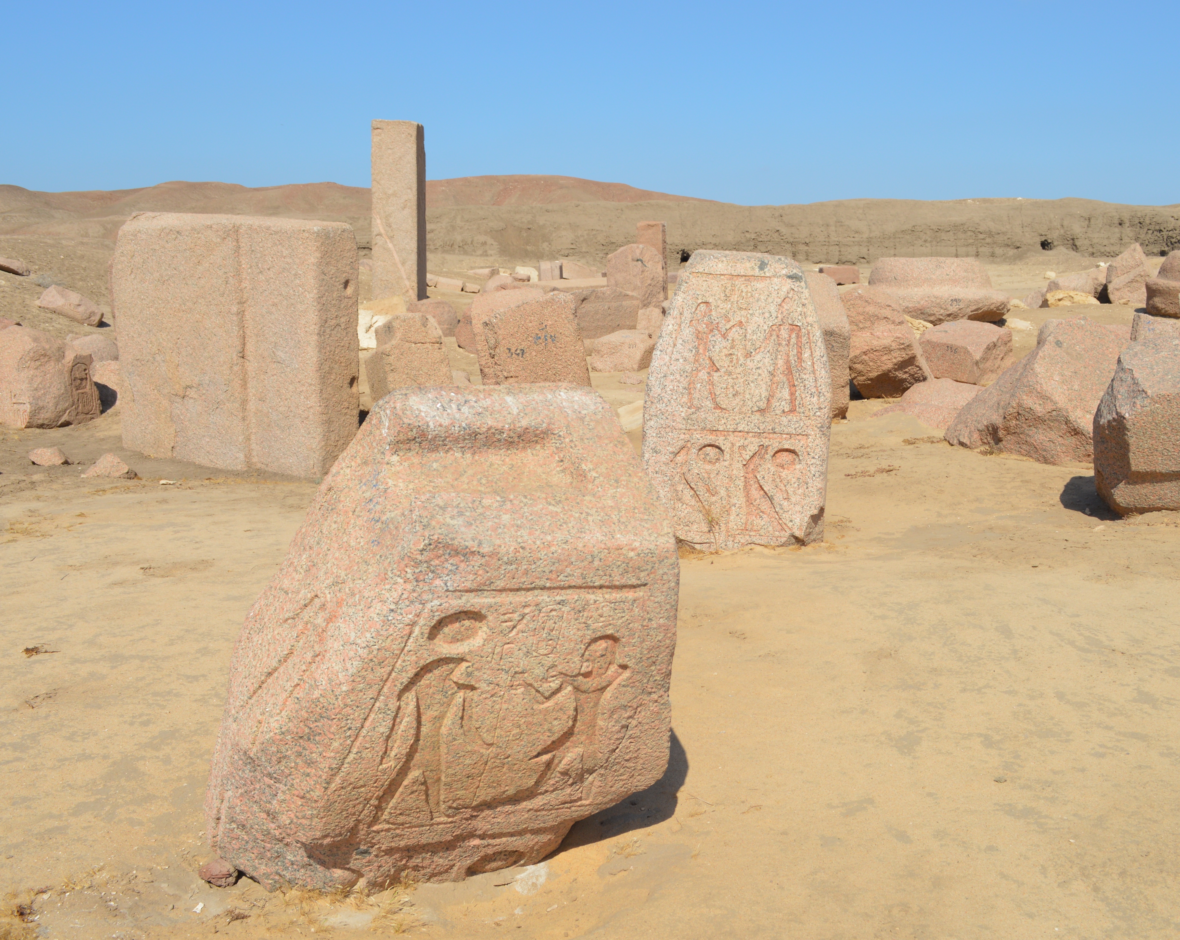 Figure 41: Obelisks 9 (front) & 10 (back) |
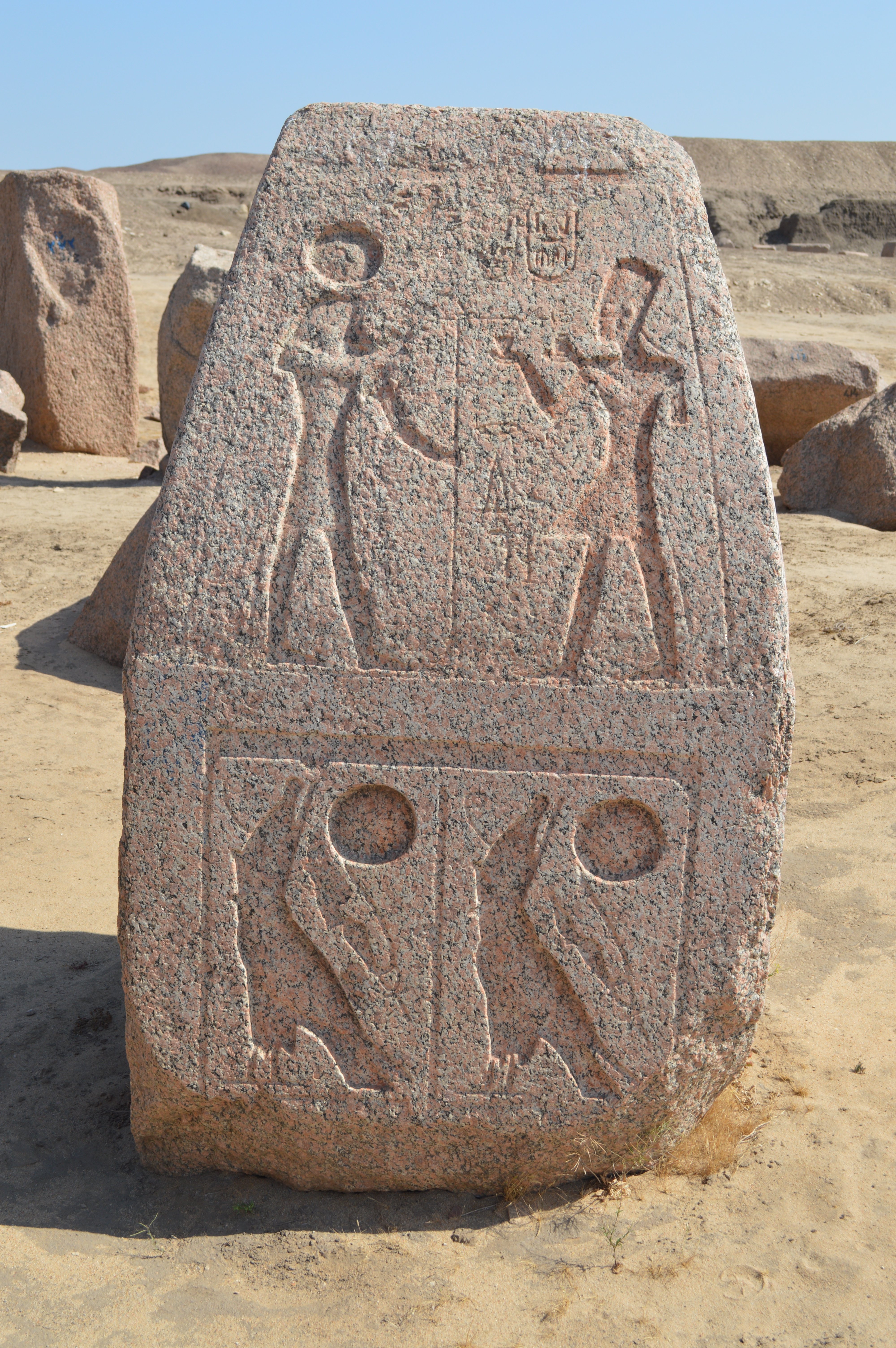 Figure 42: Obelisk 10, West side |
 Figure 43: Obelisk 10, South side |
||
April 27, 2016 by Hiroyuki Nagase (For high definition image, please click the picture)
| ||||
Obelisk 11
In the area where fragments of small stone of around 1 m are gathered, there is a fragment of a top portion of small obelisk, which is about 1.5 m high. This is the Obelisk #11. In this Obelisk 11, there is also a concave-shaped scoop which is believed to have been fitted with a metallic part at the top of the pyramidion. However, weathering is progressing and the condition is not good.
In addition, there is a lying fragment about 7 m ahead in the east side of Obelisk 11, but it cannot be determined as an obelisk since wearing due to weathering is very intense, and no inscription can be confirmed at all. Also, there is a concave scoop in the top part, but the shape is different from the obelisk 11.
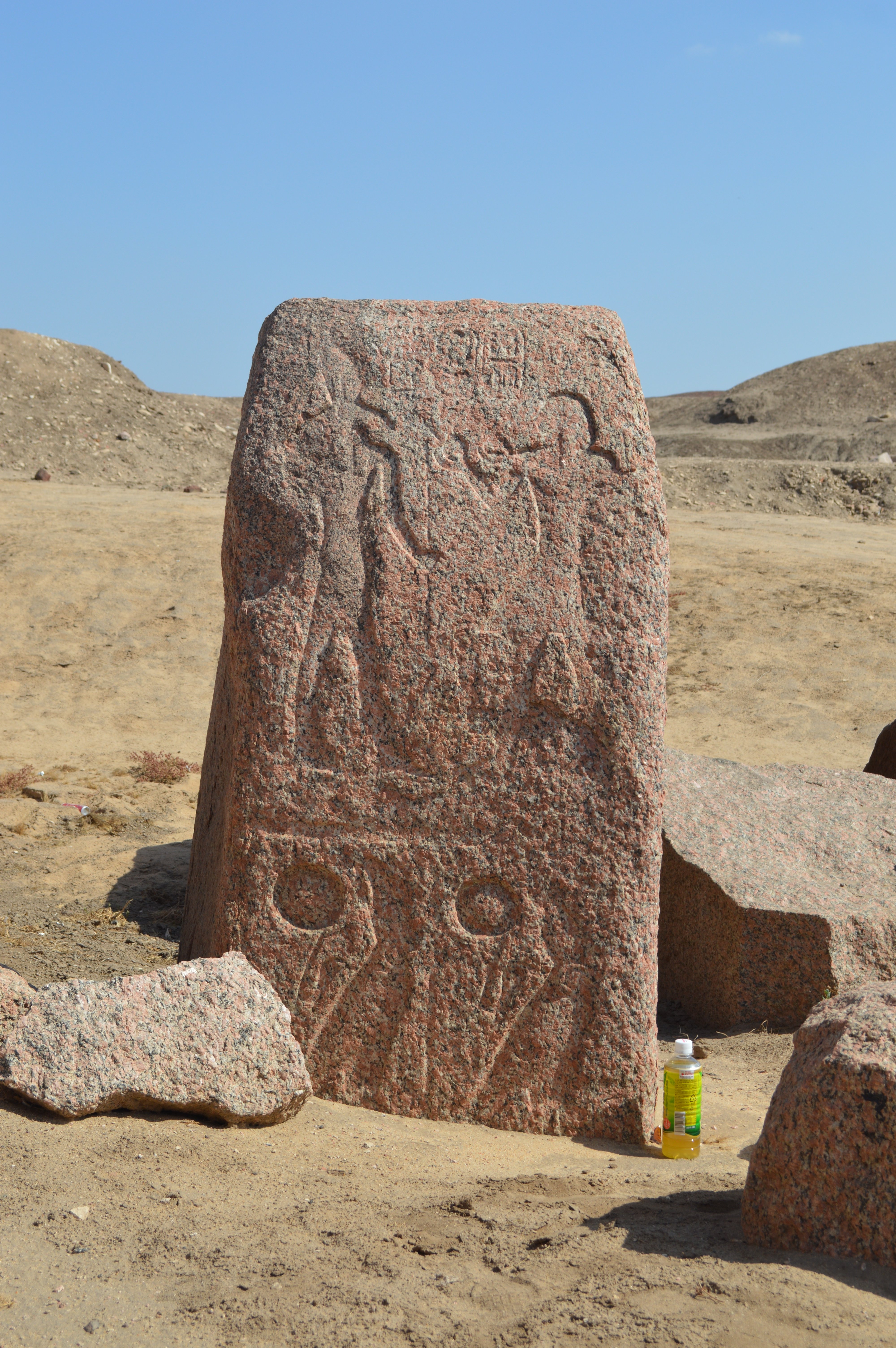 Figure 44: Obelisks 11, West side |
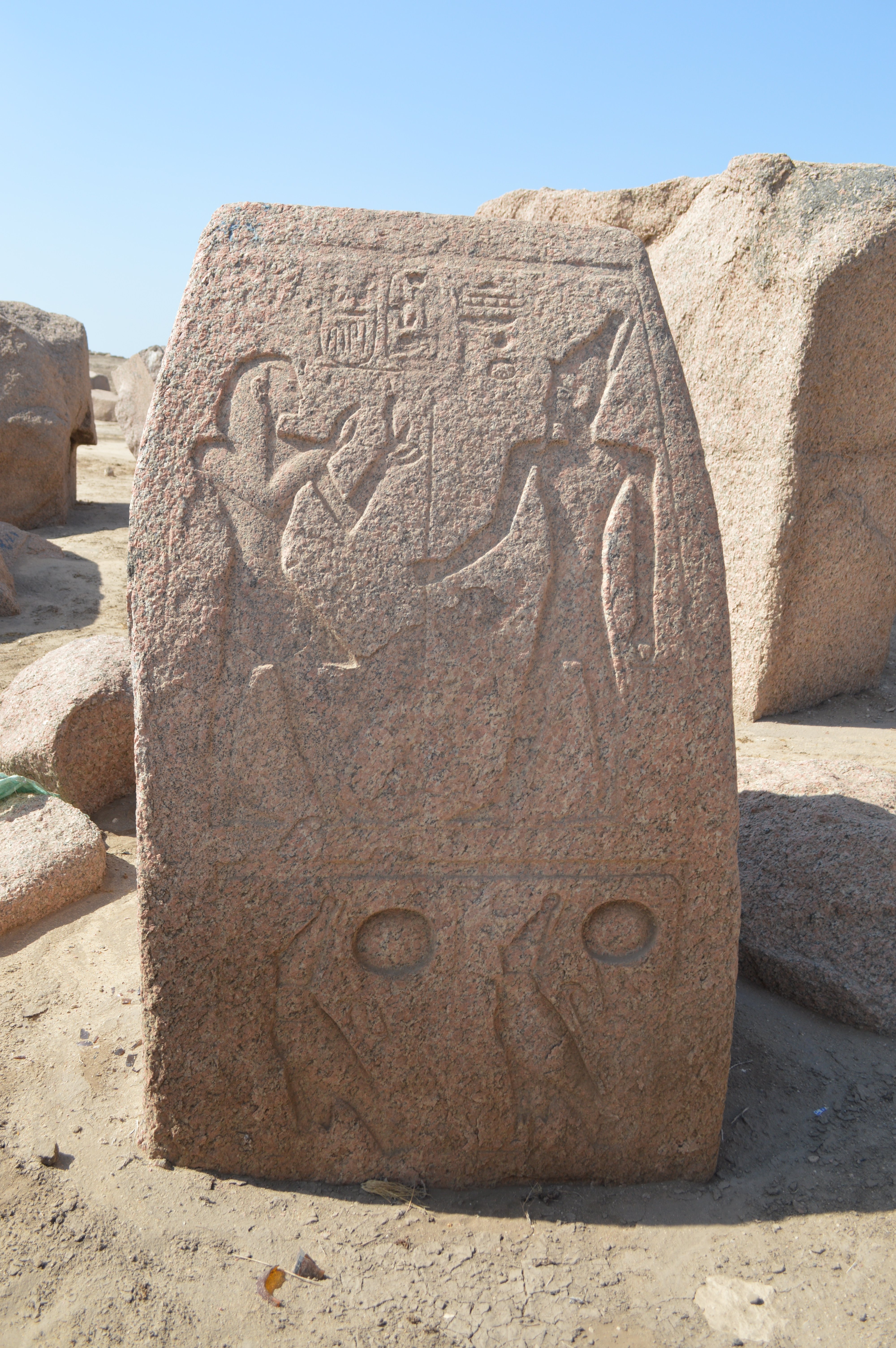 Figure 45: Obelisks 11, East side |
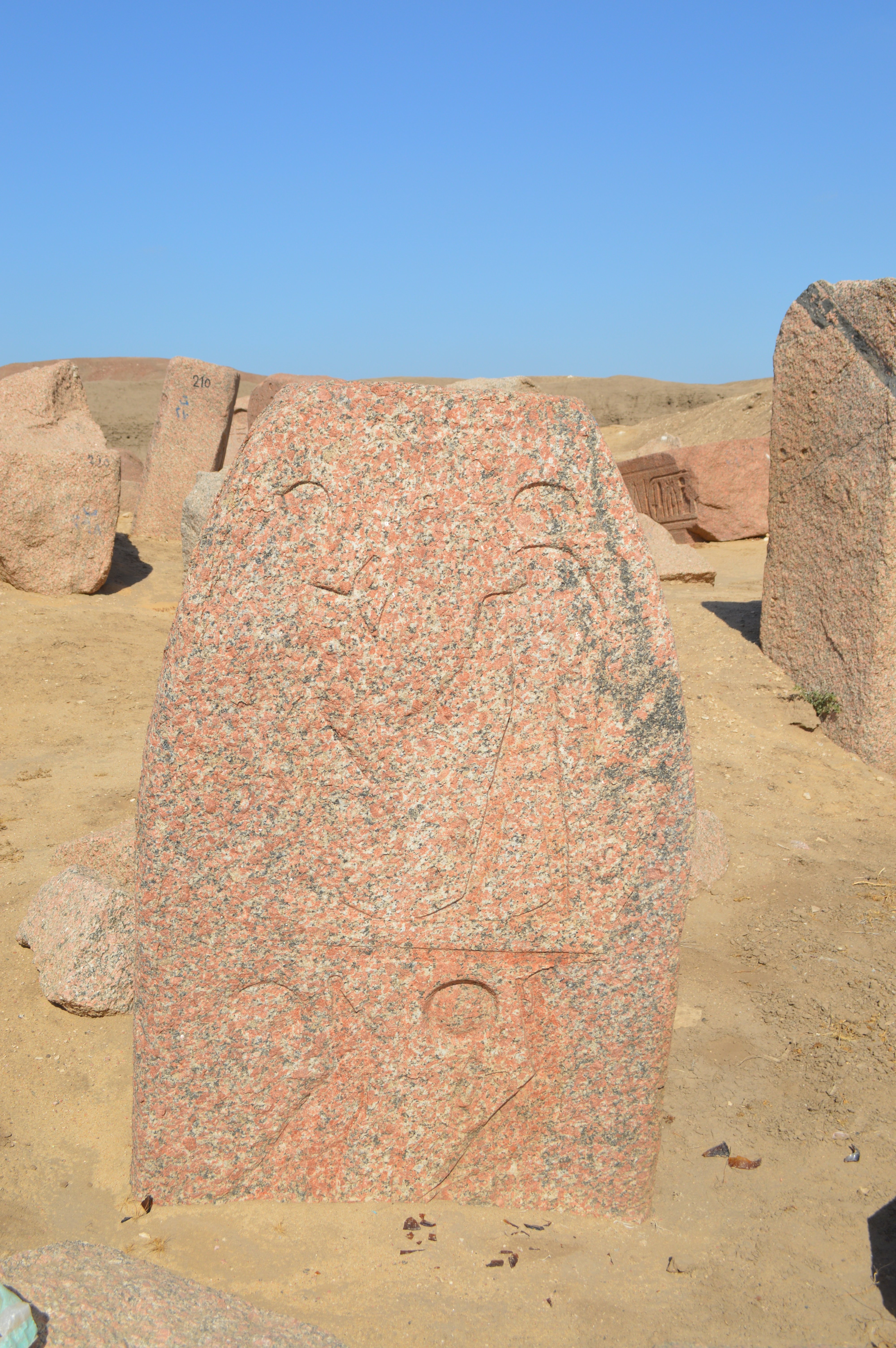 Figure 46: Obelisks 11, South side |
||
April 27, 2016 by Hiroyuki Nagase (For high definition image, please click the picture)
| ||||
Obelisk 12
In the farthest area of Amun Temple, near the Sacred Lake, two broken large obeliaks of Ramses II are lying, Obelisks 12 & 13. The near one in the Figure 47 is Obelisk 12, and its Pyramidion is placed on the sand. Two broken shafts of the obelisk are lying beside the pyramidion and its pedestal is placed in the back. However, the lower portion which would probably be engraved the Horun Name is missing. The pyramidion part (Figure 48) is about 60 cm high, the upper portion of the shaft (Figure 49) is about 3.3 m long, and the center portion of the shaft (Figure 50) is about 5.3 m long. The original whole length, including the lower portion, is estimated more than 10 meters. This Obelisk 12 corresponds to Eastern Obelisk North in the Flinders Petrie's book "TANIS Part 1".
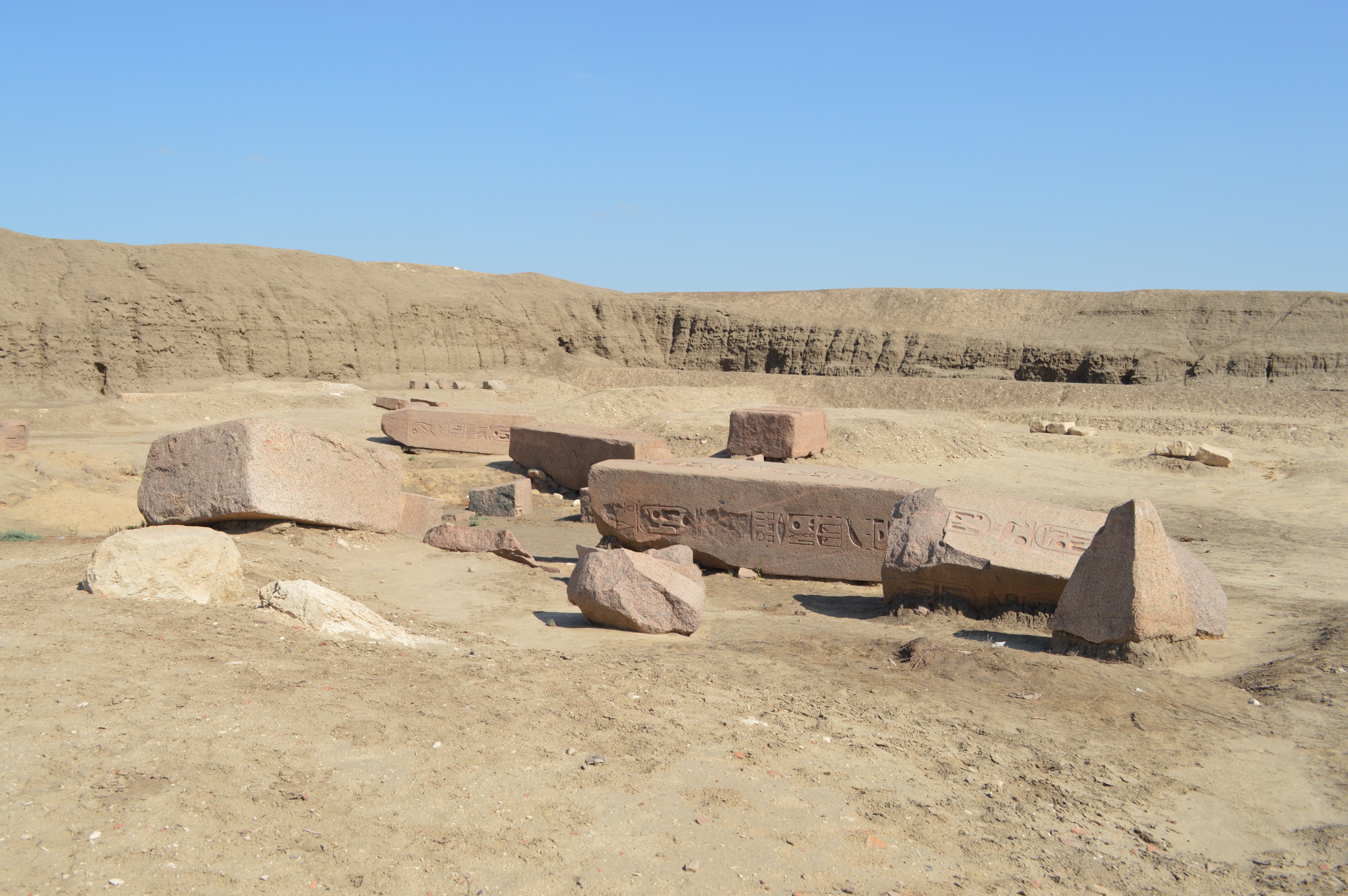 Figure 47: Obelisks 12 (near) & 13 (back) April 27, 2016 |
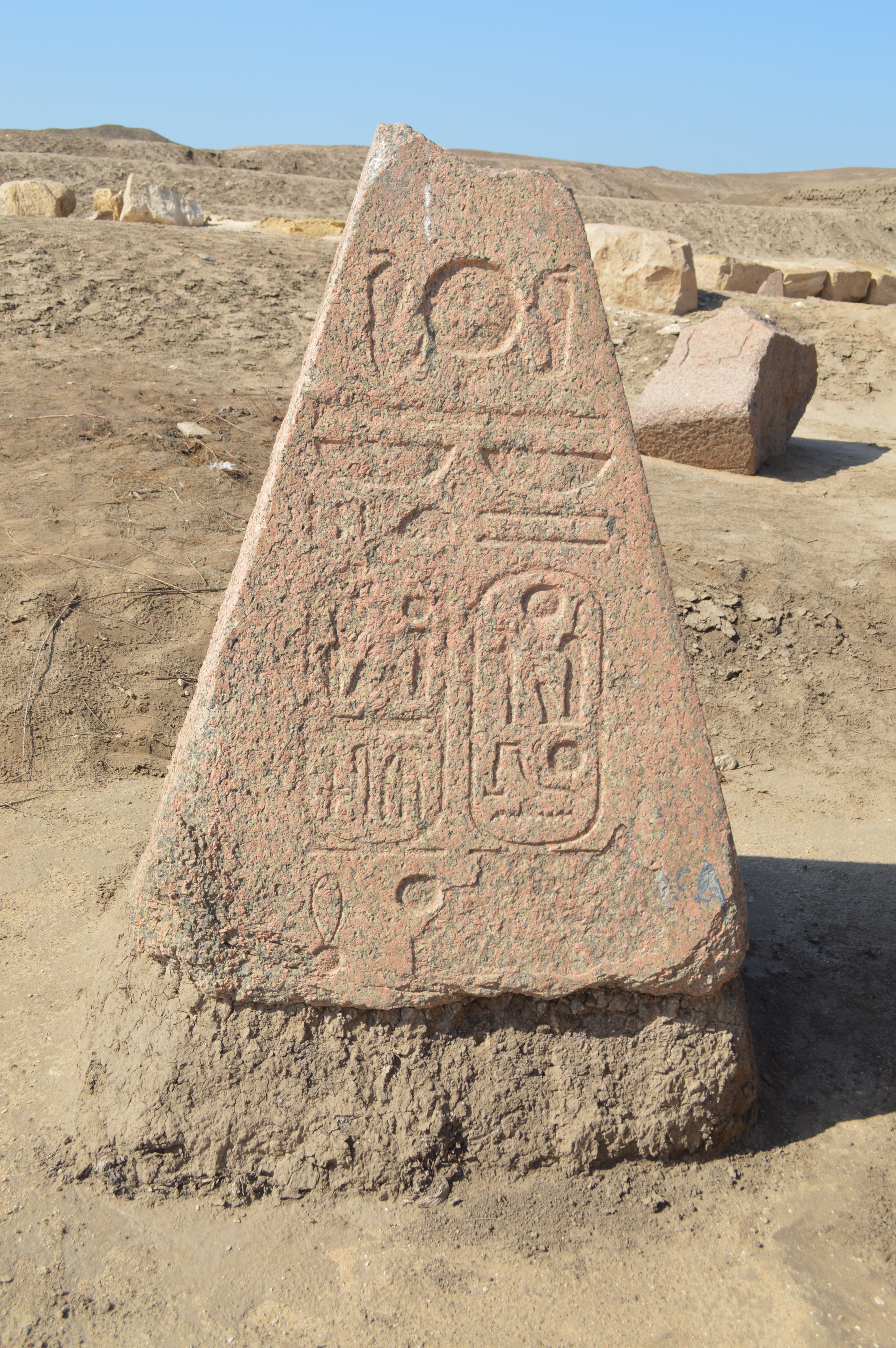 Figure 48: Obelisk 12, Pyramidion part April 27, 2016 |
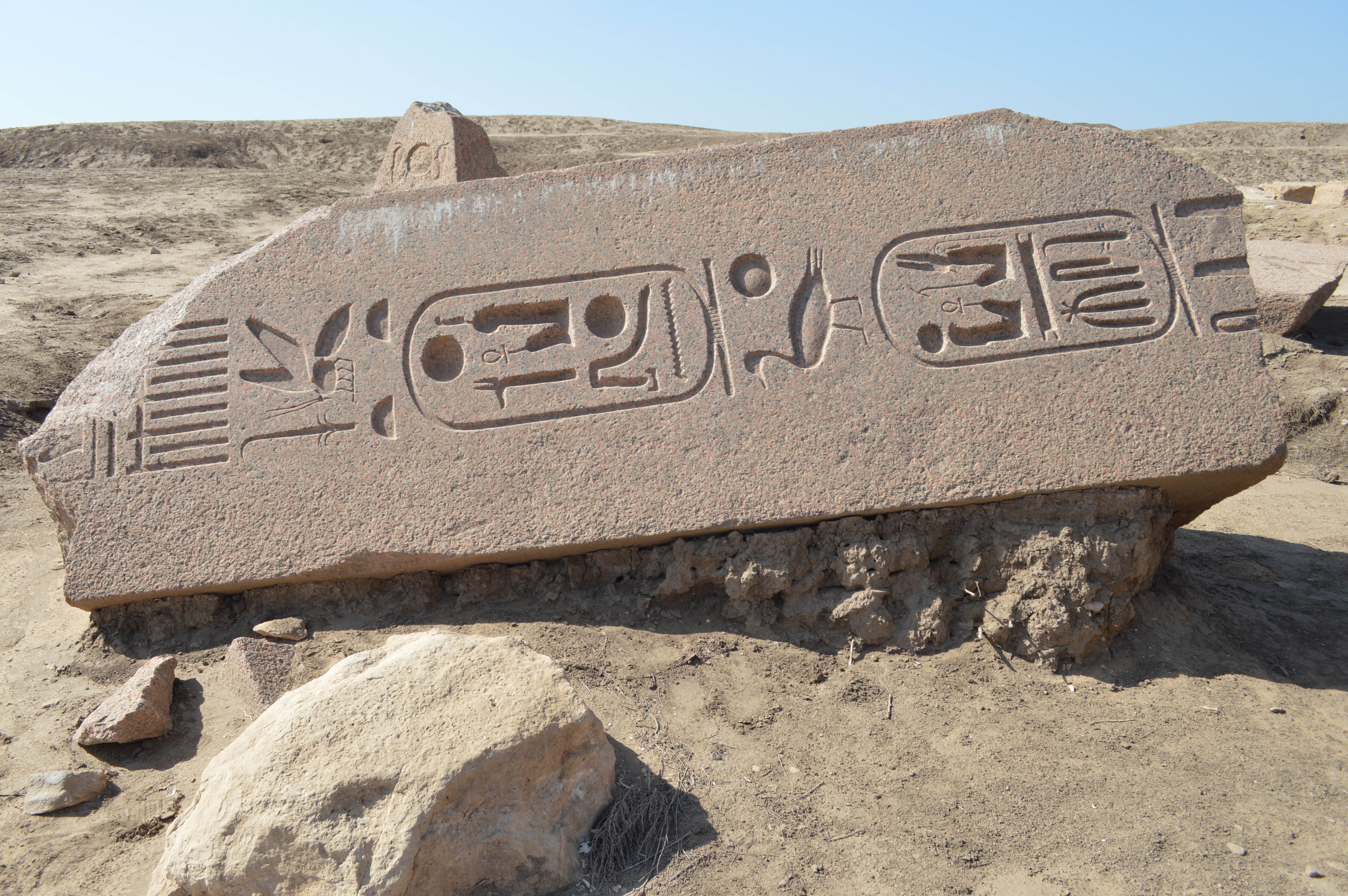 Figure 49: Obelisk 12, Upper portion of the shaft April 27, 2016 |
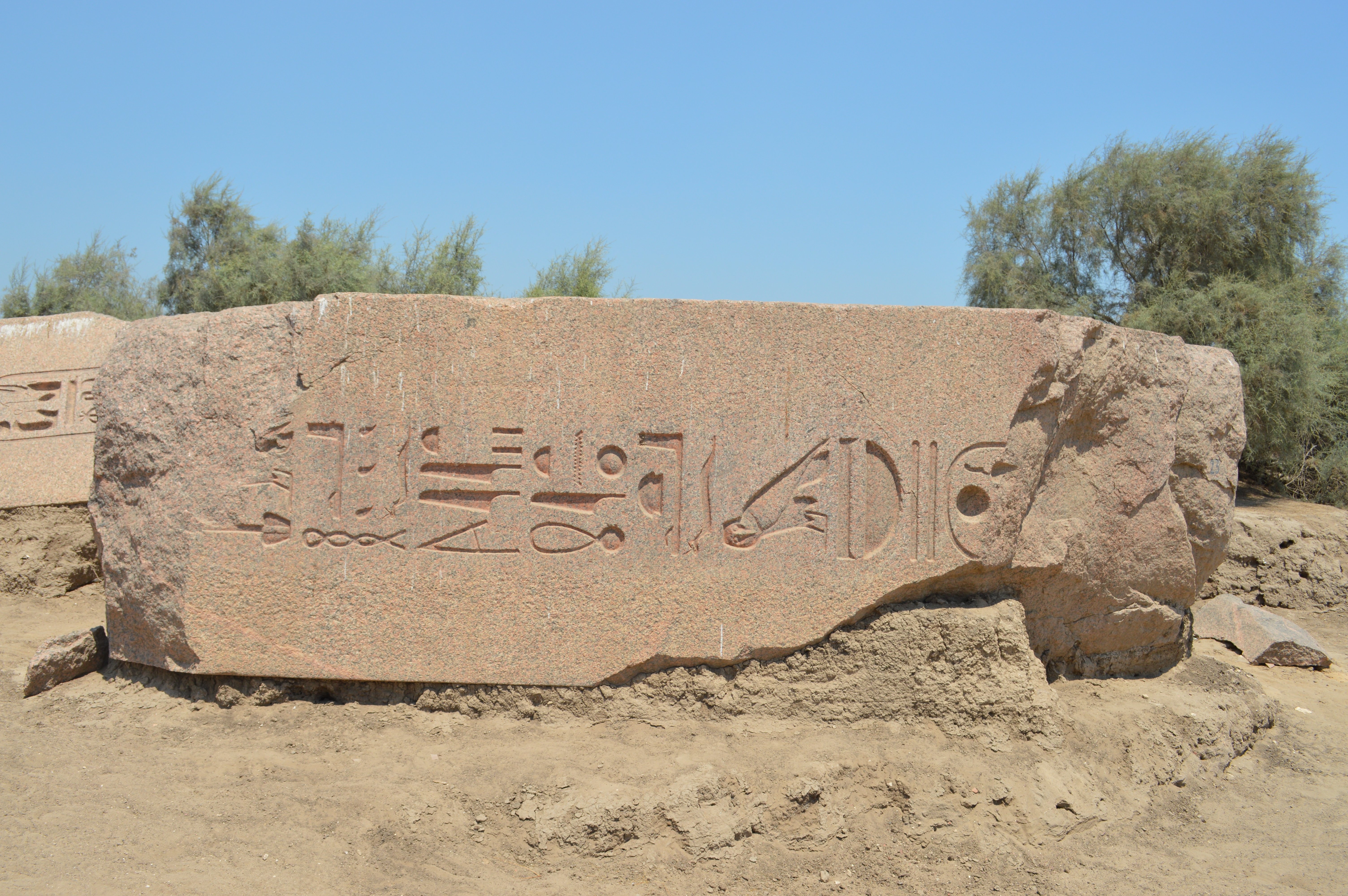 Figure 50: Obelisk 12, Center portion of the shaft August 5, 2014 |
|
by Hiroyuki Nagase (For high definition image, please click the picture)
| ||
Obelisk 13
This is a large obelisk which is lying in the farthest area (east most) of Amun Temple. This is a pair with the Obelisk 12, which is introduced as Eastern Obelisk South in "TANIS Part 1". This is broken into four parts; The upper portion which includes the part of pyramidion (about 4.5 m long) (Figure 52), The center portion which is broken into small pieces, The lower portion (about 4.9 m long) (Figure 53), The pedestal (Figure 54).
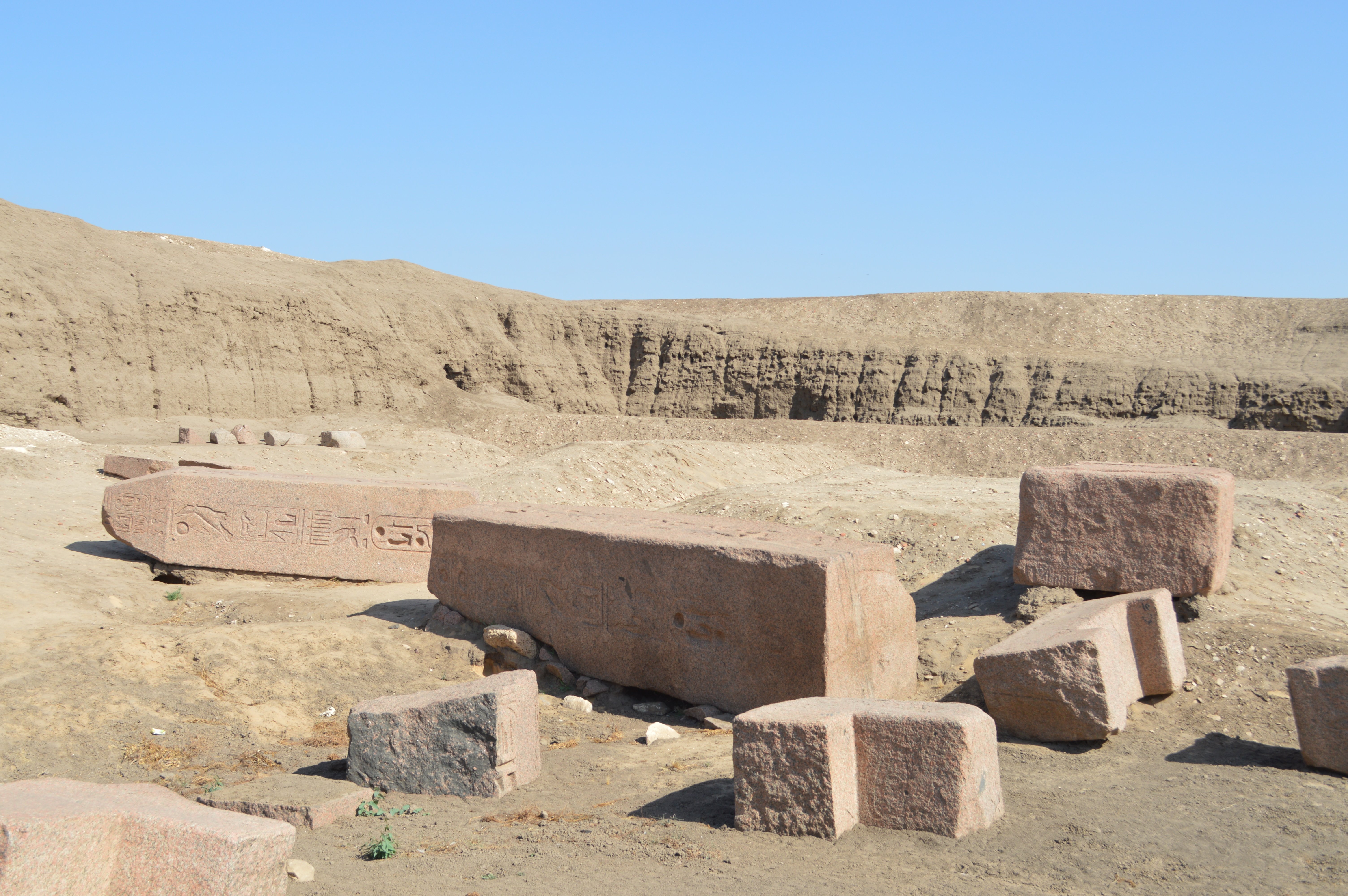 Figure 51: Whole Obelisk 13 |
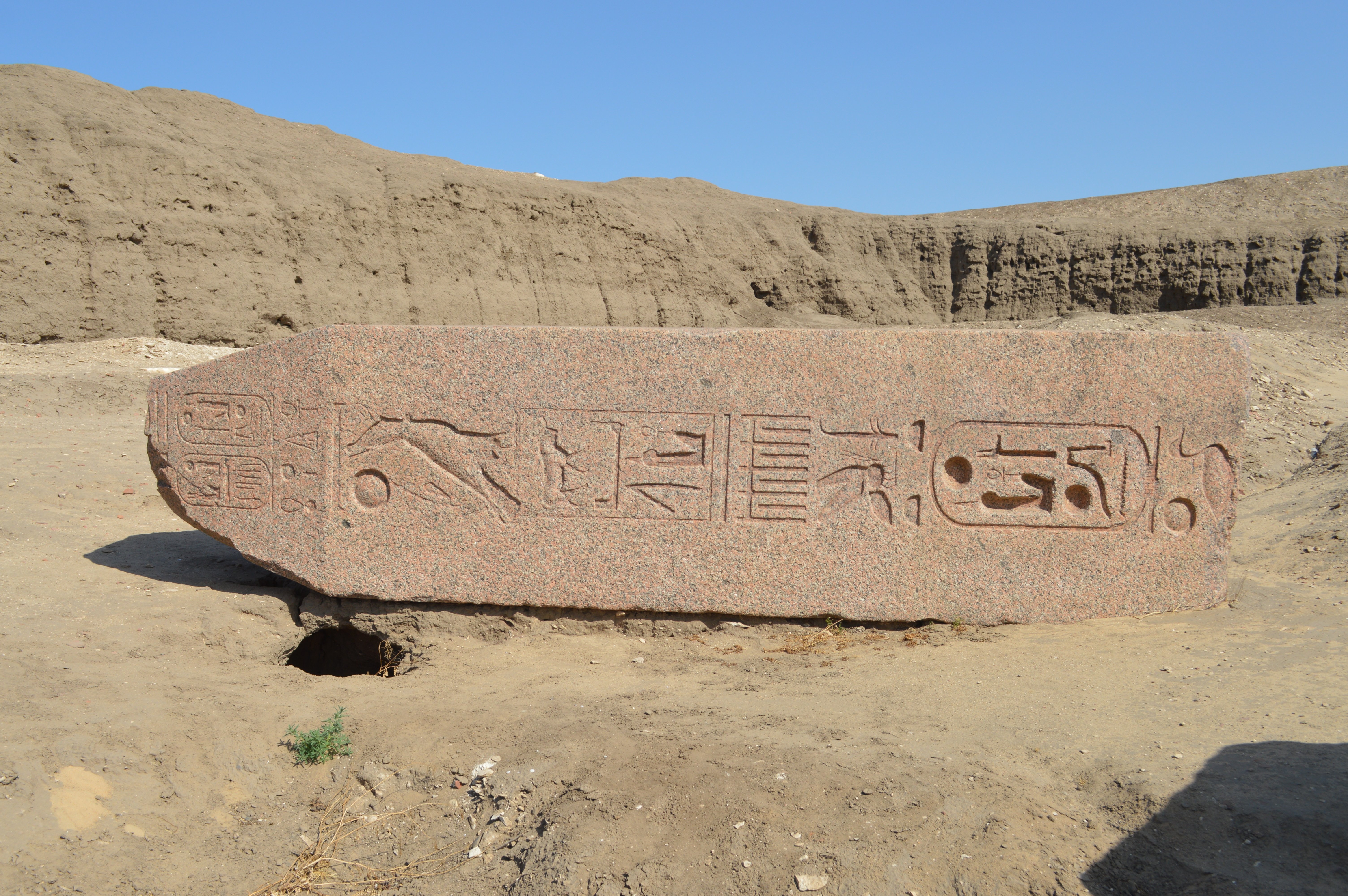 Figure 52: Obelisk 13, Upper portion |
|
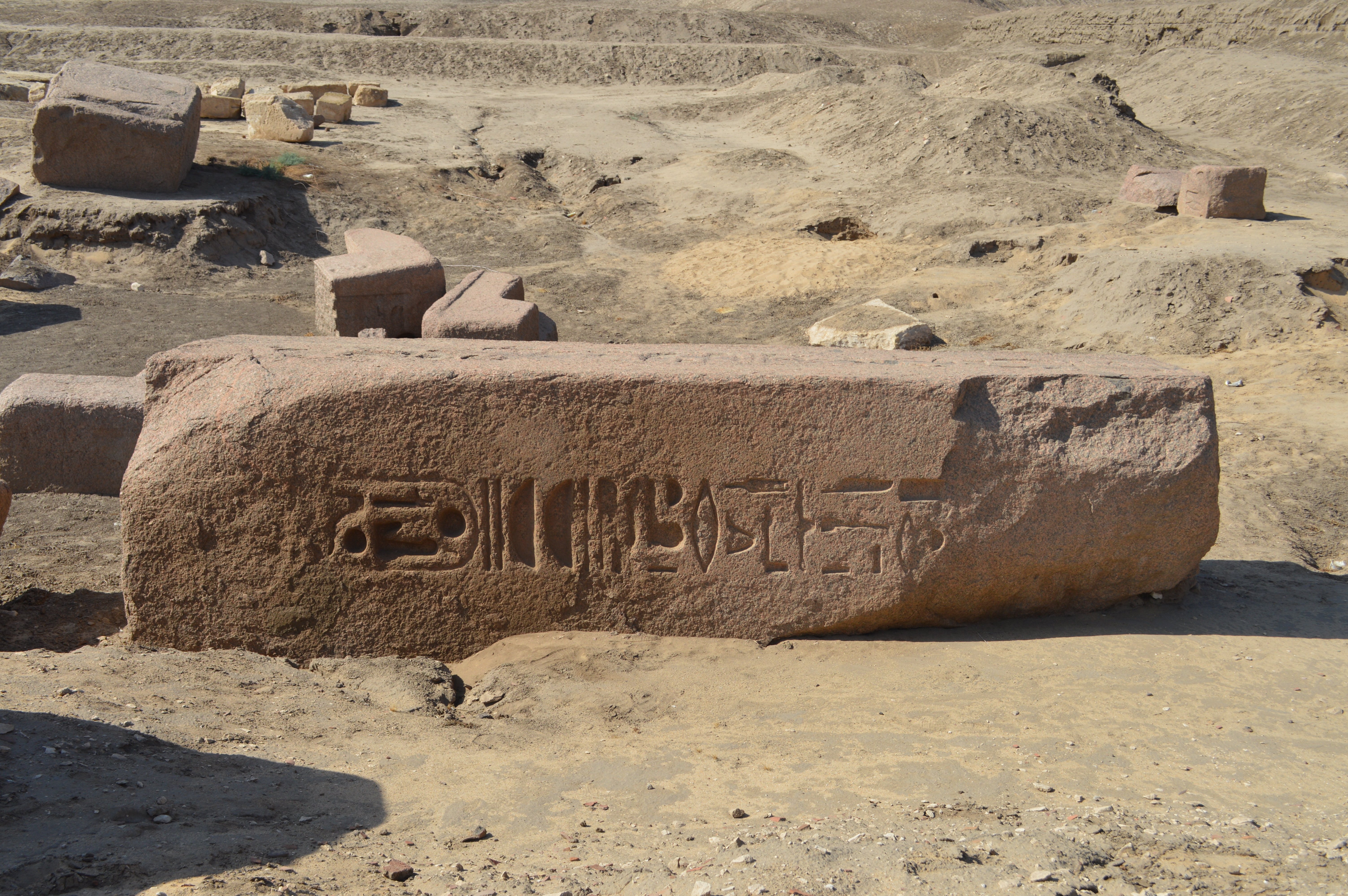 Figure 53: Obelisk 13, Lower portion |
 Figure 52: Obelisk 13, Pedestal |
|
April 27, 2016 by Hiroyuki Nagase (For high definition image, please click the picture)
| ||
Notes For Pictures:
For visiting Tanis from Cairo, we need to come here by the dedicated car. Even when it was crowded with tourists before the revolution, few tourists have extended to here, but little tourists come here today. When I visited here, I have seen no other tourists than I and my tour guide. Since the ruins of Tanis has a landscape like a vast and uninhabited desert, the scene where the large stones are scattering is full of natural. Since there are no other ruins where such many obelisks remain, I think that it is worth to visit with taking one day if you are an Obelisk Fan.
Copyright Hiroyuki Nagase nagase@obelisks.org and Shoji Okamoto okamoto@obelisks.org